The Pemi Loop – it evokes proper noun status of places like The Great Range, Hat Creek Rim, the Maryland Marathon, and the Hundred Mile Wilderness. The hike traverses several 4000 foot peaks, with many 360-degree summit views. There are high campsites, a neat little alpine pond, and some fun scrambles up and down some of the steepest trails around. The condition of the trail is in most places excellent, although it was a dry summer. Bog bridges have been placed in the worst and most sensitive areas are well protected. Up on Franconia Ridge there is extensive trail (re)construction to keep things from eroding too badly, and for the most part it works. High levels of traffic and jerks who don’t stick on the path are still big concerns. I am looking at you, runnerbro who was off-trail, laughed and said “Oops, I’m aerating the revegetation, at least my intentions are good!”
While some people do the whole thing in a day, I chose to take a more leisurely three. And in the end it worked out, 11 miles a day was about all I could manage in 9 hours of hiking (and eating, and summitting). The days are short these days, and the mountains are steep. Plus it’s been a full year since I’ve done any real hiking, and sitting at a desk for 12 months has taken its toll. This was the real deal instead of a previous attempt 7 years ago, that ended early last time I tried it.
Basic Math and Logistical Stuff
~32 miles, click here if you’re interested here is the Caltopo Map
11 of the 4000-footers
I knocked off 6 peaks on the NE-111 list of 4000 footers, there was 1 just offtrail which I didn’t notice was on the list until later, and there’s Owl’s Head, which sits in the middle of the wilderness itself
Most people start at the Lincoln Woods Trailhead and work clockwise, doing Franconia Ridge the first day. I figured I’d need the time to loosen up, so I did it backwards. I recommend this as all the traffic went the other way.
Pack weight numbers
12 lbs 10oz
3 lbs 6 oz water for starters in my trusty 1.5L Smartwater bottle
6 lbs 10 oz food for 3 days (turned out to be WAY too much)
Gear choices and breakdown
I went stoveless, I figured it was not quite cold enough and was looking to save weight. In hindsight, it would have been nice, but not essential, to have a hot meal or some tea. I should have dumped some of the food (you don’t need 10 tortillas for 2.5 days), and brought the stove. I didn’t bring spikes, trusting to luck – and that worked out. While the Whites can get bad weather any month of the year, early October is generally free from snow and ice. I brought the trusty Chrome Dome umbrella, because hiking in the rain sucks. I knew it wouldn’t help much on the Ridge itself, but getting drizzled on below treeline still sucks. Of course since I had it, I never used it. Either way – I stayed dry. I also brought the old shemagh, because it helps keep me warm, and I like it. I’ve carried it over 3000 miles by now, why not 32 more? On my feet I wore a brand new set of Altra Lone Peaks, Currex Running Insoles, and ENGO blister patches – and had minimal foot pain and zero blisters. These trails are tough on the ankles and knees, and nothing but training fixes that. I ditched the Flagyl that I carried on the PCT – I had no expectations of drinking unfiltered water, and figured I’d be ok for a day or two even if I got sick. Plus it was expired.
Electronics and Navigation
I carried the old trusty Samsung S7 Active, from my PCT days. I also brough my real camera, a Sony RX-100, but no power brick. One thing I learned about cameras that aren’t purely point-and-shoot: make sure you set ALL the settings. In many shots I had left ISO set to Auto, so despite what I did with shutter speed, the camera fought back by changing ISO, leading to a lot of muddy shots.
I printed a Caltopo map, because the route is SO well marked, but I ALSO brought my old NH maps from my 1997 AT attempt. Its nice to have old paper to rely on. The one challenge that comes up is that the loop is stitched together pieces of other trails, so you’re always on a ‘different’ trail. But the signs are well done and you really can’t get lost.
Animals
- Many dogs, especially on Franconia Ridge itself, despite the horrible weather.
- Canada Jays
- Chipmunks
- 1 insane raven soaring on the Ridge in the wind and fog
Day 1 – Lincoln Woods Trailhead to Guyot Campsite
This day consisted of a 4 mile riverwalk, then a steep climb up Bondcliff, another climb up to Bond, a side trail to West Bond, and then a slight drop to Guyot Campsite, run by the AMC, complete with a caretaker, bear boxes, and composting privy. Hooray toilets.

After about a 4 hour drive, I arrived at the trailhead at around 9:30 am. Only to find it, and a quarter mile of highway adjacent, completely packed with cars. This did not bode well. I theorized that the majority of people would be doing the river walk, or exploring the waterfalls upstream past where I was going to break off. And I was right. After the first few hours, I saw almost nobody. The path runs on an old rail bed left over from when this was a huge logging area. Fun fact, the Pemigewasset Wilderness was the first one created, in 1911.
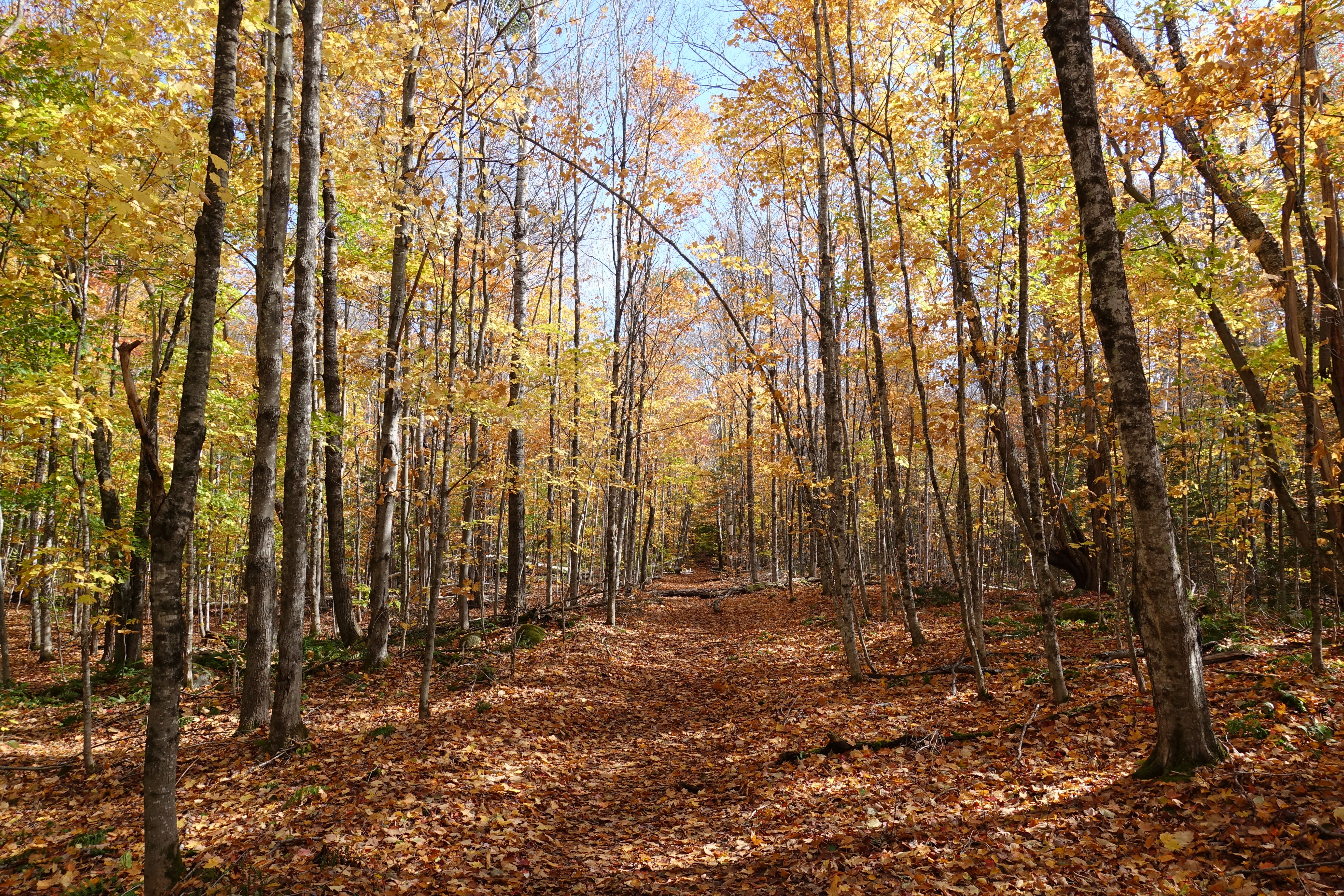
After about 4 miles, I took a break and had lunch. Along the river there’s plenty of maples, and the cool air and warm sun combined to give it a really “Fall” feeling. Peeling off the main trail, things immediately started to get real.


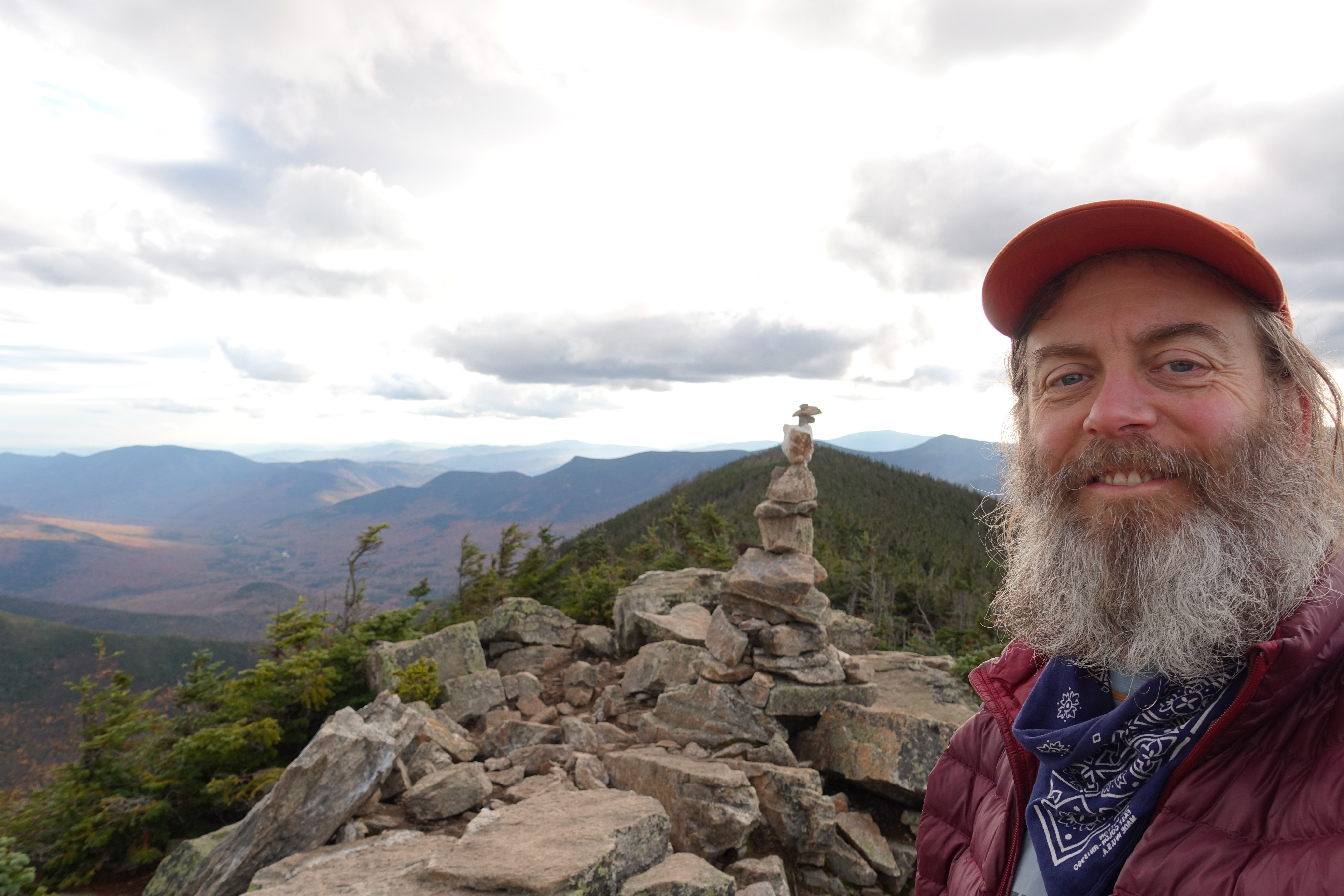
By the time I hit the top of Bondcliff, I was huffing and puffing. Yet, within 15 seconds, I was cold. Without the sun to warm me, the cold air coming in from the north and west really put a damper on things. But, from the relatively exposed line between the peaks, there are great views, including 1 of mighty Washington to the northeast. I’ve been up it 3 times, each time starting in nice weather and reaching the summit in thick cold fog. Some day I’ll get lucky.

After slogging up Bond, the trail does a bit of up and down and a small trail junction led west to West Bond. Wise with years, or miles, or just lazy, I dumped my pack and made the quick 0.8 mile jaunt over to West Bond. There I talked with a guy I’d been hopscotching with since Bondcliff, and we debated whether the first or second “peak” of West Bond was actually the summit. Depending on your GPS and depending on your map, we either were, or were not on the peak. By eye our vantage point was higher than a prominence further to the west, so we called it good.
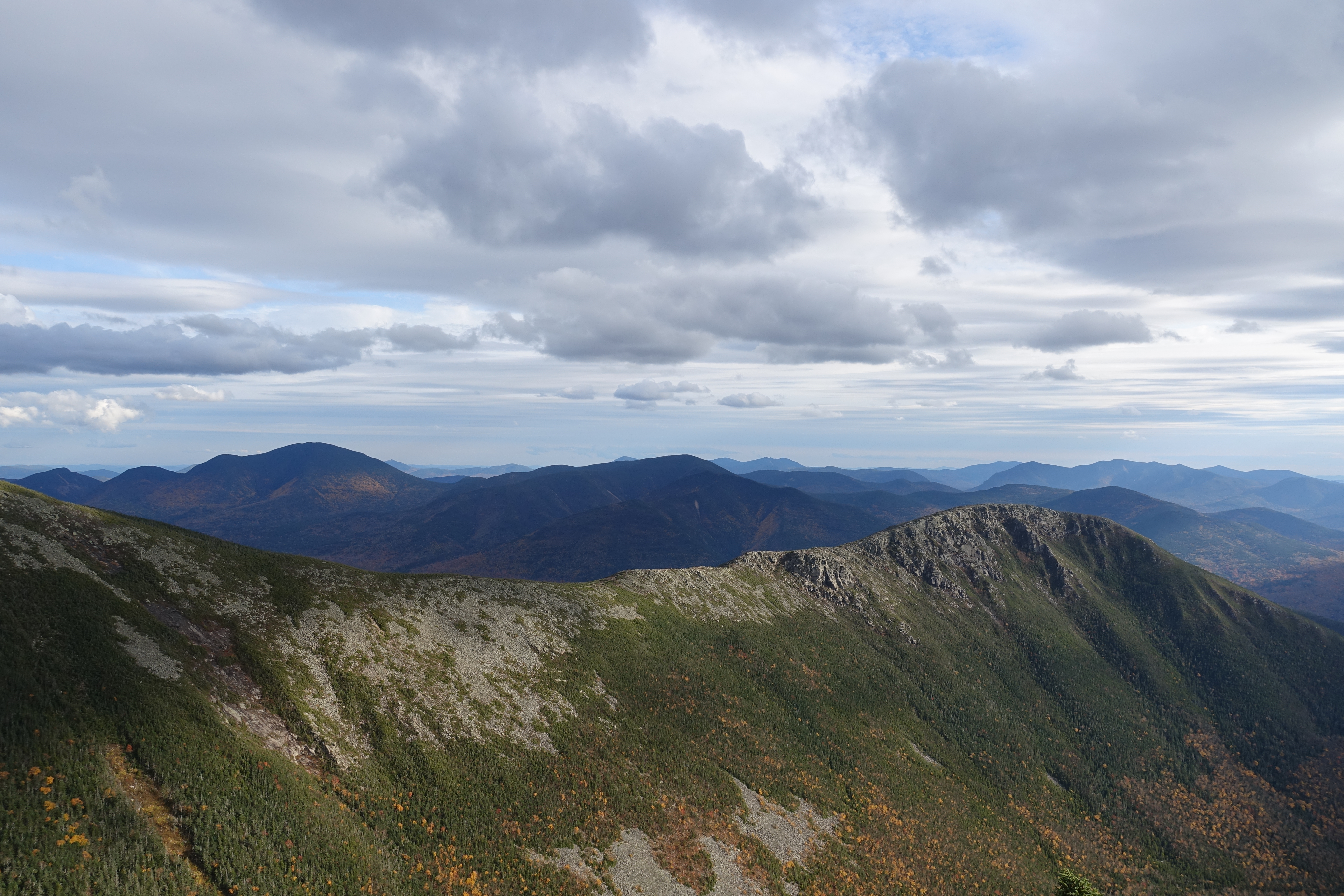
One thing I reflected on as I toiled up the hills was the difference between the eastern and western trails. In the East, my theory is that back in the old days, people were very much into the “climb the mountain to conquer it and claim it” mentality, Manifest Destiny, and all that. I think by the time people reached California, they took a more measured approach, where the trails traverse the same AMOUNT of land, but slabbing and switchbacks give you gentler slopes, and views of the peaks that you actually miss out on when you’re standing ON the peak. Outside of Goat Rocks in WA, there’s nothing on the PCT like the run between Bondcliff and Bond, or indeed Franconia Ridge – yet that’s the norm in the Northeast. You take the steepiest, gnarliest route to the summit, then stay as high as you can walking the tightrope between peaks. On the PCT the trail would pass over the ridge at the lowest point, weaving back and forth across.
I started seeing signs for the AT, and it got me thinking about the days when I had no grey in my beard.


Guyot Campsite
While some bemoan the “Appalachian Money Club” and their monopoly on formal backcountry camping spots, the prices are reasonable (10 bucks), they offer work-for-stay if you need it, and they build tent platforms and shelters, which prevent hordes of hikers from trampling and bootlegging all over the place. And, they stir the poop. I met the caretaker right when I arrived, which was fortunate (for her) since she was laid up with a really bad knee injury – as in, she couldn’t even walk. But not to worry, another caretaker was packing a week of food for her, and some more Advil, so she planned to be back on her feet in time for the shutdown of the site the following weekend. The site was pretty busy, and by dark, I think all 12 platforms were full, AND some people were in the 22-person shelter. I shared a platform with some guy and his dog, Trooper, who was so hungry and tired that he came over to beg food, then laid down next to me. A few minutes later, he got up, walked into my tent, and tried to lay down on my quilt! Super cool dog, just pushed past his limit. But in short order his bed and dinner were made, and the 3 of us fell instantly asleep as soon as it got dark.

Day 2 – Guyot Campsite to past Garfield
Day 2 was up and over a few peaks, with a stop at a closed AMC Hut, ending with a grind up and over Mt. Garfield. I ended up sleeping, on and off, for 11 hours. It’s dark by 7, and the sun doesn’t rise until after 6, so there’s nothing else to do. Plus I was pooped. Heading out, I chatted again with the Caretaker, and sent some texts on her behalf (since she had no bars on her phone), and headed north towards the Twins. Soon the morning overcast lifted and it became quite nice. Starting at elevation had its benefits too, no giant slogs, just enjoying some ridge time.

One of the reasons this stretch is called The Twinway.
After South Twin, the continues west towards Galehead Hut and Garfield, but the side trail continues on to North Twin. I skipped this in my AT trips, since in that mode, who wants to walk an extra 2.6 miles ? But now that I’m in peak-bagging mode, I chose to do it. I wasn’t sure when lunch would be, and it was over a mile so I decided to bring the pack. Here’s the false summit of North Twin, seen from the col.


Lunch ended up happening on North Twin. The old Smokebeard Special, skipping the optional peanut butter.

Down from South Twin towards Galehead Hut is a section of trail that someone I met said “made them consider their life choices”. And this was one of those crazy hikers who do the whole Loop in a single 24-hour stretch. You drop about 1500 feet in 1.3 miles, and most of that elevation drop is in the first half.

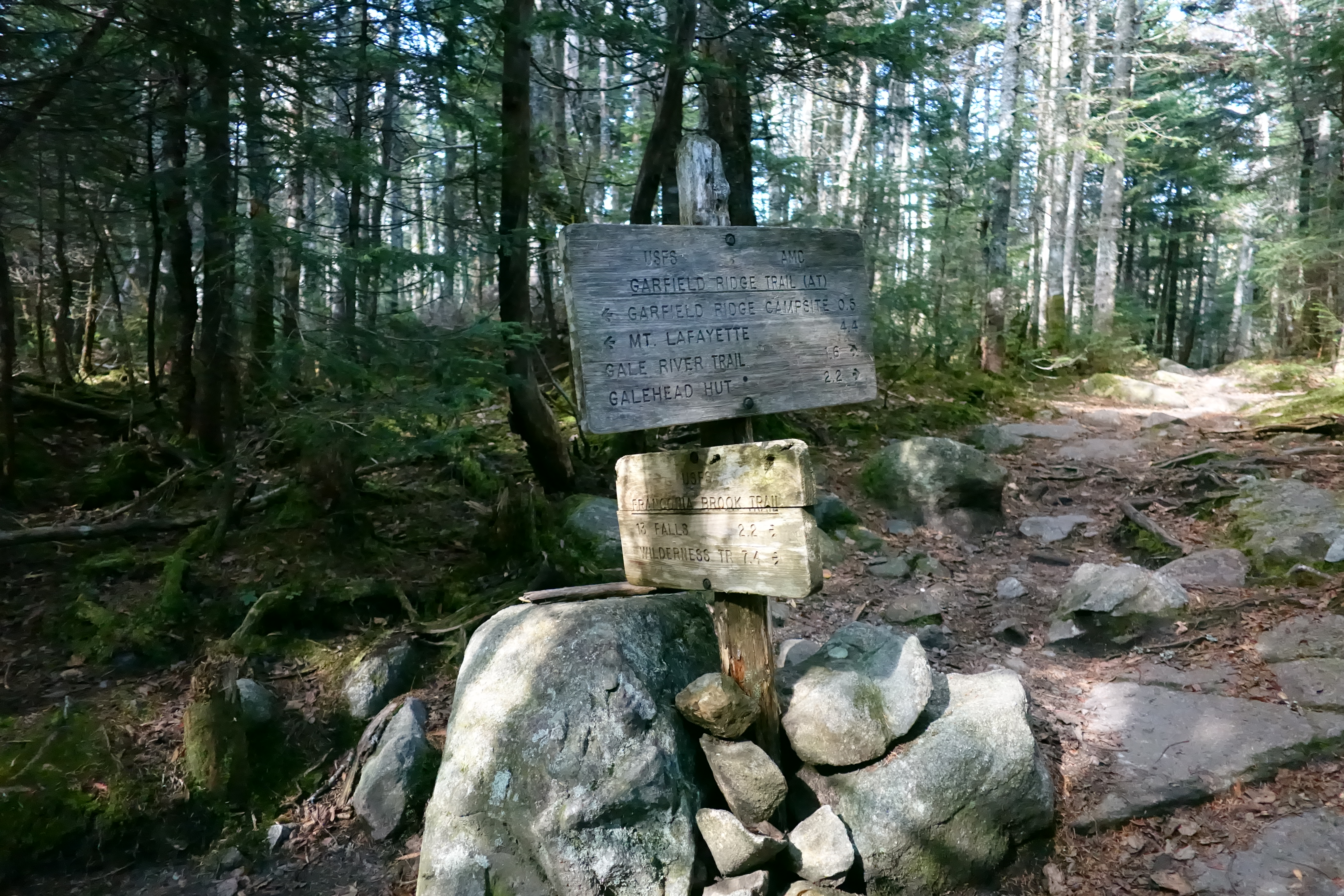
Finally at the base of this, you reach Galehead Hut, where my 2013 attempt floundered due to a badly injured knee. Oh, and the 6 inches of snow that rolled in on the eve of Memorial Day. Slightly different weather this time, where I paused for lunch. I had a bit of an internal debate here – do I head to the Garfield Ridge Shelter with water and a toilet in a few miles, or do I push on, up and over Garfield, and bootleg before Franconia Ridge?


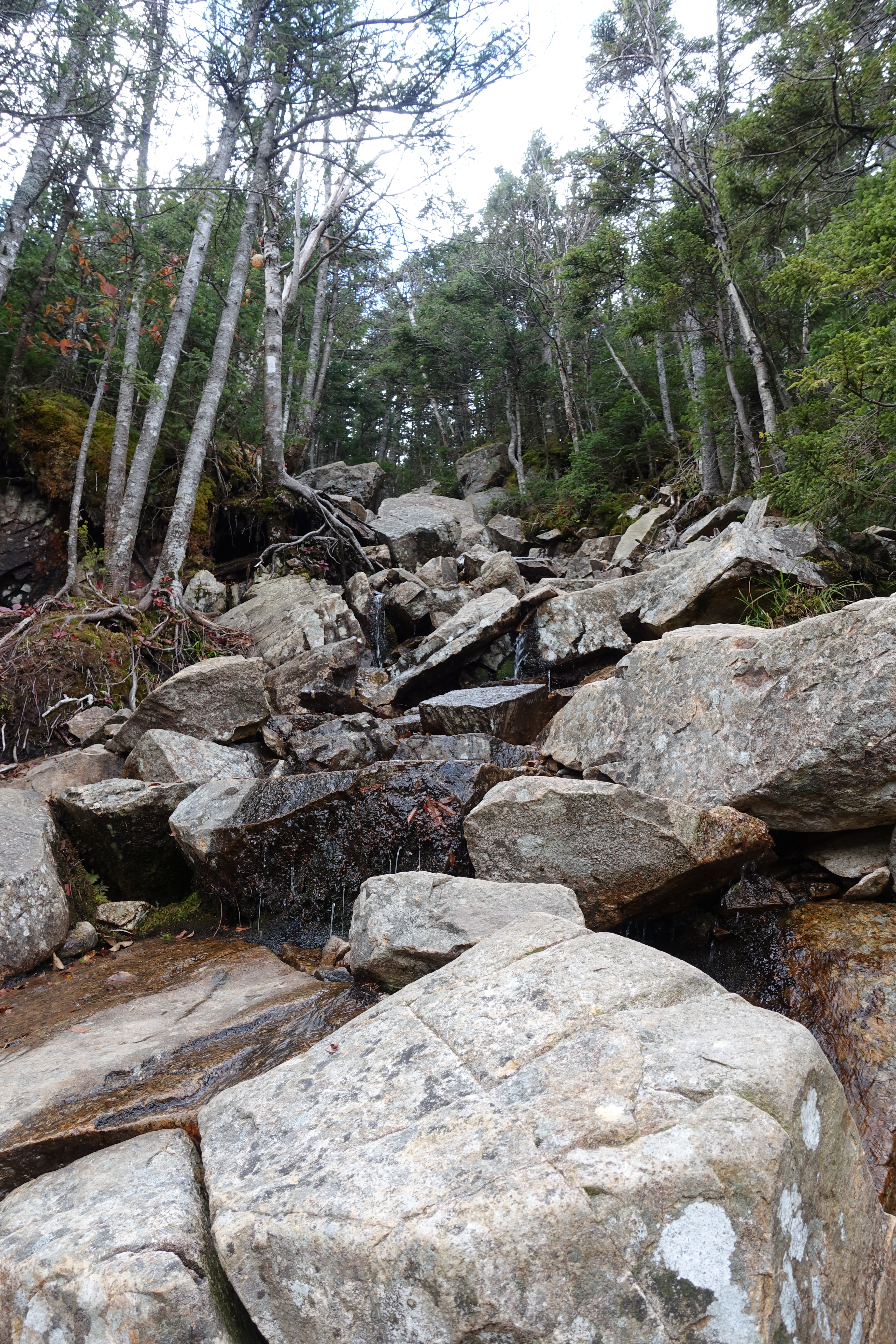
I had heard from the guy with the dog two things – one that there were campsites between Garfield and the Ridge proper, and second, the trail up Garfield in my direction was “hiking in a waterfall”. I decided that although it was the end of a long day, I’d rather grind out Garfield at the end of day 2, than in the early part of day 3. The third day was for the Ridge where I hoped to spend time summitting, plus I had to plan for the drive home.
The climb up Garfield was not hard, just steep, and certainly not “a waterfall”.
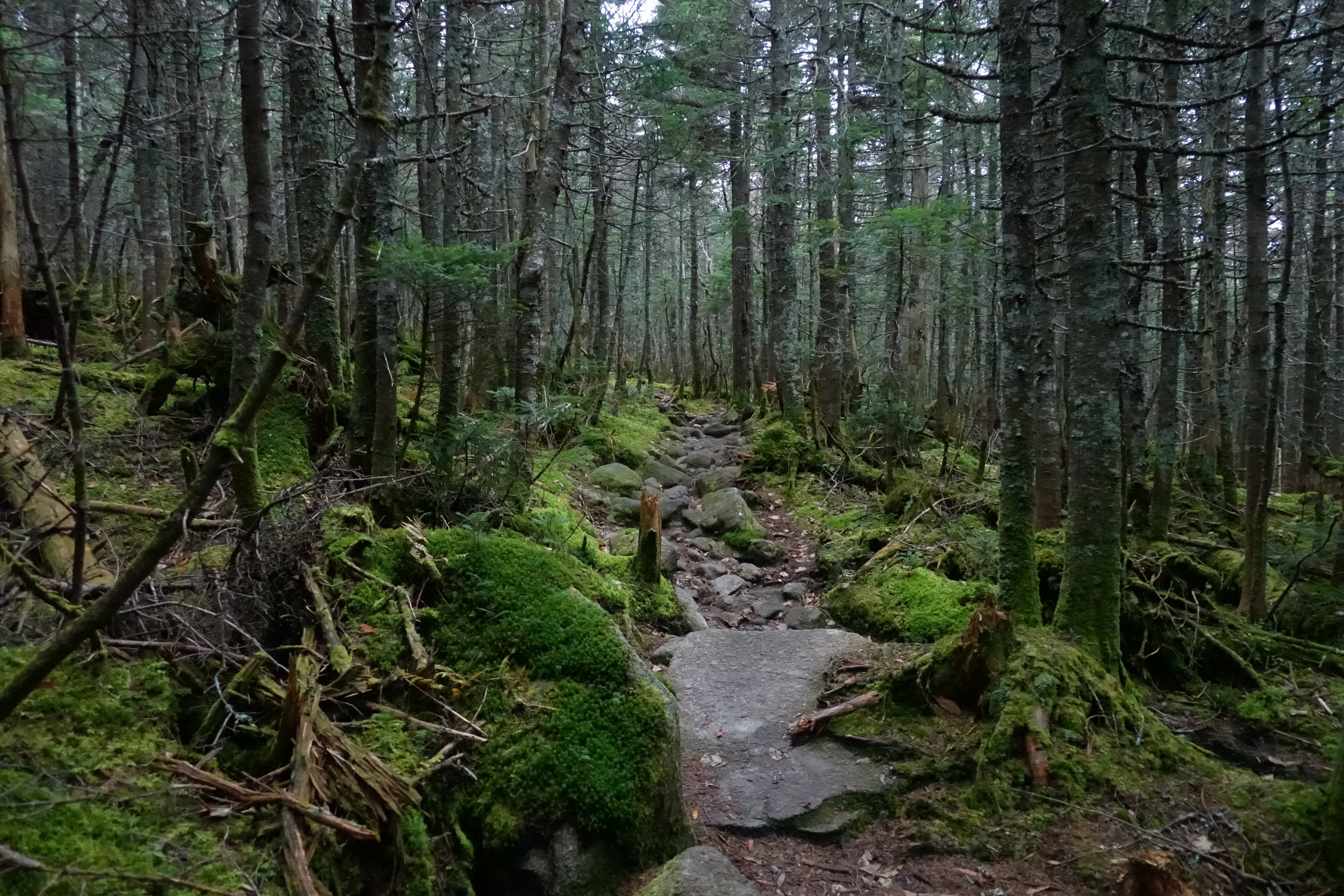
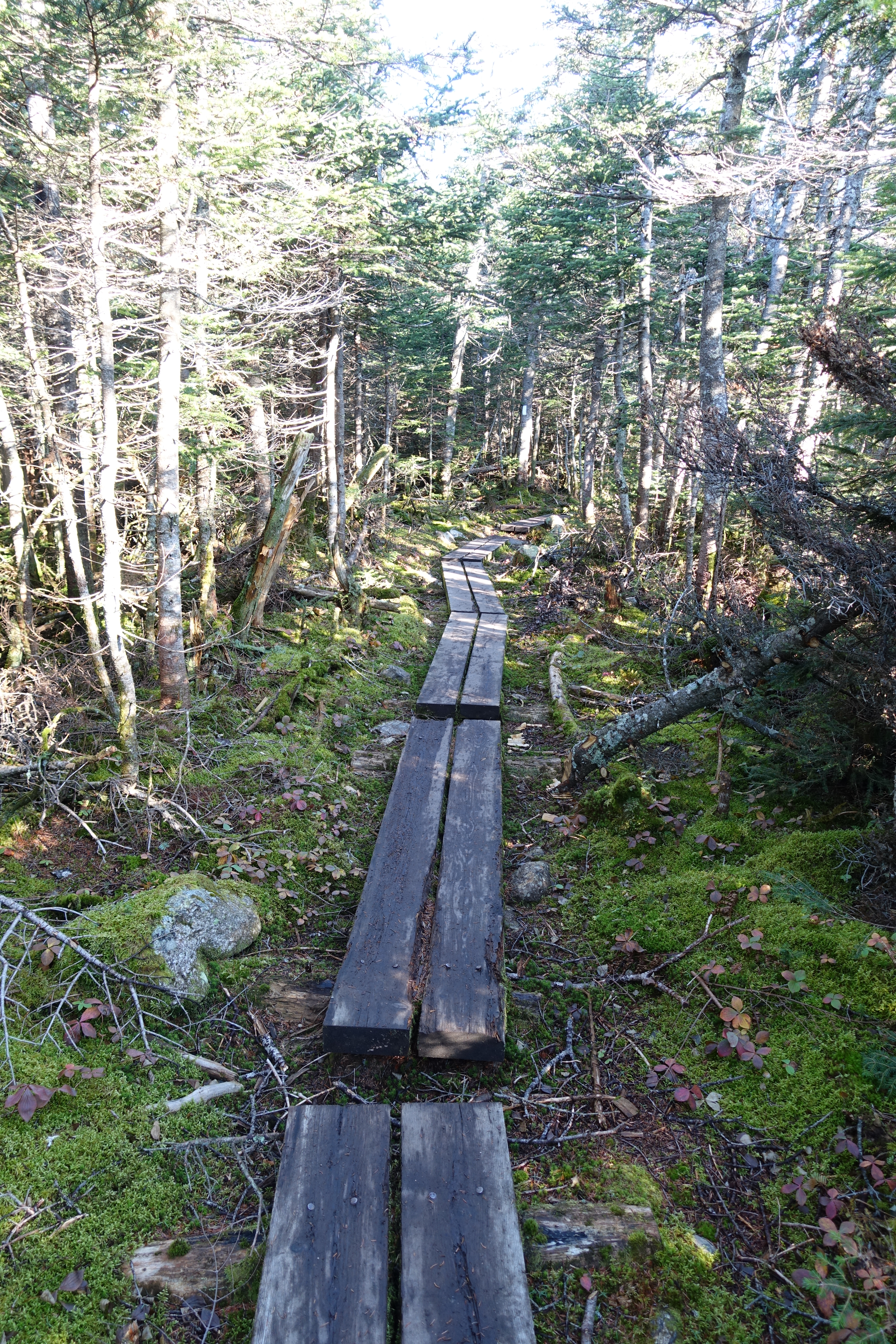
I realized the best way to describe just how GREEN the woods are up here is this: take every green crayon from a Crayola big box, hold them all together in your fist, and then try to color a picture of a forest. There’s every shade imaginable, and the intensity is something you have to simply experience.

I found a few crap sites right after Garfield, but pushed on thinking they had to get better. Just shy of 5pm, when it dropped to about 45 degrees and my legs were shaking from exhaustion, I came to an area where the trees opened up a bit, and the trail levelled off. I ran into another hiker bedding down for the night in a pretty sweet, concealed site. She told me just ahead there were more, and there were. Of course the best site in that area also had a TP flower in the middle of it, so I found a cleaner, if lumpier site and quickly pitched the tent. And then I broke a tent pole. The FlyCreek, who had sheltered me for about 120 nights on the PCT, was finally showing its age. But, with some ingenuity born of 6 years of engineering school, I managed to snap off the broken part, and like a caveman, pound the 2 parts back together with a rock. With a few wraps of Gorilla tape and crossed fingers it held. Fortunately the break occurred in a convenient place and not mid-pole. Fun fact: the Gorilla tape wrapped around one of my trekking poles is from a hiker box at a hotel in Sisters, OR, just after mile 2000 on the PCT. After 2 years on the pole, it was still flexible and sticky. The duct tape on the other pole failed completely.

Big Agnes tents are awesome. First off, when you call, you immediately talk to a human. When I called them and told them the problem, they sent me a diagram so I could tell them which pole (S4), and for $4 they are sending me a new one!
Day 3 – Franconia Ridge
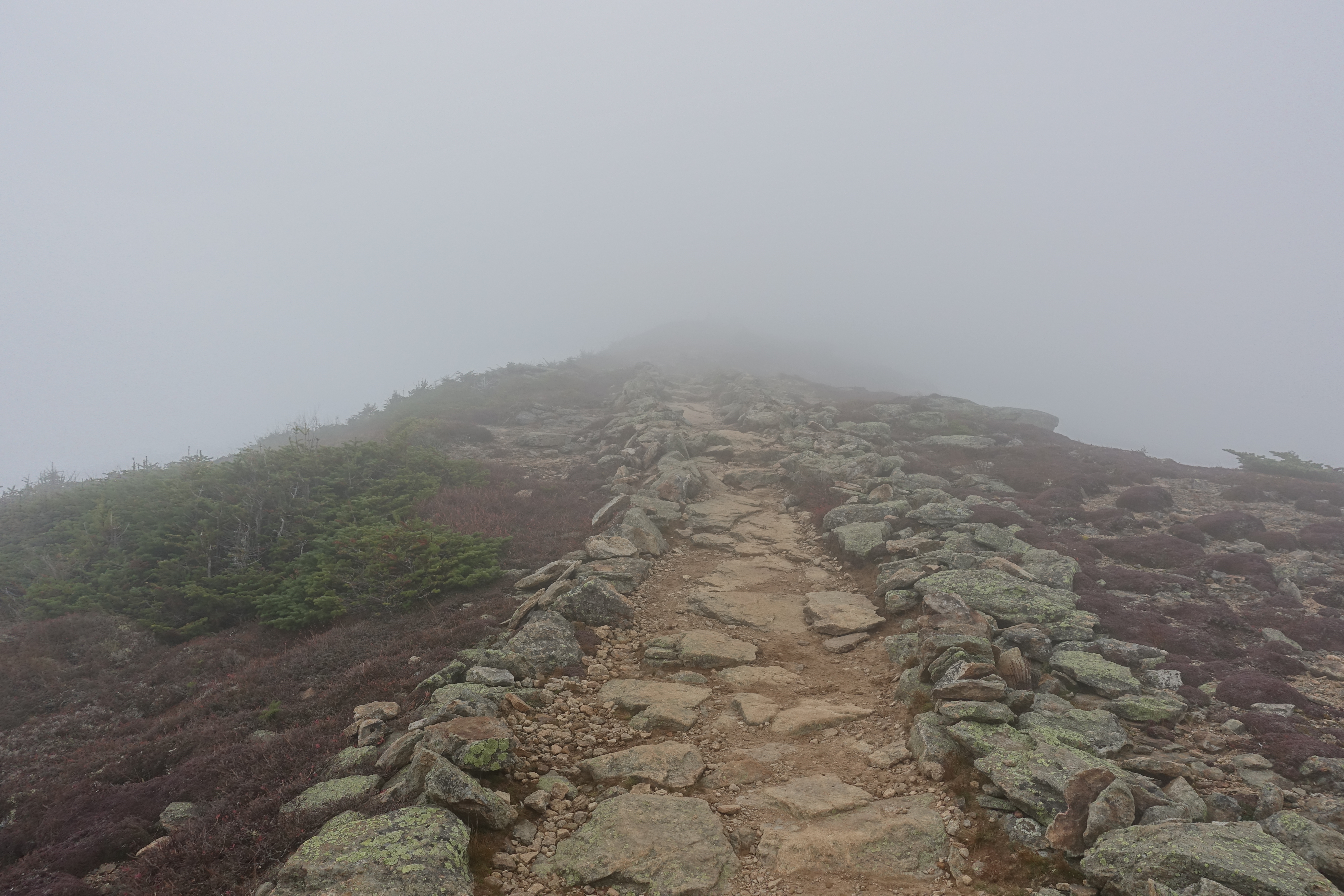
Up early, I decided to make a leisurely start, since I couldn’t even see the start of the ridge through the fog. I wanted to hike in the clear weather. I left at 8 and made my way to the Skookumchuck Trail junction, which is basically the start of the real Ridge.

No dice. I waited here for half an hour until I got too cold and pushed up Lafayette, a big boy at just a few feet short of a mile high.

Here’s the junction of the trail down to Greenleaf Hut (which is super nice). Nope. I waited another half hour here. but by now I was fighting the clock because my car is 8 hours away. Plus, it was chilly.

Once I got here (Little Haystack) the number of people increased rapidly, and I was going against the flow, so it was an endless series of put-your-COVID-mask-on-and-step-to-the-side maneuvers.

And that was it, Franconia Ridge, done. I ran into a guy near Liberty Spring (just before Mt. Liberty) mentioned how hard the “stairs” on Mt. Flume were, and how it was a tricky climb. What I found was something quite different, and miraculous. This is most of the way up a 4000 foot ridge, about 6 miles from the nearest access point. Someone CARRIED all this here.

At this point, it was all downhill from here – a gradual descent into a valley alongside a stream. Soon the maples re-appeared and the sun poked through, and the Fall “rainbow” came back.


Final Thoughts
Will I do the Loop again? Probably not. I’ll definitely be back for Owl’s Head, and Galehead, and if the weather is fine, I’ll do the Ridge once more. When I was a caretaker back in 2002 in Maine on the AT, I told southbounders “if you get to Franconia Ridge and the weather is bad, wait for a good day, it’s worth it” – and its true. Next time I might start in better shape, and tweak my gear a little, but there will be a next time.
You are an inspiration, truly! So glad you are still able to get out there. Love the pics! Polly and Jeff