The Bishop to Mammoth Lakes stretch is challenging for a whole host of reasons. Firstly it’s long, about a hundred sixteen miles. Secondly, you go over a high pass almost every day which puts a serious dent in the mileage you can do. Lastly, you also have to keep the eight or nine days of food you’re carrying in a 3-pound plastic bear proof container. You’ve also strapped on micro spikes and an axe to your pack; about 5 lb of extra crap all together. Pack weight is equal to or heavier than on Day 1.

A typical day starts with you getting up at about 4 in the morning, hitting the trail by 5 (or earlier). When you wake, its below freezing, you’re already hungry, and desparately have to go to the bathroom.
The goal is to climb up out of the valley to a pass at 11 or 12 thousand feet while the snow is still crunchy underfoot. This is so that you don’t slip and slide all over the place, or fall to your death. Its dark, you need to get your stuff packed but you can’t work zippers, so you leave your gloves off. Your hands get numb. Fumbling around under headlamp, you eat a Probar or a handful of granola, guzzle some ice cold water and you’re off. Soon you’re sweating, so you take off your down jacket and gloves. But then you stop hiking to pee and you’re freezing. An hour later and you’re starving again, and the cycle repeats.
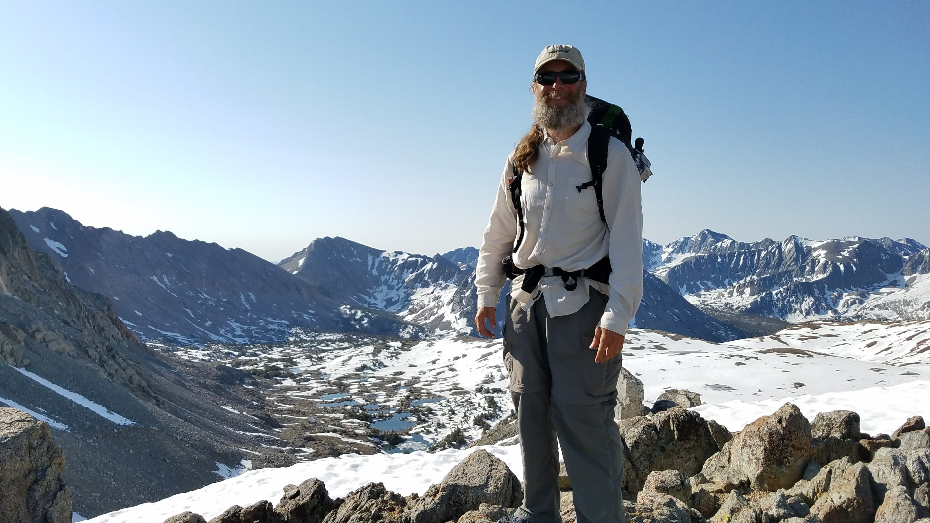
Once you get to the top of the pass you can take a breather, eat second or third breakfast, take a few selfies and then you have to head down. By now the sun is up. The longer you wait, the softer the snow gets and the more annoying and somewhat dangerous things become. As a bonus, there is often no actual trail on the way down. You are making it up as you go. Optimistically following in others’ footprints, you hope you don’t slip, or worse, posthole. (This is when one leg sinks into the snow up to your crotch. It is at best tiring, and at worst you can injure yourself). Or crash through a snow bridge into the meltwater stream you hear rushing under the snow.
By midday you’re back down around nine or ten thousand feet and you’re doing lots of water crossings. The snow melt comes down in pretty significant streams and most of them do not have bridges. You end up hopping from rock to rock or across logs, or sometimes just wading through thigh-deep, 40 degree water. By the time you get across the stream your toes are usually numb. Its worse if you go barefoot, but wet shoes are no fun either. My hard-worn desert blisters are fraying away under the constant soaking.
It’s awesome.
And I’ve lost another 6 pounds.
Author’s Note: This was a tough section to journal because there’s just so much to take in and after a while the exhaustion sets in, making the days and mountains blur together. I am doing much of this by speakjng into my phone rather than typing, which probably explains the sloppier grammar and sentence structure.
Day 1, Wednesday, Glen Pass

After a long hard grind up to the pass, I rewarded myself by glissading part of the way down. Glissading is like sledding except you are on your butt. You use your ice axe as a rudder and your feet as the brakes so that you neither run into rocks nor pick up too much speed. It’s a great way to bypass a slippery traverse. provided of course that you can see where you will end up. It’s important to be wearing pants for this, as Scooch found out when she tried it in shorts. After a 50 foot slide, there was both an uncomfortable underwear situation as well as a scraped and bloody butt cheek.
The Rae Lakes waited for us below. Clear jade green water, trout, and a series of natural spillways between the lakes made the valley beautiful. We also had several wet feet fords to manage.

People started complaining about mosquitoes for the first time. The Sierra mosquitoes are legendary. This did not bode well, as I did not have my head net or any bug spray. However, I did have my cool permethrin soaked shirt that Shana sent me in Bishop. I put my trust in that. I am also waiting to pass final judgment until this is all over. New England bugs, especially up in Maine, are nothing to trifle with. I feel well prepared mentally and physically for the bugs here.
Day 2, Thursday, Pinchot Pass
Woke up covered in ice. The others tend to tent, to stay warmer. I figure if I’m going to be cold and slightly uncomfortable, I might as well not have to pack up an icy tent. Plus by cowboy camping, you usually see at least a few shooting stars.


Pinchot Pass want too bad. The fun part of these is getting down. Theres either nicely frozen footsteps of all the hikers ahead of you, or there’s nothing and you have to figure it all out by use of maps and dead reckoning.


We did the ford where Strawberry died last year, there was not much to it this go around. I poured out a little electrolytes for her as I passed. The poor girl reached the end of her own long Trail too soon. Or, it was her time, who knows.
By 3pm we were just short of Mather pass, which was renowned for its steep headwall. We camped on the gravel at almost 12,000 feet, waiting for the ice to freeze up overnight. It was a nice short day, and I think everyone needed the rest. I know I did.

Day 3, Friday, Mather Pass
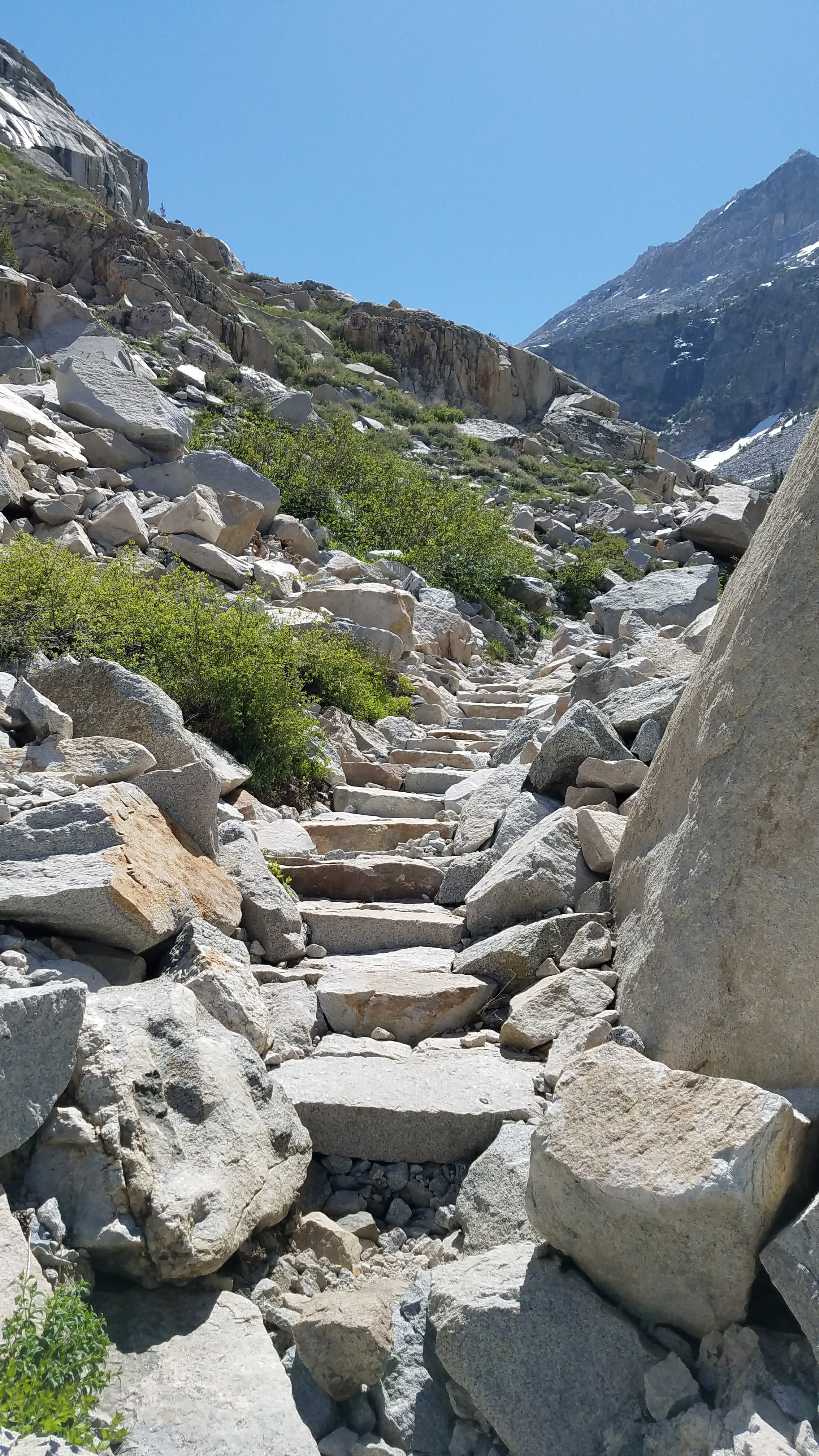
Mather itself was kind of boring. It wasn’t that steep, or snowy. Even the descent wasn’t hard. What was hard was getting down into Paradise Valley, over an endless series of switchbacks and stairs laid out by some extremely hard-working maintainers.


The lakes and valley were beautiful. Something like honeysuckle was blooming, sagebrush was everywhere, I even saw a few lizards. At times the trail wound through huge groves of aspen trees. It’s a big difference from 12000 feet up. I met back up with the group at a place called Big Pete’s Meadow.
I was completely fried by the time I reached the bottom. I think I was dehydrated, plus my feet were killing me. The group split up, since some people were getting worried about doing Muir pass and also had the energy to push on. I teamed up with Fireball and Cherry Bomb. We squeezed out another mile or so, camping just at the 10000 foot bark. Our plan was to go easy, rest, then get up at 3:30.
We were kind of sad, reflecting on the fact that Mather was the last time we would be at 12000 feet.
Day 4, Saturday, Muir Pass


Muir Pass was the best, most scenic, most awesome of the passes. We did several miles in the dark, watching the sunrise as we climbed up into the snow. There was even in icy ford, complete with frosty rocks to get across, and I ended up with wet, very cold feet.
Climbing up into the snow fields around the pass, I felt like one of the Fellowship trying to cross Caradhras.
Because why not, the last half mile or so was ridiculously steep. However the trail soon flattened out into abroad saddle where the Muir Hut perched majestically at the top of the pass. We had amazing views on all sides. Despite the cold, it was pretty sunny so we were able to relax and hang out for a bit.
The really gnarly stuff began on the way down. At the time we knew there were 4 miles of snow fields to cross. Everyone took off ahead, so I got to do the track solo. It was neat looking at the watermelon snow, and all the grooves melted into the snow Surface by the sun and the wind. What was a little sketchy was crossing large portions of the snow field where water was flowing underneath. My feet were already wet, but I had no desire to get the rest of me wet. After a few hours I reached the first melted Lake, and was able to take off my spikes. Everyone had the same idea. I came around a bend and found a whole group of hikers stretched out on the rocks along the growing river, drying clothes and basking in the Sun like lizards.
I left a trace. During a big stream ford, one of my flipflops slipped off my foot and floated downstream. Im now That Guy.
Continuing down the valley the trail wound through giant growth of pine trees and alongside Evolution Creek as it crossed a meadow filled with deer. It reminded me somehow of the land of Ithilien in The Lord of the Rings.
Talking about it with the gang later, I said that today packed every experience I had expected in the trail into one day. Pre-dawn climbing, icy streams, amazing views from the top, route-finding across snow fields, river fords, wildlife, and alpine meadows.

We capped off the day with an amazing walk through Evolution Creek Gorge. Because we were below 10,000 feet we were able to make a nice fire, warm up a little, and even slow-roast some socks and shoes to dry them out.
Day 5, Sunday, Selden Pass

Because there were only 12 miles to do, and it was cold, we started off the day with another campfire. The morning consisted of more rolling down hill through tall pine groves along the side of the canyon. I think because the rock around here is all gray granite, the stream beds are nearly white. This, combined with the cold water, means the streams are crystal clear and have a almost Caribbean blue glow to them.


Despite the scenery, I can tell that my energy levels are low. In the second half of the day when we started doing a climb, I was once again almost out of gas. I was going to camp just before the pass but since Selden is so low, I figured I would get over the top. Kind of frustrated with myself pushing to catch up with the group, because right now there is no hurry.


Of course the reward for pushing more miles is getting down across the pass near sunset. We camped near Marie Lake, which was half frozen and gorgeous.


Day 6, Monday
We just did miles, no passes today. It was kind of nice, a mini vacation. Coming down the steep switchbacks to around eight or nine thousand feet the trail again passed through some big pine and aspen groves. Even the animals changed. I think if you replaced the aspens with birches it would be a dead ringer for some of the lower elevation Adirondack trails. Of course the problem with aspens is there white bark. This motivates certain jackasses to graffiti the trees, for instance a guy named Safari in 2013.
Some of the group took the side trail and lake ferry to the Vermillion Valley Resort. There for a lot of money you can take a shower and eat real food. Also, you can pick up mail drops if you sent food ahead. For a fee. I didn’t head in because I packed out enough food from Bishop to go all the way.
Through some geographic or atmospheric glitch, at around mile 881 you can get cell service, provided that you have AT&T. I had a much-needed call home with Shana. My mental and emotional batteries recharged, I dug in and did the next few miles uphill. There is no way I could do this without her.
Right near the top there was a pretty significant stream crossing. People had been talking about it and it was mentioned in some of the online guides. However, there was an old tree across the stream about a hundred yards down. Following this I got to do a really fun, climbing and crawling on all fours scramble up a rock face back to the trail. After miles and miles of simply walking along a trail, doing a little bit of off-trail work and getting to use my arms was a treat.


Day 7, Tuesday, Silver Pass
I wrote in my journal, “well, Silver Pass was boring but the snow and off-road stuff on the way down was great.”
We were down at Squaw Lake by 9 where I let everyone go ahead so that I could eat third breakfast and dry out my socks.
Probably the coolest part of Silver Pass is that right before it, we passed the 1/3 Mark for the entire PCT!

I even did a little skinny dipping.
The whole day felt like one giant downhill traverse, either on switchbacks or on beautiful, smooth, well-graded trails. I passed High Lakes with names like Duck Lake and Purple Lake, soaking my sore left foot in their streams each time. Since I was in no hurry, having plenty of food left, I hiked slow and steady, catching dinner right around the 900-mile mark. Also a pretty big deal.

The rest of the gang camped at mile 901 near Deer Creek. Despite a nice-looking campfire they had going, I felt good enough to push on and got to around mile 904 before calling it a day. I wanted to get another 20 in the books, plus make the following morning as easy as possible.
https://youtu.be/FFmIu73XK2g
Day 8, Wednesday, into Mammoth
Waking up near Crater Creek, I wolfed down the last breakfast I had and was on trail by around 6:30. I was very eager to do the 3.5 miles of easy terrain to the trailhead, where I knew Faceplant would be waiting for us with her car.

On the way in, I passed McLeod Lake, where I just had to stop for a swim. Skinny dipping in 40-degree water is more fun than it sounds, but I could not enjoy it for more than about 60 seconds. Changing into my clean town shirt, I almost smelled normal.
A mile or so coast downhill and I had made it. 115 miles of PCT over some of the highest, trickiest and roughest terrain on the trail. I felt like a badass.

Coming up
It’s Friday, June 15th. We are packing out probably around lunch time and my plan is to only do 7 trail miles today. I can camp right next to the San Joaquin river at a proper campground. It also leaves only 31 miles to Tuolumne Meadows, in the Yosemite National Park, a nice, easy 2 days. There I am getting some more food. The rest of the crew is going to then hike into Yosemite Valley, a 22-mile side trip. I may or may not do the trip. I have miles to go before I sleep.
100p mile mark, here I come!


I have no words to describe how I feel reading your descriptions and seeing the pictures. I am impressed and astounded. Take care of the feet! I’m very proud of you.