Charity update: considering Leadville at mile 1138, you’ve pledged just over $2000. Fuchs’ Dystrophy is in first place at just over $1300.
COVID update: officially negative. One less excuse for why I’m so slow on the uphills.
A mile you walk today is a mile you don’t have to walk tomorrow.
Smokebeard
The Long Hitch to Salida
I couldn’t stay in Lake City any longer. Plus, I felt pretty good. Thus began the Long Hitch To Salida. My plan was to hitch ahead past another rough, 12000+ foot section, and ease back into things. In theory I was no longer contagious.
I stood on the road to Gunnison for about 2 hours, when finally a 4-door pickup stopped. I tossed my stuff on the back and they opened the door – and the stench of cigarettes wafted out. Just what I needed. But beggars can’t be choosers, so I got in. The driver proceeded to light a joint, while the front seat passenger lit up a cigarette. The two other folks in the back seat were vaping, and they offered me some, via this strange device with a yellowed plastic mouthpiece that looked like the world’s filthiest recorder.
And it was 55 miles, plus construction to Gunnison. I spent most of it with my face pressed to the side window, playing for it to be over. Eventually we got to Gunnison, a sort of trashy town ( “but it has a Walmart!” they assured me) combined with a little college-y area. I found a grocery store, shopped, and then began walking east to hitch to Monarch Pass / Salida.
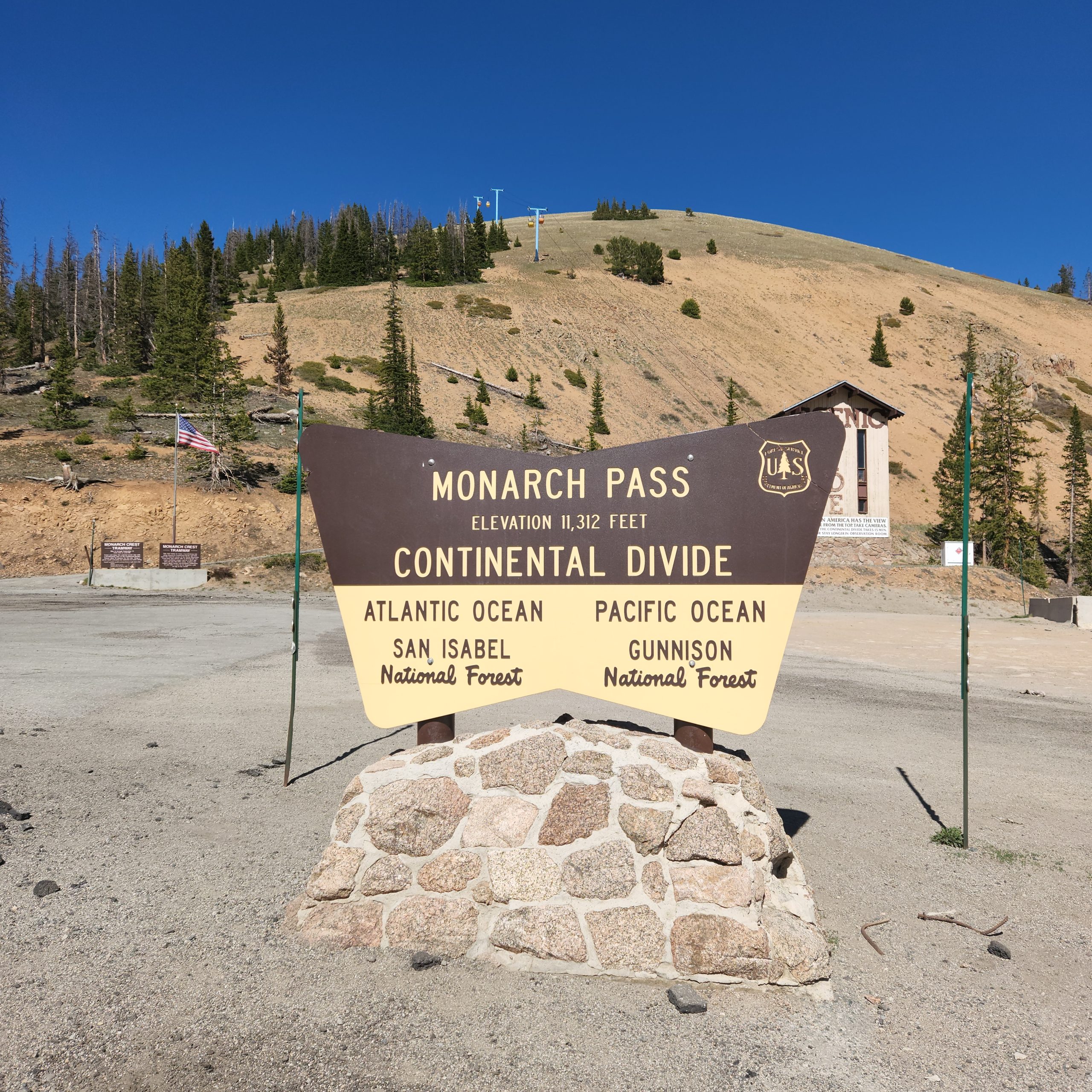
Two hours later, a guy stopped and hitched me partway there. My plan was to get on at an easier pass, and do 4 relatively easy days to Salida. It was a tiny side road with no traffic. After waiting an hour, I decided to head right to Salida and just start there. Pretty quickly I got a ride up to Monarch Pass. The driver mentioned that the Colorado Trail split there, with the eastern branch being easier. Decision made. I hiked in a few miles to test myself, and camped.
Day 1 – back on the CDT
The next day I walked out, then hitched down into Salida to pick up a few more supplies for the 78 mile trip to Leadville. I planned on 5 days, to be safe.
 Salida was nice, touristy, but nice. Both the guy who hitched me in, and the woman who hitched me out, complained about the influx of tourists, Texans mostly, ruining the town and its property values and water table.
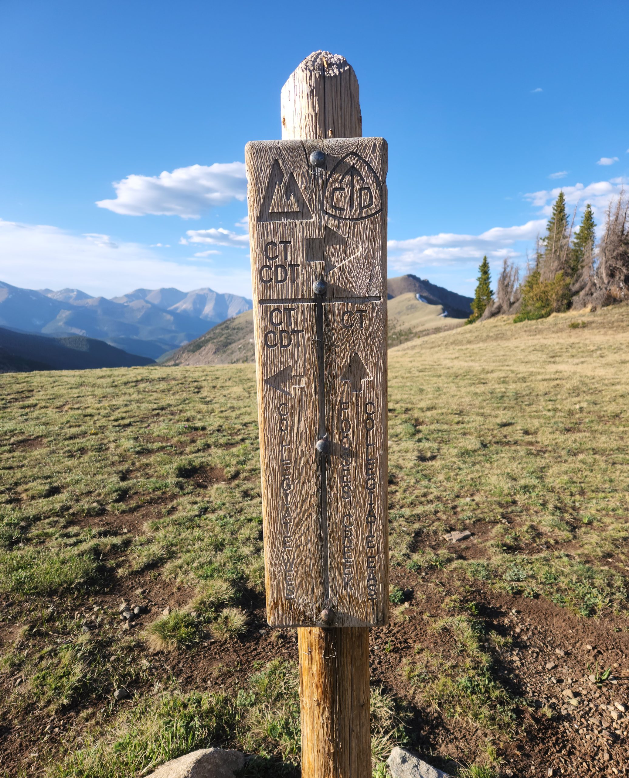
I did the 5 miles to the CDT/CT junction and had dinner. Then I made my way down a steep, sketchy, wet slope into a valley. The the valley was one big drainage, and it was a challenge to find a campsite. Finally found one, amidst a bunch of beetle-killed widow makers. Not ideal, but it was getting dark. Plus, what was the likelihood that a dead-but-solid tree would choose to fall in the next 8 hours?
Day 2 – 19 miles on the Colorado Trail
COVID or not, I just can’t make good speed uphill. Supposedly your kidneys produce a hormone that tells your body to make more red blood cells to compensate for the lack of oxygen. Mine must be taking a nap. And I’m even taking iron pills along with my multivitamin, B12, and probiotic. Either that or I’m perpetually malnourished and just can’t get out of first gear. I am down around 15 lbs.
Today was a bit of a push, to see how I’d do on rested but soft legs. Plus, if my experiment worked, I could do this stretch in 4 days not 5. So I set out as I was going to do 19, just to see. It worked. First 8 miles were downhill which helped a lot. The rest was flattish, lots of pine woods, and aspen groves near streams. Of course people can’t seem to NOT carve things in them.
Got to a USFS campground at 2:30, rested for a bit and then made dinner. The place had a hand pump for water, old timey. I was going to wait until 5, but the new thing in CO is flies. Slow, little flies, but gross flies. Drove me out at 4:30. With the long days, I know I can’t hike all day, but I don’t have to in order to make miles. 20 miles a day is fine. No points for finishing early.
I did the big climb out of the valley ( a pattern forming ) with a belly full of mac & cheese. I got to a stream around 7:30, plenty of light and great camping in an aspen grove. Soaked my tired feet in the icewater, my new trick. I wrote in my journal, “today was a good day”. So restful to hear the water rushing all night.
Day 3 – 19 more miles to Silver Prince Creek
I could tell it was a weekend. Plus, I wasn’t in National Forest Wilderness, because there were mountain biker-bros all over the place. And the whole thing about bikers yielding to hikers, a lie. How can someone whizzing along and coming up on you shouting, “on your left” actually yield? Multi use trails, but it’s a joke. Mountain bikes tear up the trail.


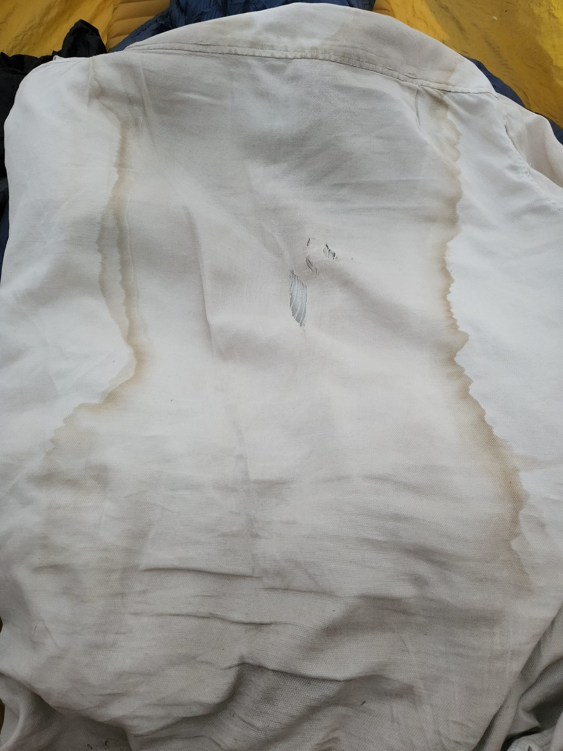
Hot today. I reached a river by noon, and washed my shirt out. Nasty. Then the roadwalk began, at least partially on dirt. When I got to the Princeton Mountain Hot Springs resort, the thermometer outside read 92 degrees. I also caught up with Jinx, Your Honor, Chris from Canada, and a guy named Cruise Control. A fountain soda Coke and an ice cream bar made a big dent in both the heat and hunger.
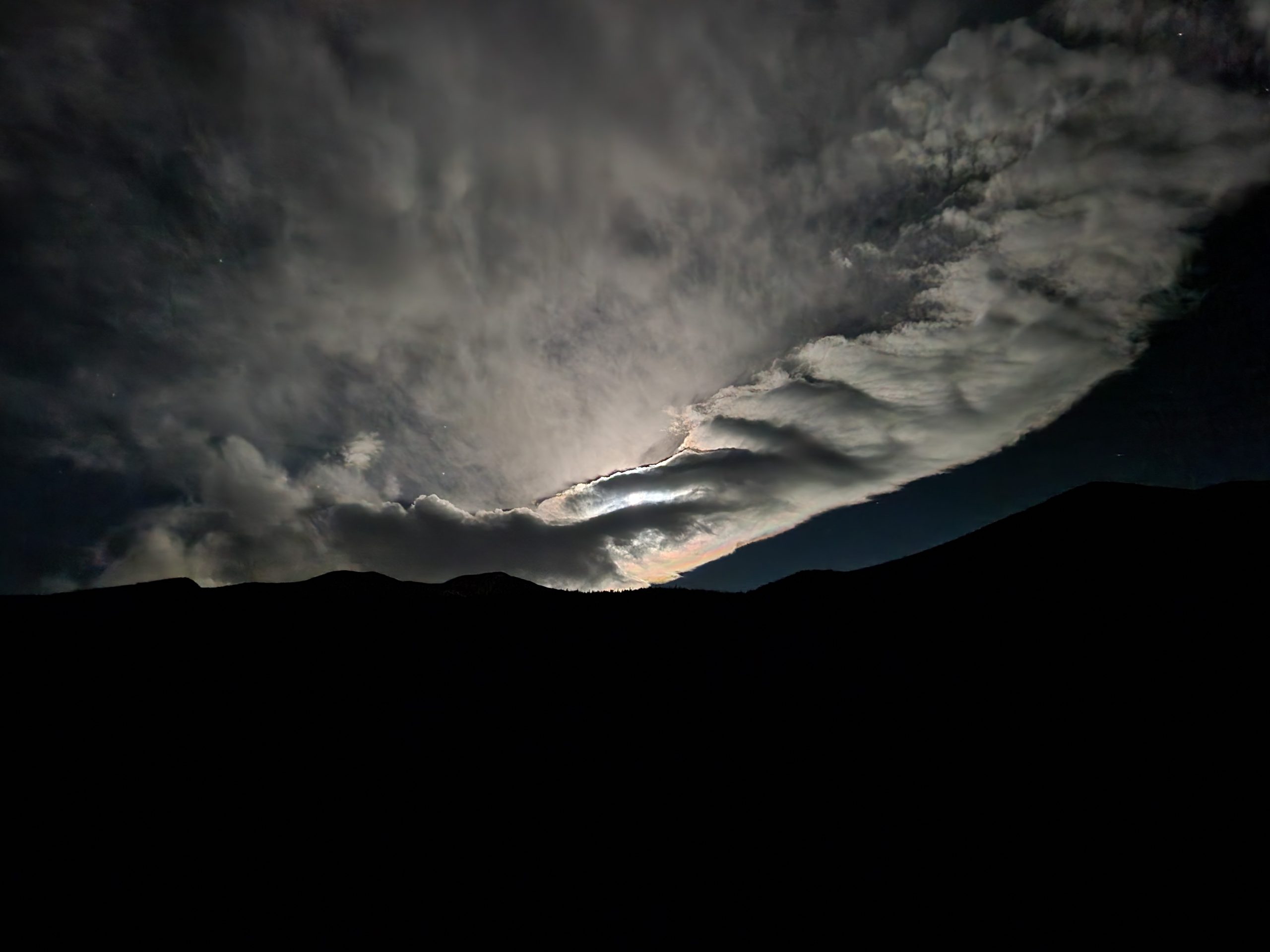
Pushed out at 3:30, up a huge roadwalk climb on the side of Mount Princeton. So many PUDs ( pointless up-and-down ), eventually coming to a creek. I still had plenty of daylight, and legs, so I pushed on. I heard that the others were doing more miles, and the terrain looked good. I ended up doing another mile, until I found a bare little hill about 50 yds off the trail. Perfect for camping. Except the mountain makes its own weather, and as soon as I set up, I was blasted with wind and rain. That night, I could see town lights, which was weird. Later though, I had epic Moon views.
Day 4 – 20 miles to Frenchman Creek

Highlight of the day, a 12000 climb with no view. But at least there was a .2 mile side trail to an open ridge. The climb took way too long, BUT, no weird COVID symptoms. Just exhaustion. You’d think the descent would be easy, but it’s an endless down, rough on the knees, back, and ultimately soul. After lunch I finally reached the bottom and there was an awesome river. More foot soaking. Eventually I saddled up and walked up to the road and there was Trail Magic! Jinx’s friends from the PCT were there with sodas, beers and candy. A Coke and 2 honey buns later, I was ready to go. Your Honor, North and I left together. When we got to the climb, I told them I’d see them at the lake. North asked, “oh OK are you going to hike slow?”. I literally laughed out loud. “Yes, because I only hike slow.”
I caught then at Harvard Lake. They swam, I didn’t. Too mucky. We had a good chat about “old” music, Rush, Jethro Tull, Zeppelin. They were blown away when I told them that the melody to the Rush song “YYZ” starts with the Morse code version of those letters, and it’s the airport code for Toronto. Minds blown. They were also stoned, so maybe that was it.
I pushed on to Frenchman Creek, where there were actual weekend hikers! Like normal people. I felt vaguely offended that they were there, it was so alien. They had dogs, one of whom was a barker. But the next morning when we chatted, the dogs were totally cool.
Day 5 – 21 miles to Twin Lake
I don’t like getting to town in the afternoon. I feel like it wastes the day. I planned to stretch my legs and do 21 miles to Twin Lakes. Not the town, the actual lakes. There were a bunch of side trails on the map, and I figured there’s always camping somewhere.
The day was the latest in a series of long downhills, hard on the knees, mixed with long uphill, hard on the lungs. Total elevation gain 5600′, total elevation loss 3800′. Sadly they dont simply cancel out. The steepness around here reminds me if New England trails.
I caught up to 2 other hikers, North and Your Honor, around Clear Creek. Aptly named, it was a crystal clear rager that threatened to knock you off your feet, fortunately with a bridge. A quick skinny-dip cooled and cleaned me nicely, and I sat in the shade for a few hours while the sun was at its peak. Nearby was the Clear Creek Campground, a dusty field where people parked their giant RV trailers. Gross.
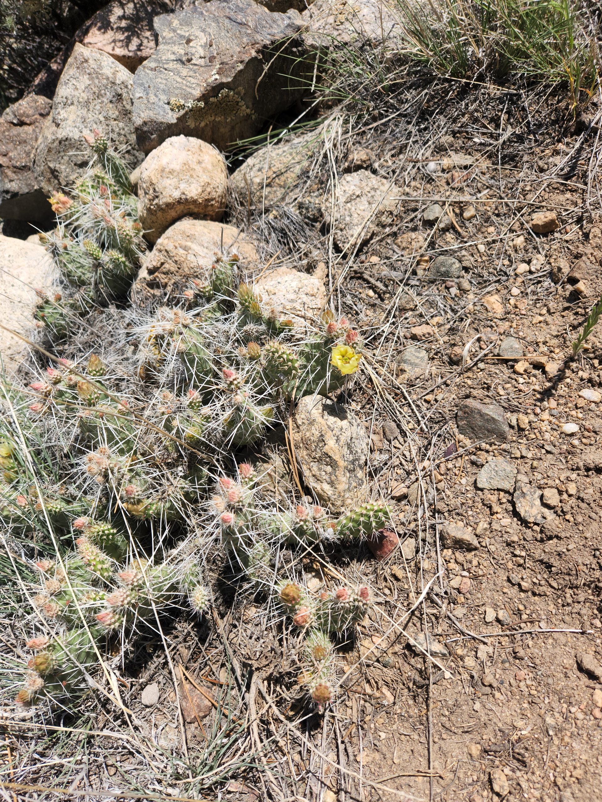
The climb out of the valley was rough, a long, steep, steady grind in full sun. It was less than 1000 feet, but like most climbs on this section, it was around 700 feet per mile. This is the “dry” section of the Colorado Trail – east of the rain shadow. This climb was so hot and exposed there was cactus growing.

Eventually the climb ended, bevayse they alwats do, and the trail switched to a lot of rolling up and down through aspen groves. Beautiful. Finally around dinner time I got to the high ridge above the lake, and had to watch it for what seemed like forever as I made my way down. Hitting the shoreline trail, I headed east to cut off some walking the next day, and to find a place to swim.
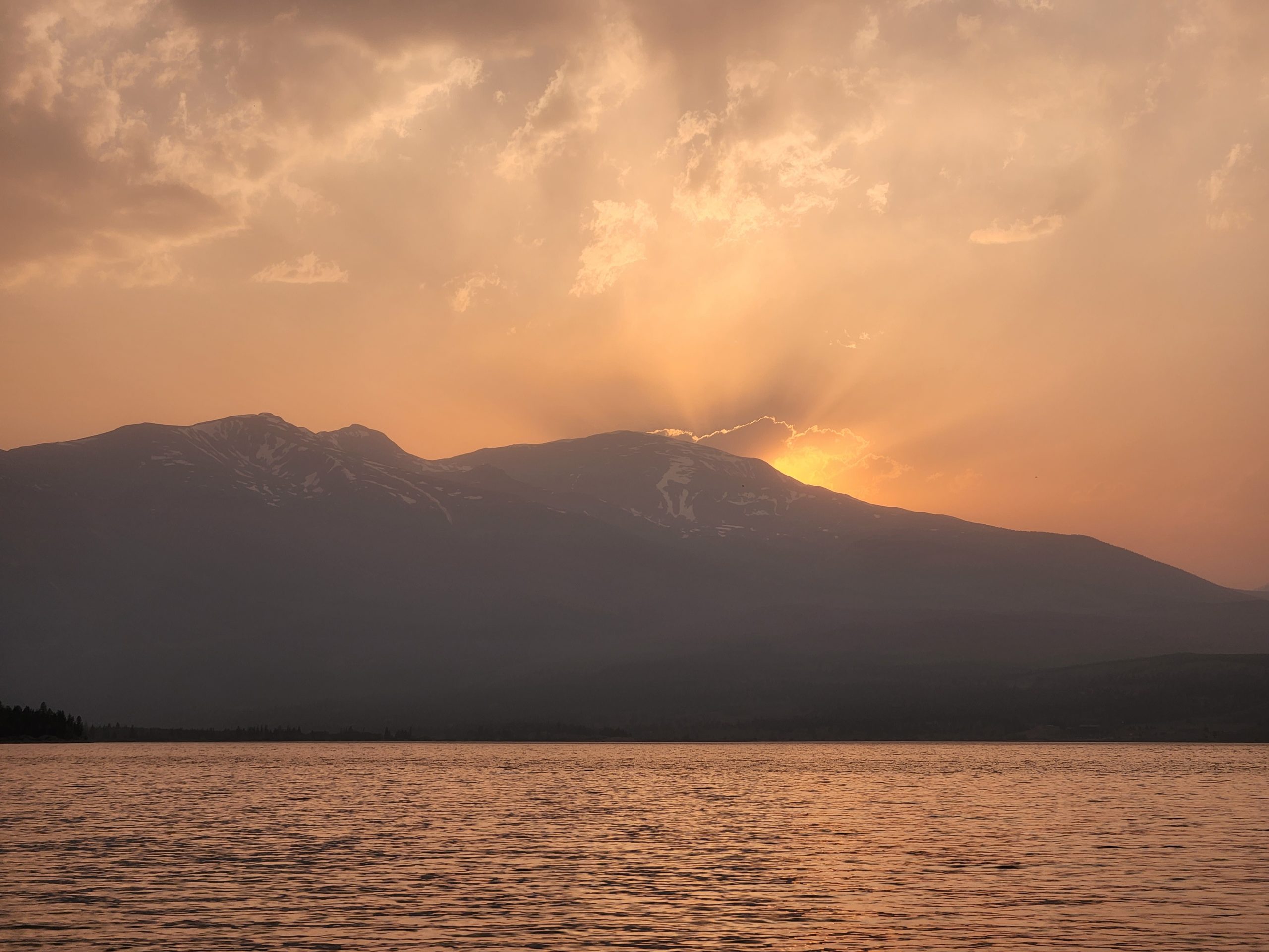

Overall an good day, ending with an amazing sunset and campsite on a high bluff overlooking the lake. I polished off the last of my food (except my vegan jerky which I’m saving for an emergency).
On the road by 7, in town by 8. Went to the Golden Burro, a plant-based place specializing in breakfast. Win.

Next up – heading N from here, into what looks like some weather. I’m keeping my warm hat, gloves, and spikes a little longer. I will try and ride it out at lower elevation, why be up IN the storm, when you can walk through the snow the next day?
I visited friends in Gunnison back in the late ’90s. Sounds like the only thing that’s changed is that they have a WalMart now.
Excellent!!! Great to hear you are back in good health and taking it slow to see how it goes. Sounds like its going well! Wishing you healthy and safe continued journey!