The last race, from Ghost Ranch to Cumbres Pass and The End. Pic heavy post – I’m not offended if you just scroll through the image gallery.
Day 1 – Back to the CDT
At least for my exorbitant, non-airconditioned hotel … room(?), I got free breakfast. Sat with an old hippy lady from San Fran, who was there for an art week. I had forgotten how much Left Coast people hated President Bush #2. I felt like crap, so I drank 3 or 4 glasses of orange juice, and pocketed 3 mint tea bags for the road. The rest of the breakfast was forgettable, but I recall it being pretty gross. So much for the “meal plan” that they make you pay for.
It was already warm when I left, the “green line” alternate route wound through Ghost Ranch, past the “Art Center” where I dashed in for one final bathroom break before hitting the trail. Civilization is not something to be taken for granted. Out a dirt road, past the “watch for lions” sign, the canyon opened up. You could definitely see why they film movies here – cool red rocks, hoodoos, everything was very “western” looking. After a bit the trail dropped into a streambed where there was actual water.
Note to self and for future CDT hikers – don’t stay at Ghost Ranch. Ship your mail there ($5), buy ice cream, charge your phone, fill your water bottles, then cruise an easy mile or so out of the property until you reach the National Forest. Or, skip entirely – send your mail drop to the Abiquiu post office, and stay at one of the private hostels there for $20.

Hiking out
Up and up the trail wound, I was racing the morning haze. It was hot, but in mid-afternoon, 100 degree sun, it would have been unbearable. I got up to the high stuff and walked along the mesa before the haze burned off. From that point on it was two track, passing some cows and some corrals. Thanks, USFS, for leasing the land to the cow people. Although, based on the folks I met and talked to working at the Ranger Station in Coyote, and the folks in Abiquiu, they’ve probably been there for about a thousand years. Leasing their land back to them seems kind of shitty.
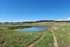
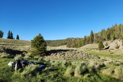
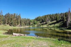
With elevation comes moisture, almost never water. But moisture nonetheless, so the trees and flowers changed from the prickly kind to the leafy kind. At around Mile 702, the Ghost Ranch alt meets up with the CDT again, near this amazing meadow and “dope” water source. Clear water gushing from a pipe into a not-totally-gross tank. This was about 14.5 miles from where I started, and about 2700 feet higher, up over 9,000.
It was close to dinner time by now, so I filled my water bottles, calculating 5 miles per liter plus a liter to camp. With the phone app all the hikers use, its kind of easy to plan things out. Back in the day when people navigated with USFS maps and trusted to luck, I bet they carried a lot more water. I got past here into the shade and had a good break in an area strewn with the bones of elk, including some fresh ones. I’m guessing lions, and the coyotes for the smaller ones.

Back on the CDT
After the water source, it was good to feel the CDT under my feet again. It reminded me of a time back in 1999 on the AT in Pennsylvania. It was hot, and I was wearing my monstrous heavy boots, and I had been walking on asphalt to get out of some town. Then the trail turned into the woods, and suddenly the air was cool and moist and the ground had some bounce in it, and I felt like I was home. Not just because it was more comfortable, but there was a faint whisper of “Welcome back” in the air.
Once I finished dinner, I did a few more miles, mostly through grass and small clusters of Aspen trees. Scared a few elk, and disturbed more than a few cows. I camped near the top of the ridge at about 9200 feet, behind a copse of the scrubby oaks that grew in tight thickets. The wind was steady from the west, but the trees blocked it all. Cowboy camped, of course. Down the valley was the tiny “census-designated place” of Canjilon. Tiny, but they had a cell tower somewhere, since I had 1 bar of cell – not enough to text home with, though. I took a few Tylenol, a couple of ibuprofen, and made mint tea. I saved the Sudafed for the morning, I wanted to be able to sleep.

Around midnight I awoke to a “muster” of coyotes (which is my new collective noun for them), VERY close. I sat up and put the headlamp on full and shouted, and saw a few gleaming eyes run away. I very much doubt they were going to eat me, I just happened to be sleeping in a place where they gathered. Like Bilbo and the Dwarves in the Hobbit when they happened to camp in a clearing where the Wargs and Goblins were going to meet that same night.
Day 2 – Rio Vallecito
21.2 miles. Had a rough night, I woke up early, coughing. I wasn’t that high up, but air was a little hard to come by, so I took more Tylenol and saddled up. Early on I was still kind up on the ridge, so it was drier and grassier. The trail wound through some prairie dog colonies.

Dropping down, the woods got wetter and the trees taller. Mid morning I came to a nice stream, and had a good break. Quiet, ravens overhead, clear cold water, the sun hitting the hillsides, but not me. It was a great day. Once I was moving I didn’t feel so poorly, and things were looking up.

Cruising on my trail legs
Before lunch I suddenly stumbled out onto a PAVED ROAD. Seemingly in the middle of nowhere. Following it uphill, I came to Upper Canjilon Lake, where some people were picnicking and fishing. And gift of gifts, a pit toilet. I took a break and got things sorted out and pushed on. Not a cloud in the sky, hot, and elevation increasing made it hard, but the trail was in great shape, and not remotely steep. I came across a trail crew cleaning up wet areas. We chatted for a bit and I thanked them, although they seemed more excited to see a thru-hiker than I expected. I guess its just random luck, if you’re moving around doing trail work, you might hopscotch all over the place and never see a hiker, despite the ever-increasing numbers of us.

Overall it was a hot, quiet, “cruisey” day, where you make good time and nothing’s super hard. I was also starting to really get my “trail legs”, so doing 20+ miles at elevation with a 25lb pack on wasn’t nearly as tiring. Plus being out of the desert proper, there was water at reasonable intervals, so I didn’t have to hike like I was part-camel. (A were-camel?) Water’s the heaviest thing in the pack.

Later in the day, I started to poop out as I descended into the deeper trees. I stopped for a break, just plopped down next to the trail. One rule of Leave No Trace is “travel and camp on durable surfaces”, part of that is making sure you find an appropriate place to camp or rest, so you’re not just sitting on plants. Out west things are a lot drier, so there’s often just clear spots on the ground anyway. Down I sat. I had shipped a huge pile of Probar snacks – they’re epic, about 130 cal/oz, and come in killer flavors like “chocolate chip peanut butter”. Next time you’re at an REI, buy some, you’ll be hooked.
The bear
Munching away, all of a sudden about 30 feet away I hear some branches snapping. Looking up, a big brown-colored black bear waddles out right into the trail. And there I was, holding what’s probably the tastiest thing for a bear outside of a Slim Jim. I shoved the whole thing in my mouth, just to mask the smell with my own (which was considerable). He looked at me, I looked at him. I reached over to close up my food back, lest the PB/cheese/chocolate smells wafting out of it drew him closer. Once I moved, he bolted, ran about 60 feet away into some bushes and peered at me. I rolled up the food bag, looked back, and I couldnt’t see him. He was like a big fluffy ninja.
Still, very cool.
An hour or two later the trail wound down through some aspens and came out to the Rio Vallecito. There I ran into Smash, a British hiker, enjoying the afternoon. He said he was used to doing 28 mile days, but then purposefully pulled back on the throttle to do 22-23 milers, and enjoy himself. He swam in the river, had a snack, ate his dinner, and was ready to push on. We talked for a bit. We also met a woman who worked at the private Buddhist resort/retreat down the river. She was up here for a swim, which I felt bad about. Clearly she didn’t expect to deal with two dudes. But she was nice, and offered to carry my trash out for me (I didn’t really have any).
The river
Smash left, and the more I thought about it, the more I realized that I was making good time, and my cold had caught back up to me, and it was dinner time. So I got clean in the river, ate my dinner, and set up my sleeping bag in a pine-scented grassy meadow about 100 feet away. Another microclimate, I thought, although I was going to be glad of the cooler air; it was definitely getting summery.
I made more tea, and had some more Tylenol, and ate a lot of M&Ms. The problem with being in a valley is that the sun drops really early, so while the sky is still bright blue, you’re in the shade. You want to go to sleep, but obviously can’t. And then came the bugs. For the first time I wished I had a tent. So I put my baseball hat on, and put my shemagh over me like a blanket. The brim of the hat kept it off my face. I dozed off, and when I woke up it was dark and cool, so I was able to rearrange things and sleep more normally.

Day 3 – Rio San Antonio
24 miles, the biggest day of the hike. By now I was really in hike mode, PLUS, was down to only a couple of days left. There’s a sort of gravity well that a town or Terminus or just the end of a hike has, and my food bag was getting lighter by the hour. Back up into the dry pines, criss-crossed by old barbed wire fences I went, stopping for a bit at the “Shrine to Icarus”, a weird statue thing high up on a cliff above the Buddhist retreat place. Took a few pictures, and found my way back to the trail.
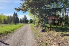
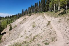
From there it was classic CDT. The trail was cut to stay along the ridge, passing in and out of aspen groves. Paralleling it, and clearly intersecting it at a pass, was a forest road. So I took the road. The footbed is easier, the views are better, and you never know what you’ll run into by doing something different. And indeed, I ran into a guy on a bikepacking trip. We didn’t talk much, he kind of waved and kept going, but there’s something you don’t see every day. Soon it was back and forth between the trail and the road, and I started to see a few trucks and those abominable “side by side” ATVs. I knew I must be getting close to Hopewell Lake campground that WAY back in Cuba, back in the desert, Girly Girl had said “was pretty”.
Hopewell Campground
It wasn’t. First there was what we would call back east a “vlei” – a grassy field that conceals the fact that it’s really just grass growing in ankle-deep water. Like a rice paddy. Then it was a series of dirt roads with small pull-in campsites, all surrounded by grass. With no shade, or privacy, but it DID have pit toilets. I worked my way through the campground towards the highway, and found the big pavilion they have there, I guess for when it rains. I spent about 3 hours there, from 1130 to 230 or so, eating, drying out my shoes and feet, and wondering what the best way to get water from the gross lake was. The campground water pipes were turned off.
I ended up just asking someone with a big camper if they had water, but they were just there for the day and didn’t. So I filtered some fishy, pondy water from the warm, green end of the lake, and trusted my water filter. It wasn’t too bad, if you dumped some electrolyte powder into it.


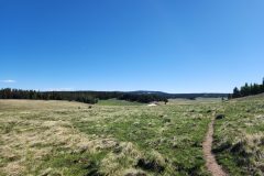
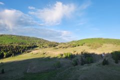
After crossing Interstate 64, yes, an Interstate, the trail went up again, this time heading straight for 11k. I had water, I knew I was heading TO water, even though it was going to be a really long day, and I knew that because I was heading to a river, the last bits had to be downhill. Up and up I went, through some really high parks, some even had snow. The wind picked up, and things got really cool – there was an emptiness that even in the woods, you don’t often feel. Outside of the occasional fence posts, there was a timelessness to the place. Sun and sky and snow, like there always was, and always would be. Well, except for the ranch land JUST on the outside of the National Forest. But, props for the name.

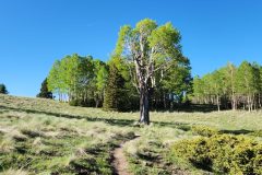
The sun started to drop; I had spent a lot of time at the campground, and there were miles to go. Through more parks and aspen groves the trail wound, occasionally passing by a really “entish” sort of tree.

Are we there yet?
The last mile or so was definitely a lot of “are we there yet”. The grind was broken up by the trail crossing and re-crossing a stream that fed the river, in a deeply eroded valley. So it was some gymnastics and careful planning to avoid wet feet. Still, it was nice to be in the cool, moist valley while overhead the sky was still bright. Kind of the opposite problem from the day before. Finally I got to the part where the trail curved up away from the river, where the phone app mentioned “several flattish spots in the grass”. Good enough for me. Flattish would do. I filled up with some clean, but brownish water, made dinner, ate a lot of peanut M&Ms, and went to sleep. In less than 5 minutes of fidgeting, I was out like a light. I woke up cold; another microclimate, but got to see some bright stars and satellites overhead.

Day 4 – camping at 11000 feet
20.8 miles, the last night. The cool part about camping in steep river valley/canyon areas, is that the morning sun gives you great golden hour light for a long time. I got to hike up out of the valley and along the west side of a ridge, just below it. So I was in the shade, but the far wall of the valley was in the bright morning sun. The coyote packs were all howling, either they got something for breakfast, or maybe they were just shouting “Here we are!” to each other. There were again tons of elk, sadly with only a 3x zoom on my phone, no amount of “digital zoom” will help when something is that far away. But trust me, tons of elk.
Once I got up to some more flat terrain, the forest roads re-appeared, and I found myself coming into Lagunitas Campground. Unlike the first place, this was set high up in the pines, and had several small lakes (Lagunitas, get it?). There were a few sturdy cars there, mostly Subarus and small SUVs, but not a lot of people moving around. Maybe they were out mountain biking on the dirt roads? I stopped at the biggest laguna for water, and was joined by an older man which I later named in my journal as “Yackety Slacks”, because of his ability to talk non-stop, and his pants, which were patched and repaired in a variety of strange ways. I was soon defeated by the altitude, I literally couldn’t keep up with the conversation because I couldn’t speak as quickly and as at length.
Yackety Slacks
But he told me all about how NM used to be nice 40 years ago, and is gross and crime-ridden and touristy now. He gave me a wealth of knowledge about hikes I could do when I finished, I could go to Taos, and do some 13k peaks there, or go into the Rio Grande gorge and hike there. I didn’t have the heart to tell him that when I finished, I planned on sitting in an air-conditioned car for a few days. I filled and filtered water, and ate second breakfast. On and on he rambled, not unlike this blog, until after about an hour I finally made my excuses and left. It was a steep haul up out of the lakes and back into the hills, but a beautiful area.
Note to future hikers – dial in your trip so you can camp at Lagunitas, it’s worth it.


About an hour later, up close to 11k, I ran into some dayhikers, heading back to their campsite at Lagunitas. They explained how it was going to rain, and how they had managed to park their car in the middle of the CDT where it went through the campground. They seemed nice enough, but frankly having spent an hour talking to Yakety Slacks, and with the threat of rain, I pushed on.
I dug in. The trail wound up and out of the trees, and started a 10-ish mile traverse of largely above treeline. NOT the place I wanted to be caught in a summer mountain thunderstorm. As I hiked, I kept looking over my shoulder, and it seemed like the thunderheads were gaining on me. I didn’t let it completely distract me though, the views were amazing. It’s hard to say how far, but far – and I could see snow-capped mountains off to the north.
Rain at 11,000 feet
Just as rain to the south of me moved off to the East, so did a big cell move in from the west. I could see it north and west of me, lightning and everything, and it was moving across the valley to intersect the ridge I was on. And it hit the ridge right when I happened to be there. By then the lightning had fizzled out, but I still went down off the ridge and took shelter. I picked a decent sized group of trees – not ON the ridge, and there was no 1 tree that stood out from others. When you’re out in the middle of nature, sometimes you can’t find a perfect spot.
Tips for avoiding Death-by-Lightning.
I wedged myself inside a pine tree, by getting in past all the greenery and kind of stuffing myself in where all the branches were dead and bare. It worked well, barely got wet, no wind. After about 20 minutes the rain blew past and I scrambled out. The weather stayed overcast the rest of the day, but high, not-so-dark overcast, so I was fine. At about mile 767 I heard the steam train whistle of the Cumbres Toltec Scenic Railroad, which goes right through Cumbres Pass, so I knew I was getting close!
The trail wound off the ridge and down through some high park land, crossed by intermittent streams and old rutted two-track. I filled up water and pushed on, I didn’t want to camp in the open, and it started to rain again.


Camping
Once I got back into the trees, the rain stopped, which was just awesome. I really needed dinner, I was running on fumes. Then I ran into a dayhiker out exercising his dogs. Off leash, which was a little annoying, but they were well mannered. As we talked, he related the story of how the smaller of the two (maybe 40lbs) ran off after a coyote once, and only just came back to him. From that point on she wore a shock collar. But, other than that he seemed nice. He had done the CDT a few years back, so we chatted a bit about that and parted ways.
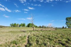
My plan was to get to the height of land at about 11,100 feet and camp. Just ceremonially, the last, highest place on trail. But two things happened: I read on my phone that a few days before people reported that it was still covered with snow, and secondly, I found this amazing small park right off the trail. It called to me. So I camped there, wedged in on 3 sides by trees in case of wind. I pitched the tarp for the 2nd time only, just in case it rained.
I ate dinner and the remainder of my good snacks. Tomorrow I had only 8 miles or so to the Pass, and from there a short hitch into Chama. I was sad it was over, but glad I came out here. And pretty psyched that I had pulled it off. You never know how much you have left in the tank.


Day 5 – Cumbres Pass and the end
I woke up slowly. There was no rush, and by definition, it was almost all downhill. I got rolling eventually, savoring the nearly empty food bag, and the 1L of water I still had. But NM had one last middle finger to throw my way. Blowdowns. Storms from multiple years had thrown trees over the trail. Over and over. As in, every time you climbed over one, you had to climb over another one.

I chose another road route. I could see on the map that the trail clung to the ridge, while the road ran below it and then tied in later as the ridge dropped. And it turned out to be clear of trees, so I could stroll and enjoy myself.

Plus there was a grouse.

I got to Dixie Creek, the last water in NM, and had a good rest. The water was amazing, so I drank some right out of the stream, then filled up a 1L bottle and pushed on. The gravity well of the border + the pass + Chama had me locked in its grip. I would be in town for lunch.
The border
And then there was the border of Colorado. Complete with license plates from both states, pretty cool.

From here I could tell the trail was well traveled, hammered flat by many dayhiking feet. At one switchback, they had even installed these sort of wooden railings for people. I ran into a couple of dayhikers, who said “we have a treat for you!” and then offered me my choice – beer or orange soda. It was early for beer, and I needed the sugar, so I took the soda. In spite of everything, it was still gross, I think only fit for children. I pushed on.
Periodically I would smell something funny, like perfume or soap or laundry detergent. Then I realized, it was the lotion (sunscreen?) that the lady hiker had on her hands when she gave me the soda. Sure enough, the can smelled like clean people. Its amazing how good your sense of smell gets after only a few weeks outdoors.
The trail bounced down towards the road, at one point with a short but steel uphill. “Oh, fuck you” I shouted before I even realized it.
But I made it to Cumbres Pass. I had connected the dots, and walked the entire length of the CDT in New Mexico.

Chama
This road is in the middle of nowhere, it connects Chama (tiny) to … some other tiny place. I wasn’t hopeful. But as I was sort of messing with my pack and arranging it for hitchiking, I heard a car coming. I threw out my thumb, and they stopped.. This was less than a minute after I had arrived on the highway.
It was the dayhiker and his dogs from yesterday along with his wife! It really made me think about timing – one more pee break, a longer chat with the soda people, more selfies at the border, and I would have missed them. Not that I wouldnit have gotten a ride eventually, but still, you can’t beat instant.
The rest of the day was town stuff; a big hot chocolate at the coffee place, a hot shower and laundry at the RV park, and another “sleep under the shemagh” night because I was once again camping near the Rio Chama river. I put up the tarp instead of cowboy camping purely for the comfort of the families camping there. This way they didn’t see a bearded hobo sleeping on the ground and call the cops. I spent the next day in Chama and got a pricey hotel room – pricey because there was an actual rodeo in town. The next day, about 9 hours of public transport including 3 buses and a train, I arrived at the ABQ airport car rental place and got my car to start my road trip.
Epilogue
Go to White Sands National Park via Alamagordo. I’ll let the pictures do the talking.


Whats Next?
I think, maybe, I might tackle the 216 miles from Wolf Creek Pass to Monarch Pass in Colorado. This was the section I skipped due to COVID. 42 miles of it will be a repeat, including the Knife Edge, but its beautiful and a lot of 12k stuff. I might be able to do it in 3 weeks total. Is it too high? Too hard? Might have to find out. If I pull that off, it will stitch together all of CO on the CDT as well.
Awesome descriptions and observations. I love the humor. I felt almost like I was there with you. what an adventure!
Wow! I love reading your posts and looking at your photos. I am amazed at all you’ve done. Looking forward to seeing your next adventure.