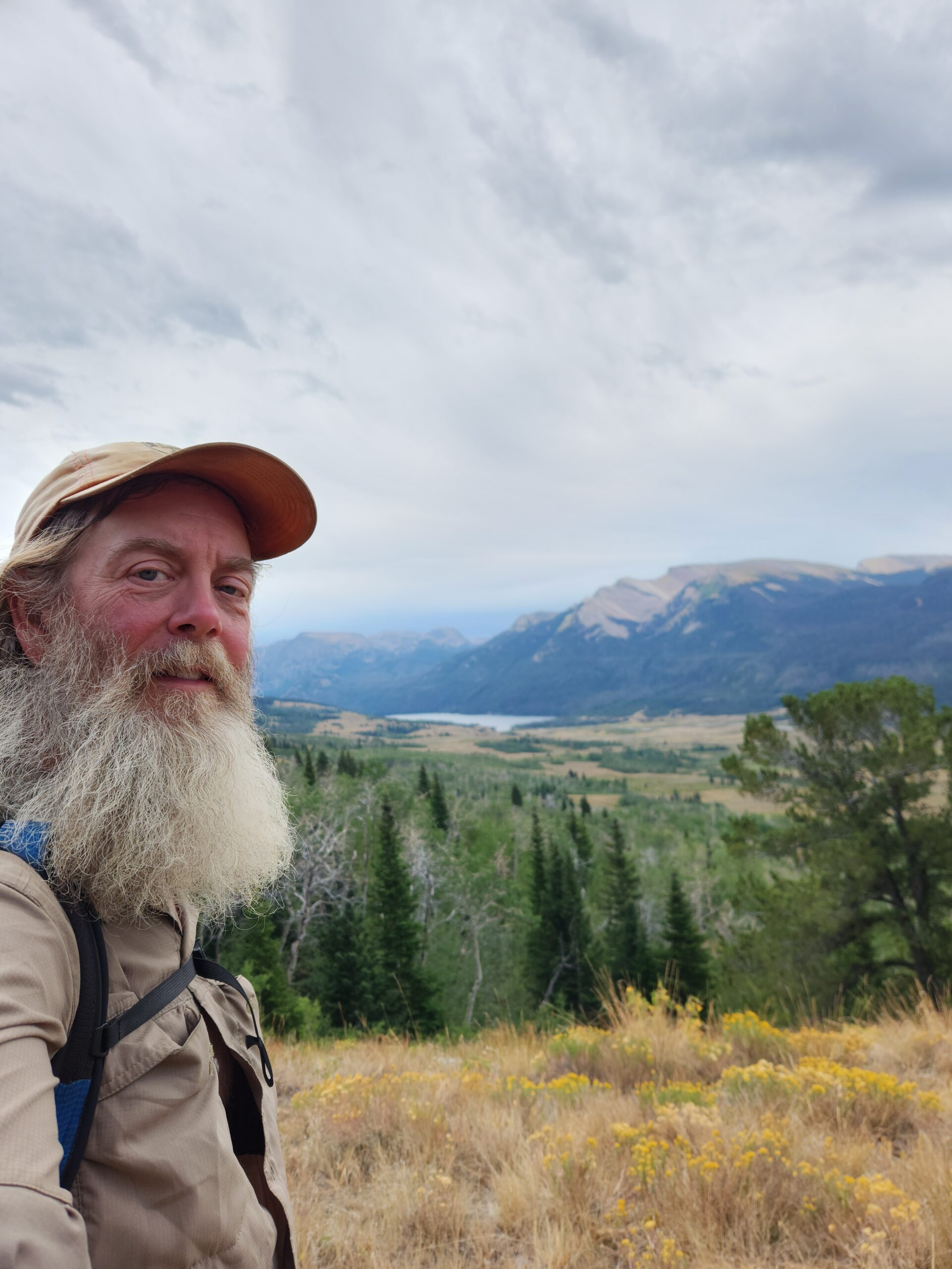
The northern half of the Wind River Range in Wyoming. Starts slow, but becomes epic. Wyoming is my favorite state on the CDT, you get Yellowstone, the Winds, and the Basin.
MORE big pictures. Lots of them. View on a real screen if you can.
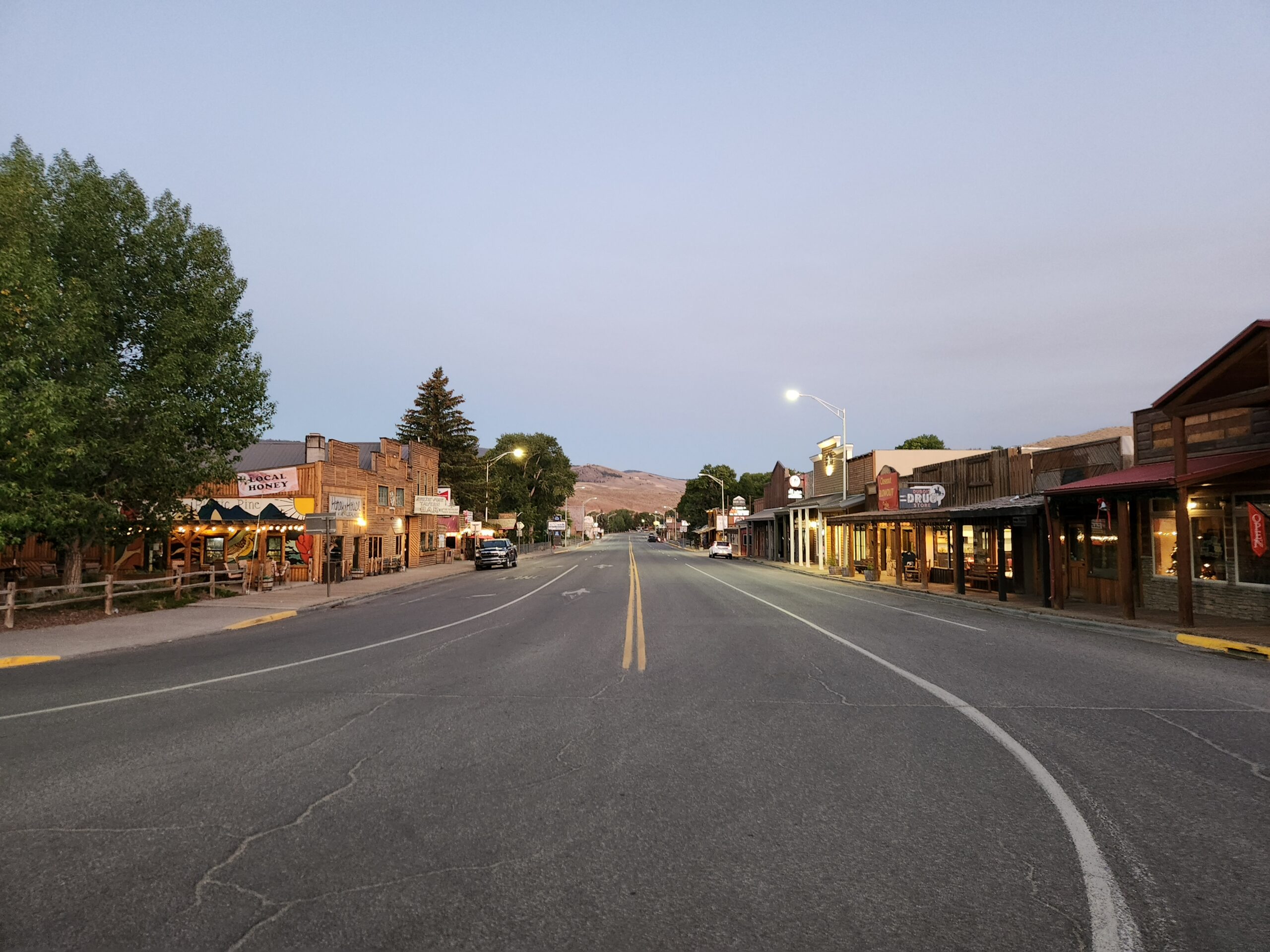
Day0 – zero in Dubois
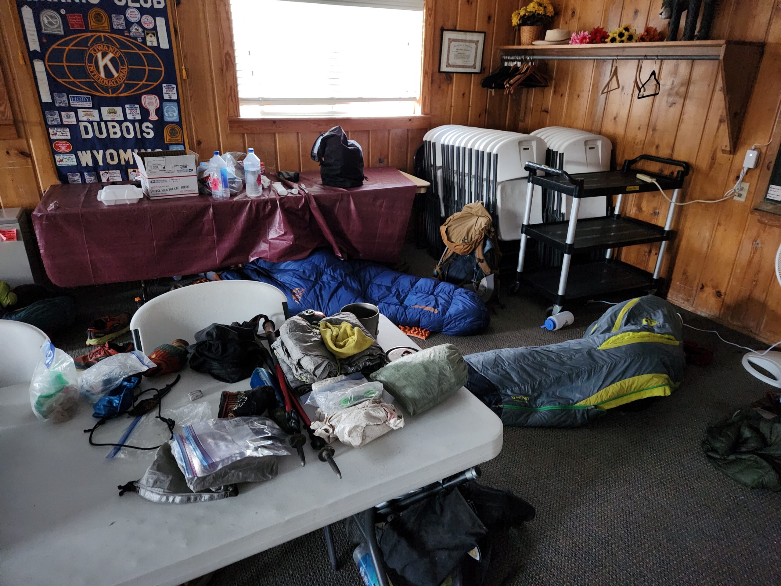
Up at 6 with all the hiker trash in the church hostel. Everyone was packing and leaving, I was taking a zero. But I was starving, so I headed out to Perch Coffee on the corner. It’s still the best coffee place on the trail, with great coffee, and great people/patrons to hang with. People in Dubois are NICE. I headed down the road to the KOA where for a few bucks I got a shower and did my laundry. I talked to a nice lady there who drives around with her husband staying at RV parks. Some issue with his prescription not being filled here was forcing them to leave and head home to … Texas maybe? Hit the only store in town for groceries, such as they were. Last time I was here I had done a maildrop, and then discovered that I could make do with what was here. The store was big enough that the chance of being out of noddles/PB/candy was low – unlike some places in NM.
I kind of just hung around all day. Rattling around this little town by myself, just like last time. Handy had bought a can of Tinactin and left it in the hostel, so I sprayed some in my shoes. They were getting pretty gross, especially after walking through mud for a few days. It was weird to just do nothing for a day. Once you do your town chores the urgency is gone, and when you’re normally hiking from dawn to dusk it feels strange not doing it. I dumped some stuff in the hiker box; bug spray, extra rope, spare notebook. Shaved off maybe 10 or 12 ounces – the rope was heavy. I had used the rope exactly once, in Yellowstone, to hang my bear bag. I still had the bag, but was going to do the ‘tie it to a tree’ method. Or just sleep with it (shhhh). A NOBO hiker had told me that “there’s so many people in the Winds now, you’ll be lucky to see a bear”. Maybe that was true?
It’s going to be a 5+ day carry, 100 miles through high stuff, to Pinedale.
Day1 – the old CDT
Cold morning, out at 6. Lady cleaning at the coffee place said, “Winter is coming.” I was there before they opened, since the church hosts community meetings super early on Tuesdays.
After coffee and scones, I got a shuttle from Mike, a local trail angel. He had lots to say about Dubois, the Winds, and bears. According to him bear spray sucks, it sprays too short, and not a jet. When he mountain bikes, he carries wasp killer, which shoots like a 20 foot jet. It’s illegal, he said, because it can do permanent damage to eyes/mouth. But, he said if the bear was charging him, it was already either him or the bear. He complained about Jackson money flowing into Pinedale, that town is not like it used to be.
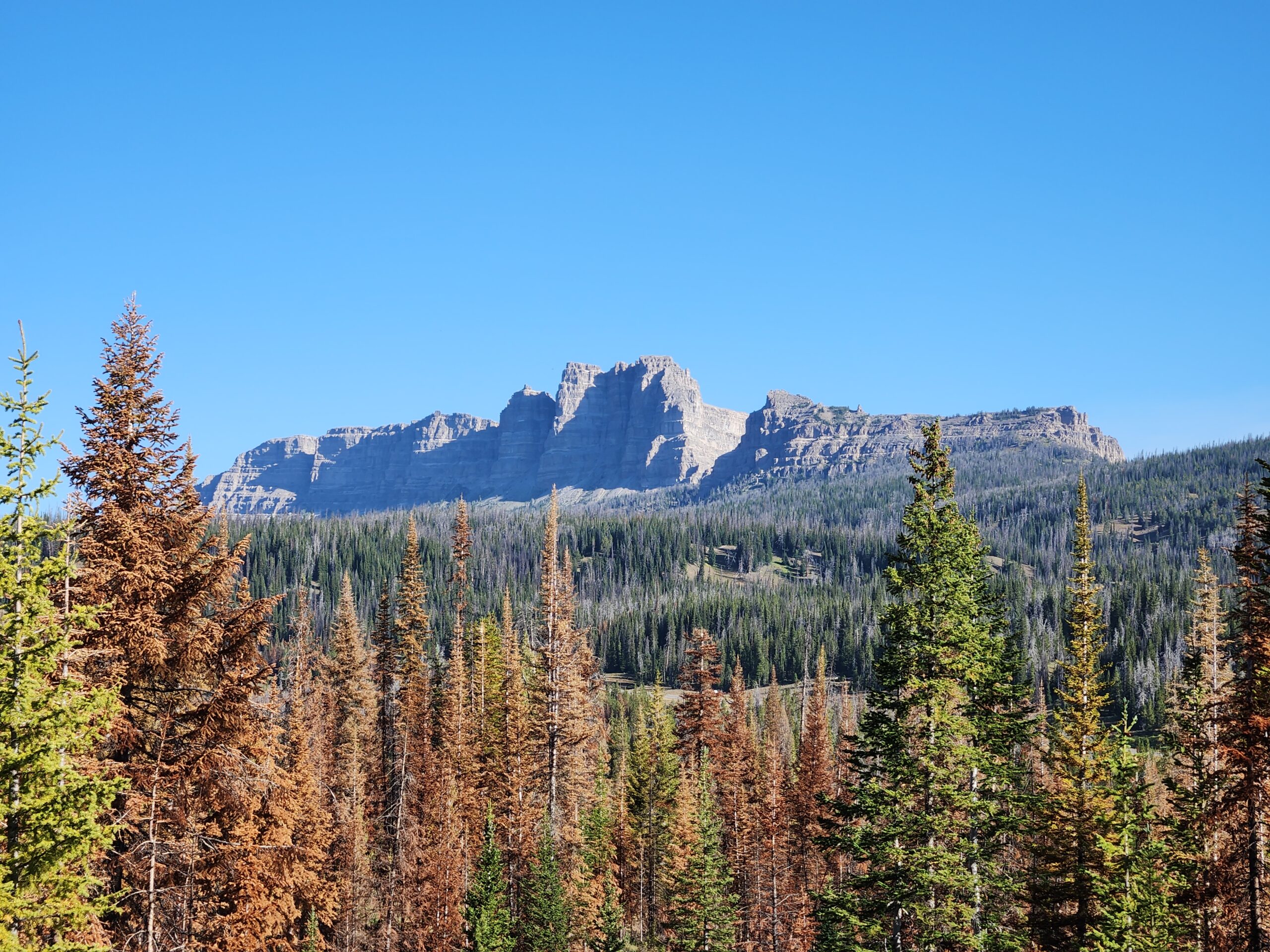
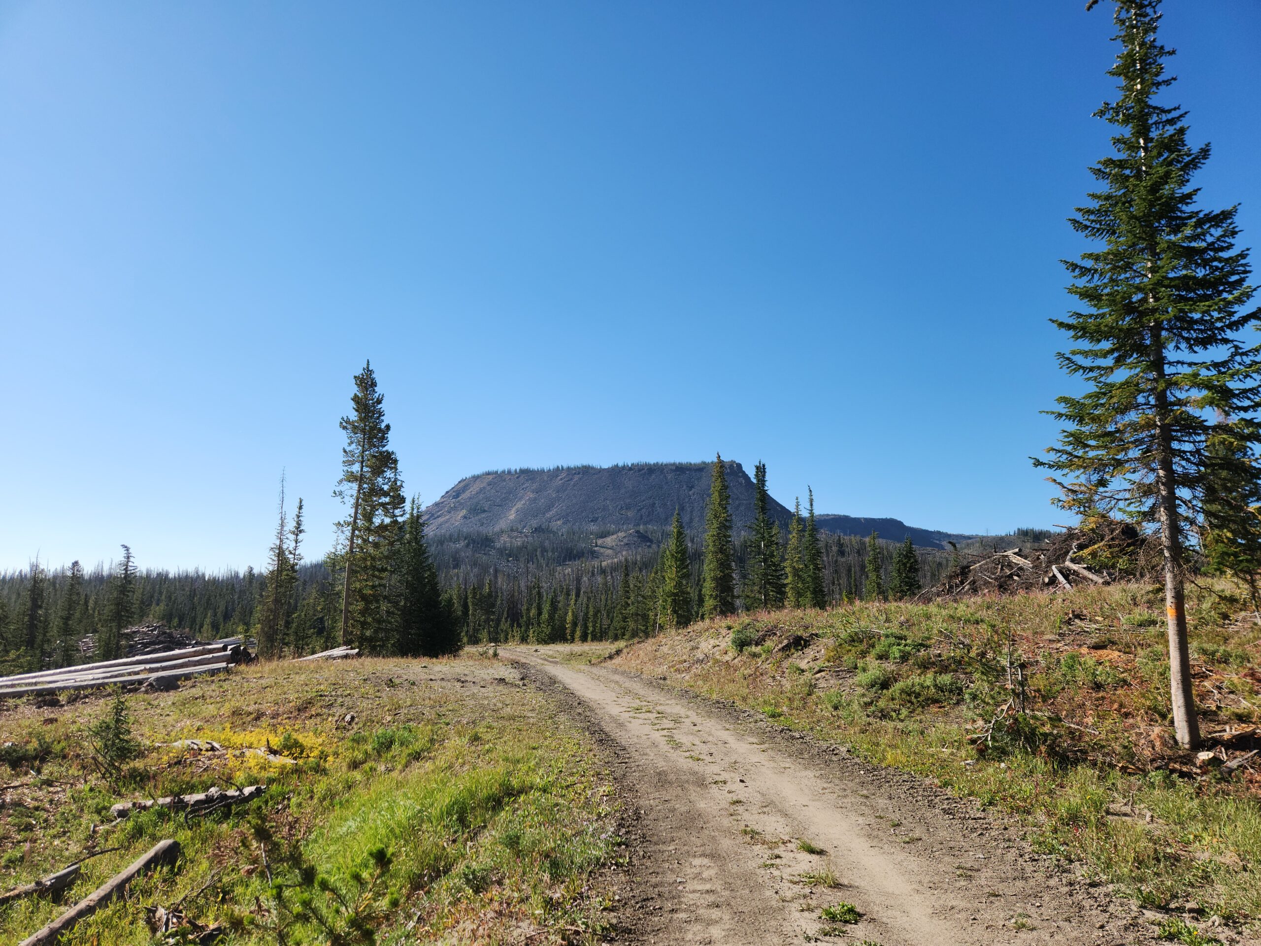
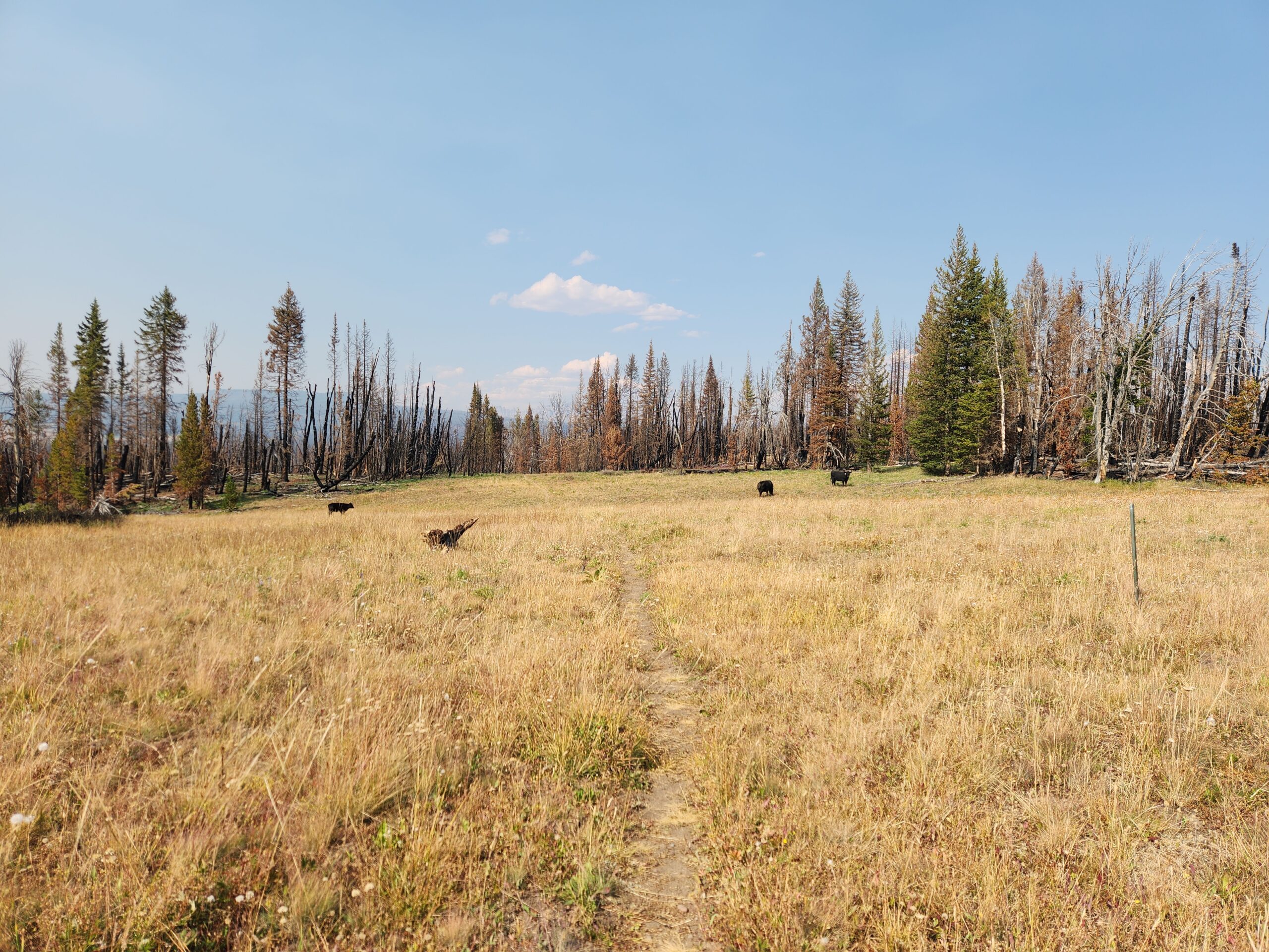
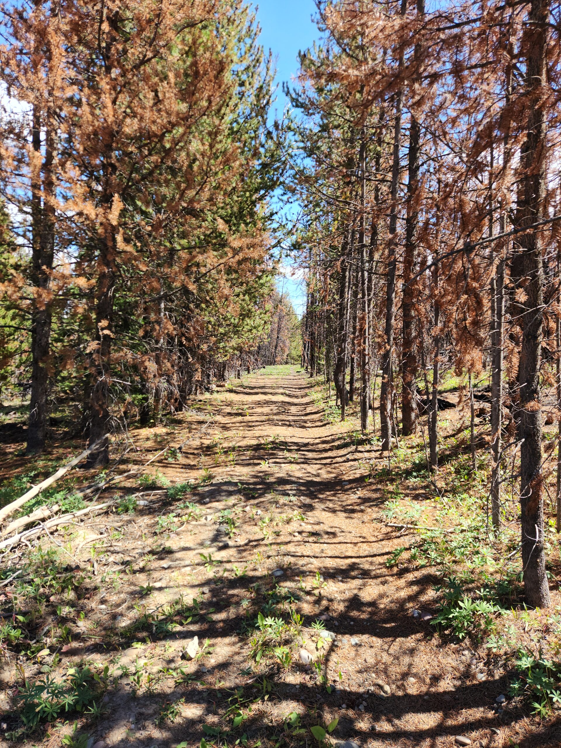
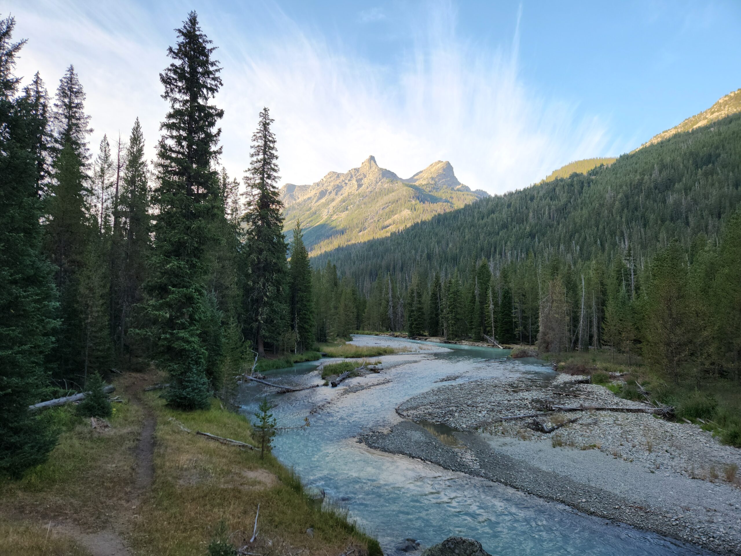
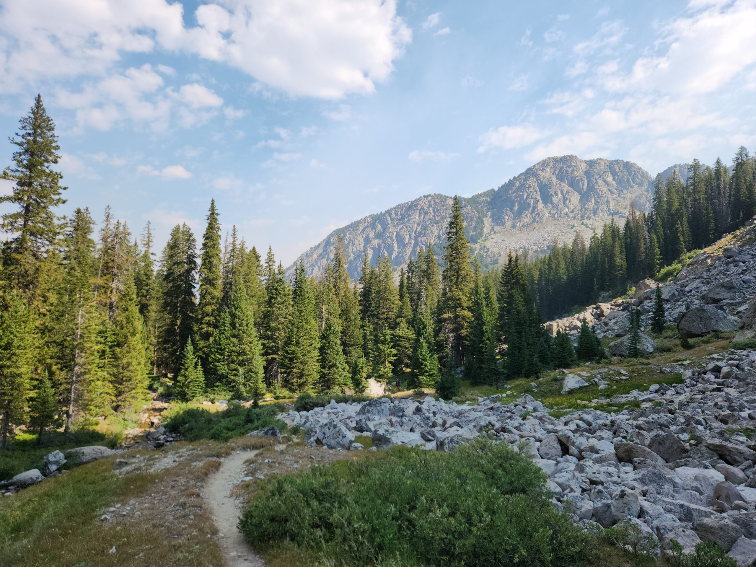
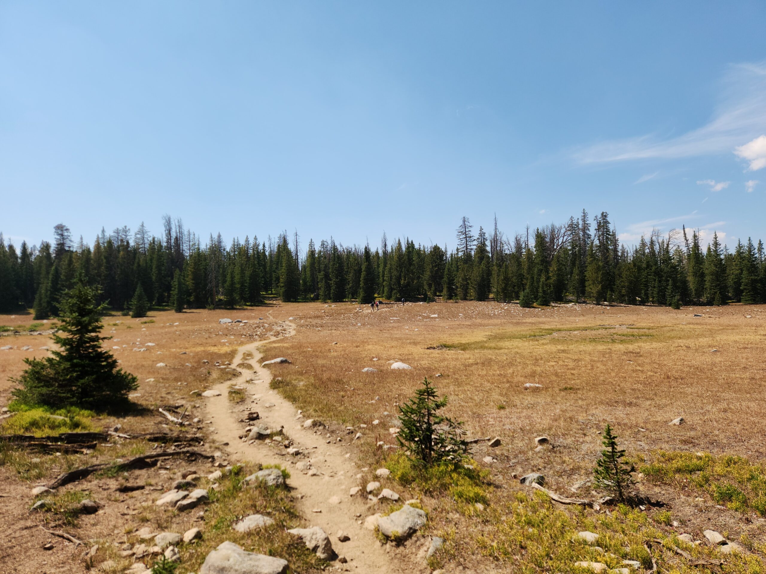
Great weather, the sun was out, and not a cloud in the sky. It got hot, and there was a high smoky haze. It was a long roadwalk on the old CDT, peaceful. Not a lot of water, but enough. I hiked until 4, climbing steadily the whole time. The CDT comes in from the north, through a huge burn area, and ties into the old CDT where I was. Cows, too.
After a mile or so there was a big open field, with a spring downhill. I called it a day, and filled up my water. At 6 or so Dr. Pepper showed up, and also 2 lady hikers, Pitch Perfect and Pepto, who I had never met. They all came down for water and then moved on. Maybe I’ll see you in Pinedale I said. Yeah right.
At this point I felt in a weird way that I was no longer a thruhiker; the idea of hiking the whole CDT seemed like a done deal, I had connected my northbound and southbound sections already, and this was just mopping up a few gaps. Or a victory lap. I had even less in common with these youngbloods than ever. It was similar to getting through most of Washington state on PCT; you know you’re going to finish, the sense of “lets do this big thing” is kind of gone – you’ve basically done it.

Day2 – where are the mountains?
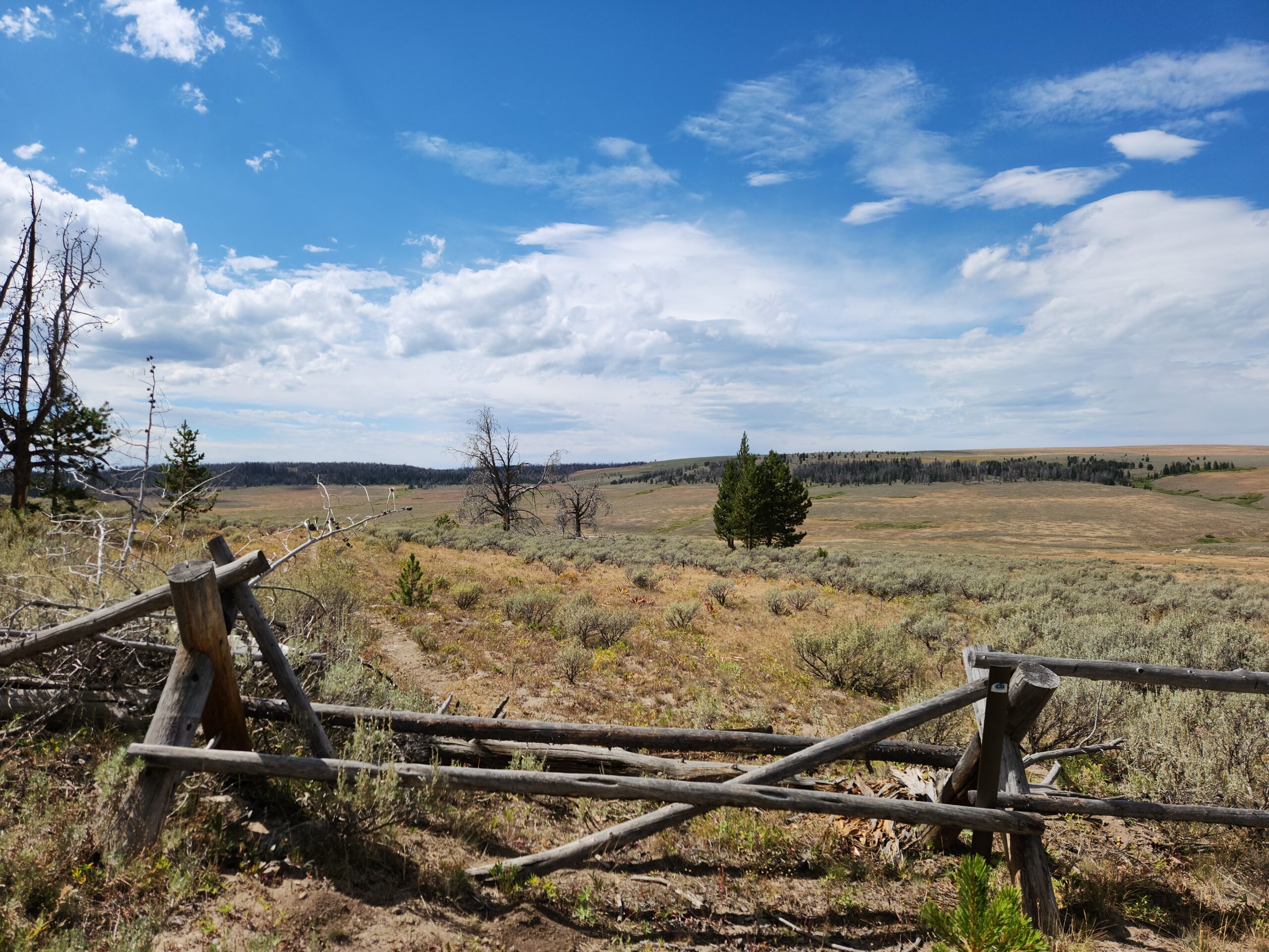
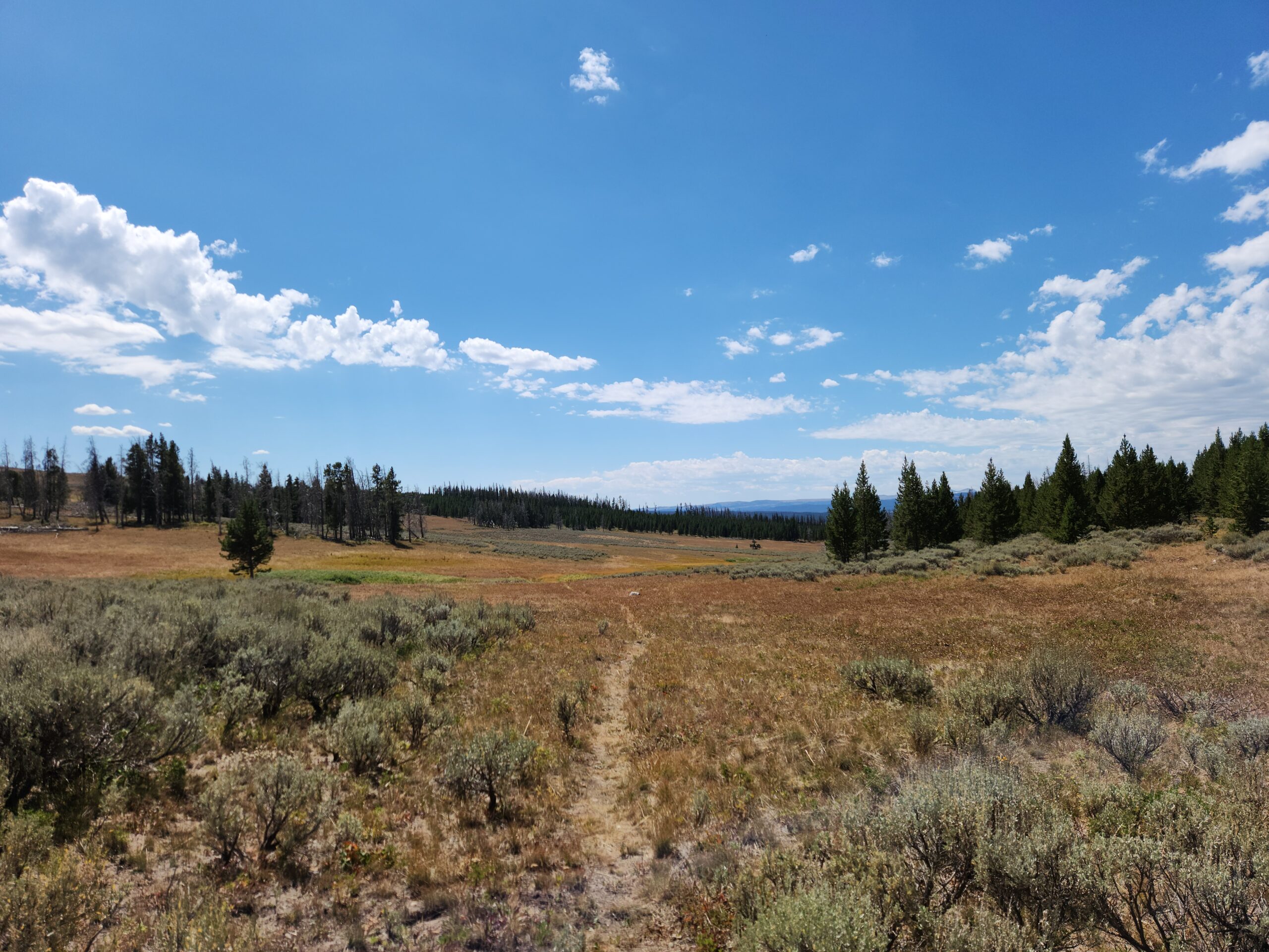
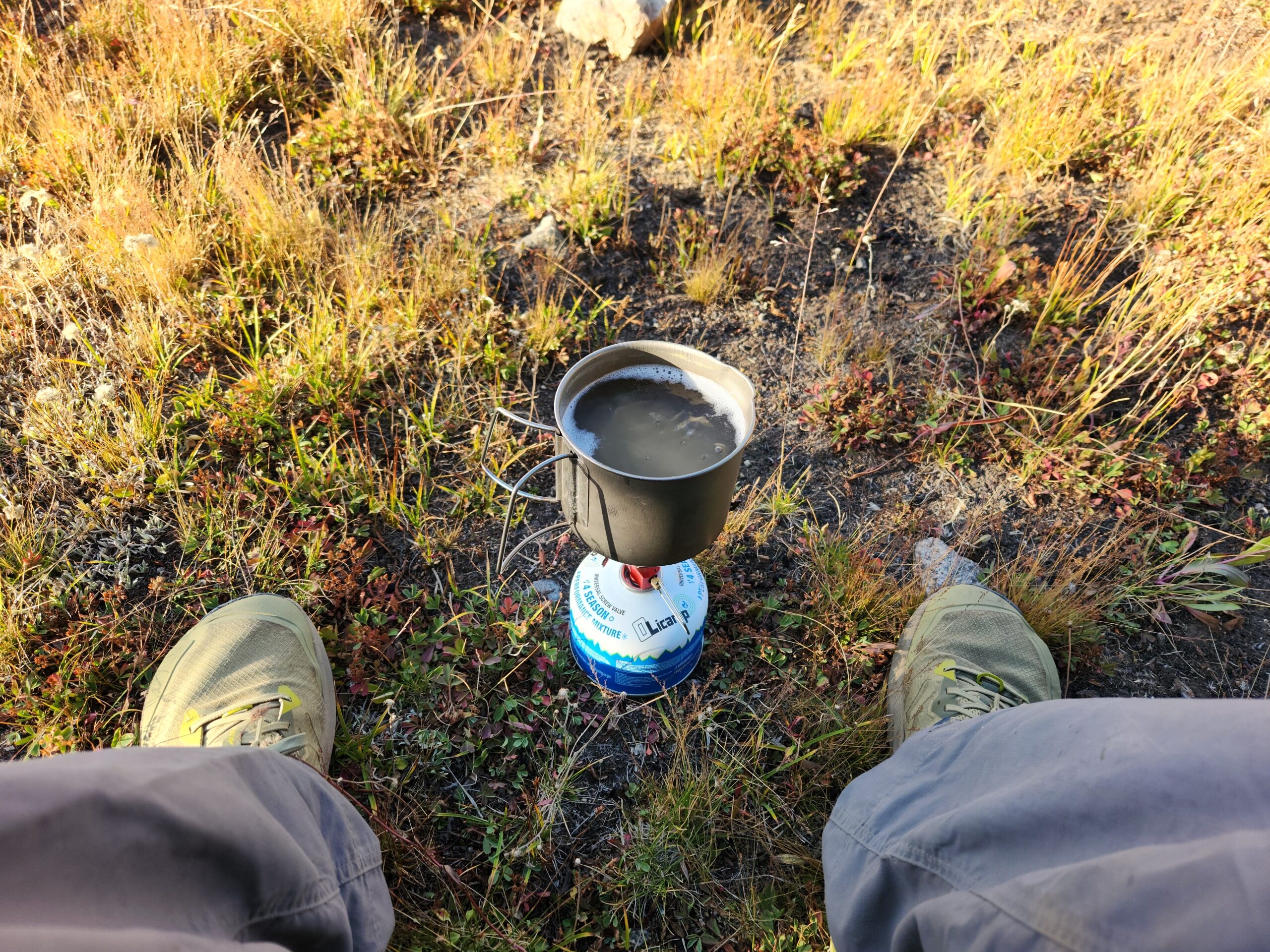
Wednesday Aug 20. Still a lot of flat walking. Through burns, mostly flattish, great views of mountains to the west. I figured that I’d see nobody. At one point I think I saw a lost NOBO on another trail in the valley. Or maybe someone out just doing a big hike. Then as I neared the lake where I wanted to camp, 3 ATV people passed me, and there were more there. I continued around the lake looking for camping, and decided to at least have dinner while I had water. Lots of cows across the lake, but it seemed clean. Plus I knew I’d be boiling the water anyway. I think for boiling to be really safe, you have to do it for a LONG time, and altitude might make it meaningless anyway – if you’re high enough up, water boils at such a low temp that it doesn’t kill the bacteria.
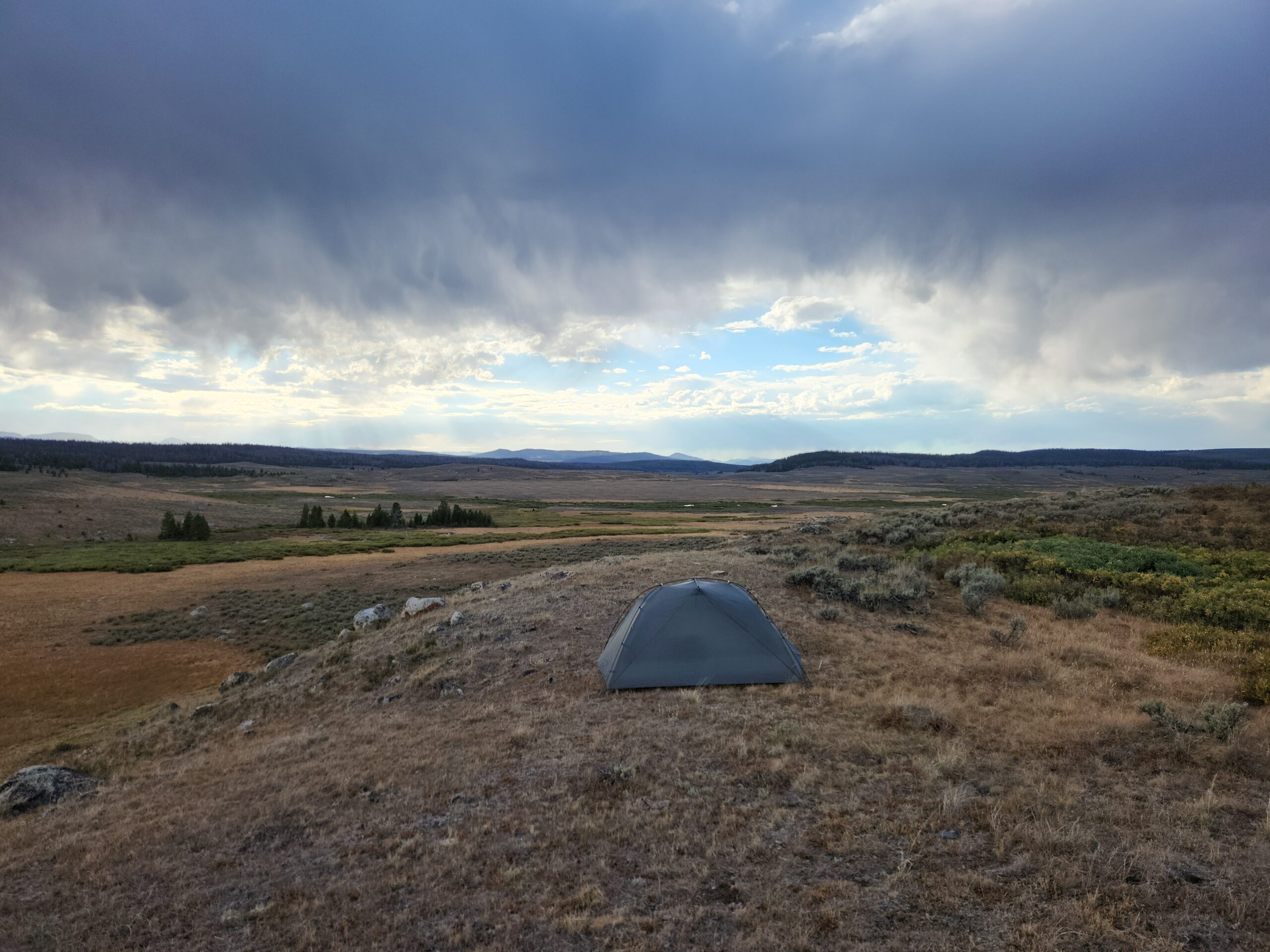
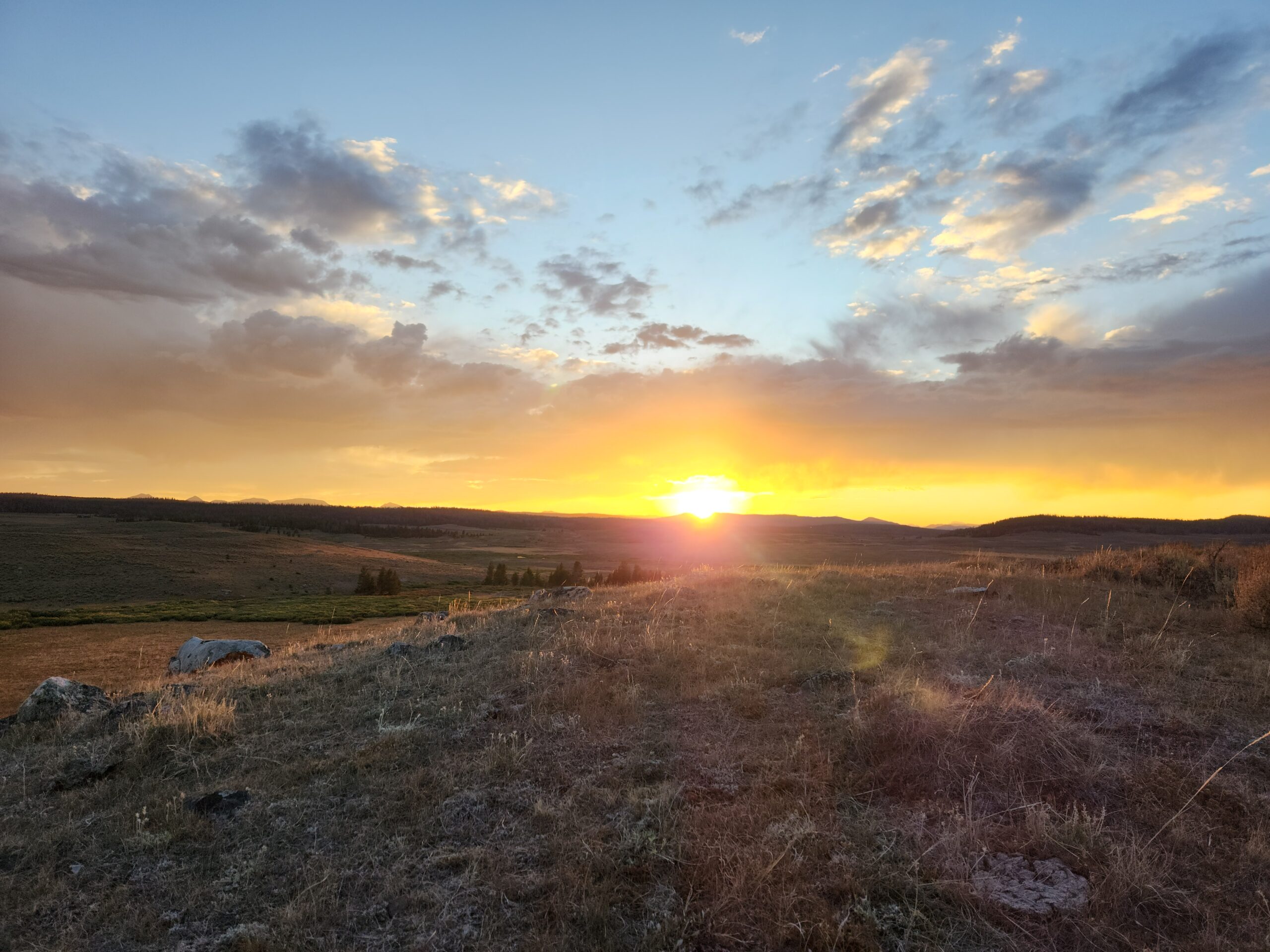
The wind picked up and so I bolted down my mac and cheese before the rain came. Just a few sprinkles. The trail left the woods and went into a huge valley. I ran out of steam 21 miles in., and walked about a 1/4 mile off trail to the top of a ridge to camp and watch the sunset. 21 miles didn’t seem like a great sign given the low elevation changes. Higher up, 9k all day. Mile 1154. The views as the sun set were awesome, and the cows mooing down in the flat sort of sang me to sleep.
Passed 3/4 mark yesterday. Also another reason to back off. I kind of don’t want to finish, I mean I do, but I also don’t want to go back to the real world. I’m also trying to save some gas for the southern Wind River Range. The really high stuff starts 25 mi S of here. But I have at least 3 day food left, why rush? Miles 1174, 1190, 1201+10 miles of side trail to the road, I’ll arrive at trailhead late Saturday. That works. Can’t get my mail Sunday anyway.

Day3 – welcome to the Winds
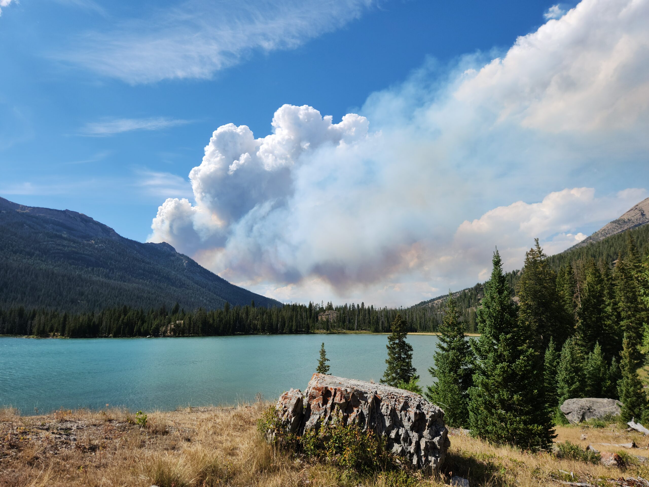
I just heard from the Forest Service that the fire is moving fast and they might have to close the road to the trailhead.
What fire?
THAT fire (pointing right behind me)
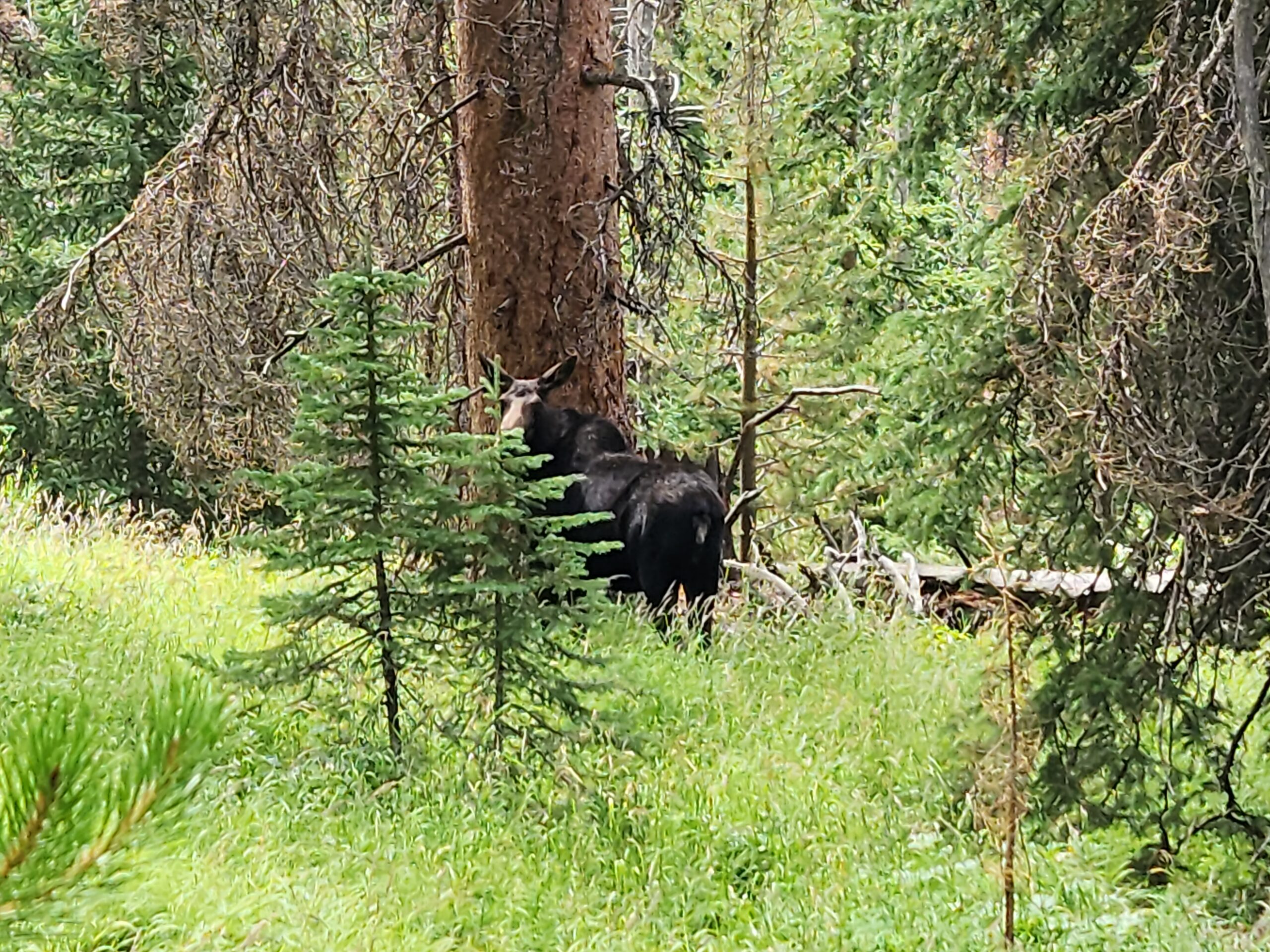
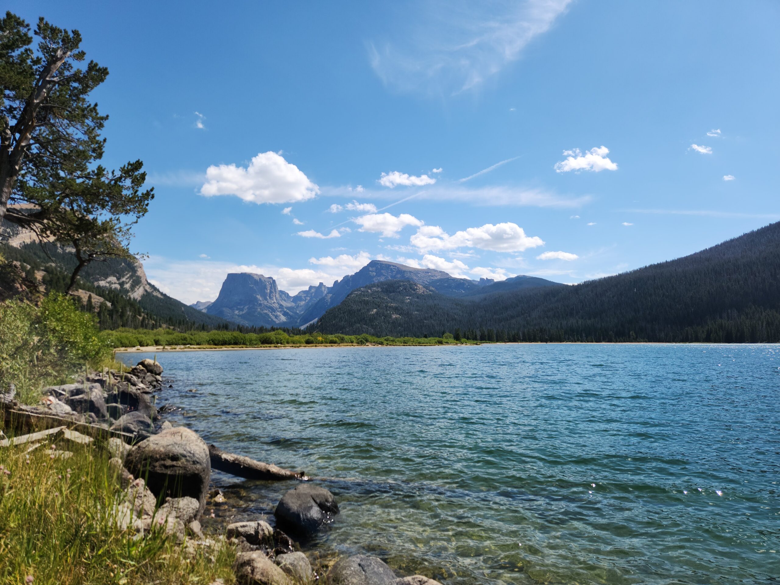
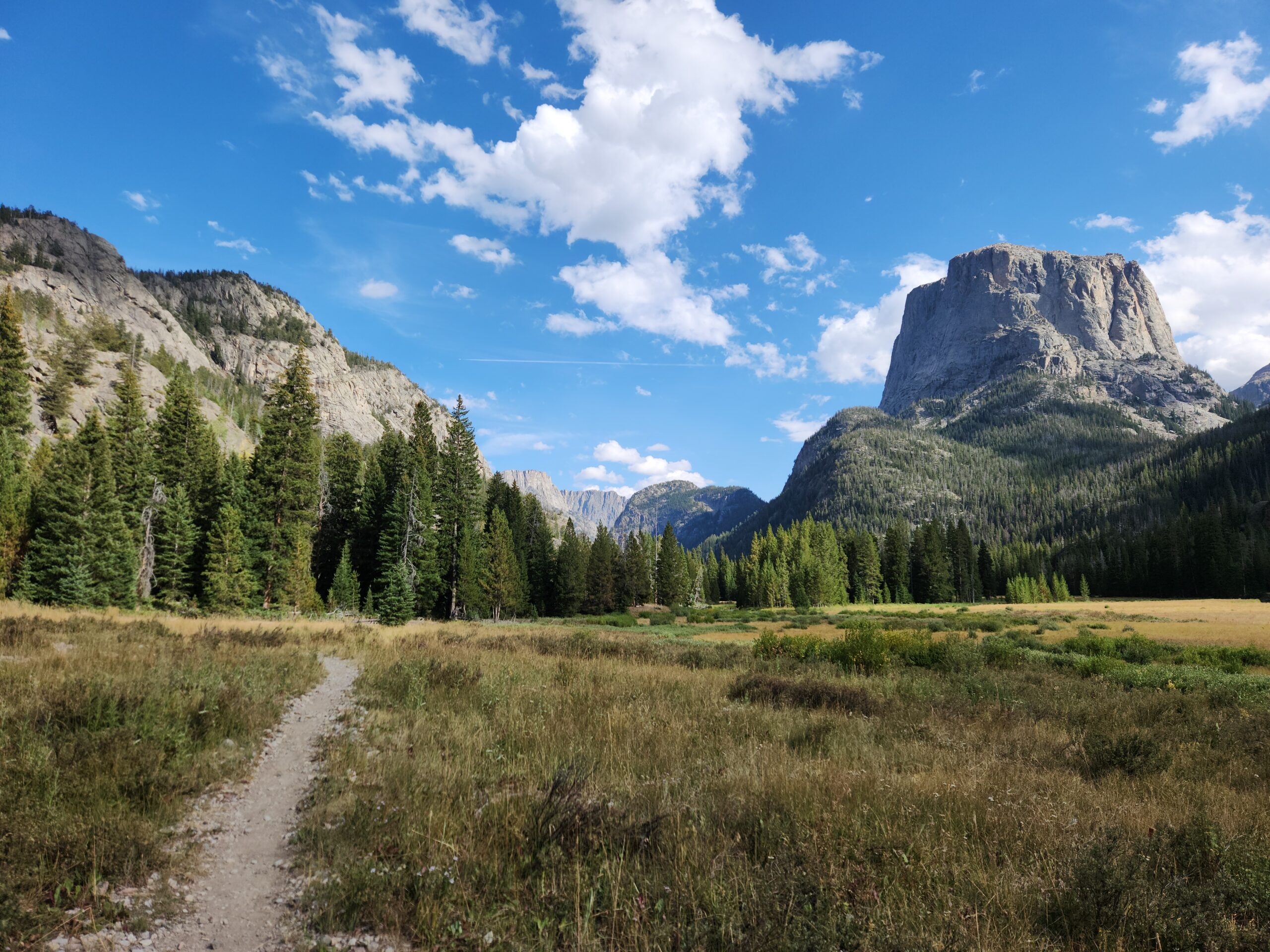
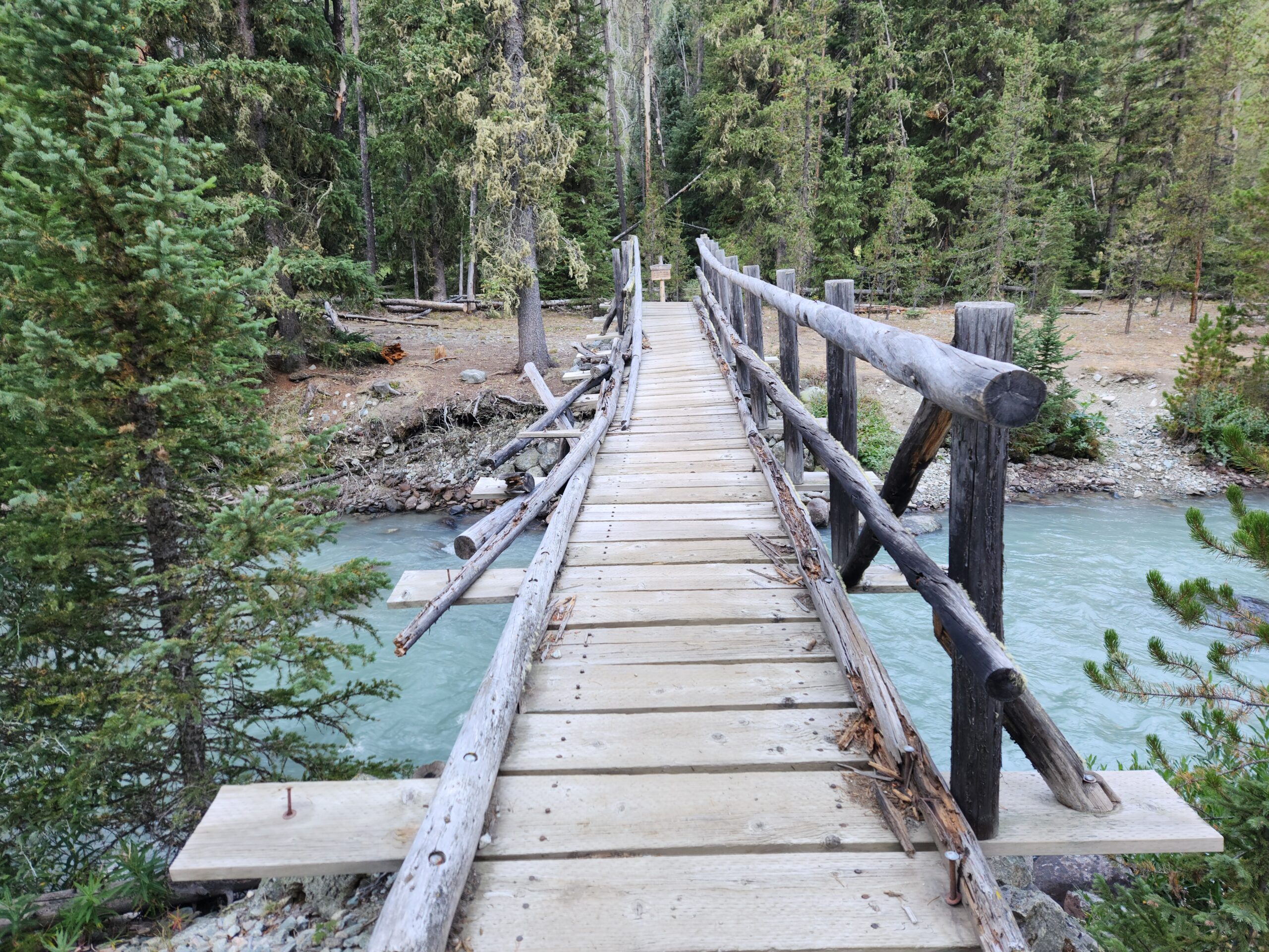
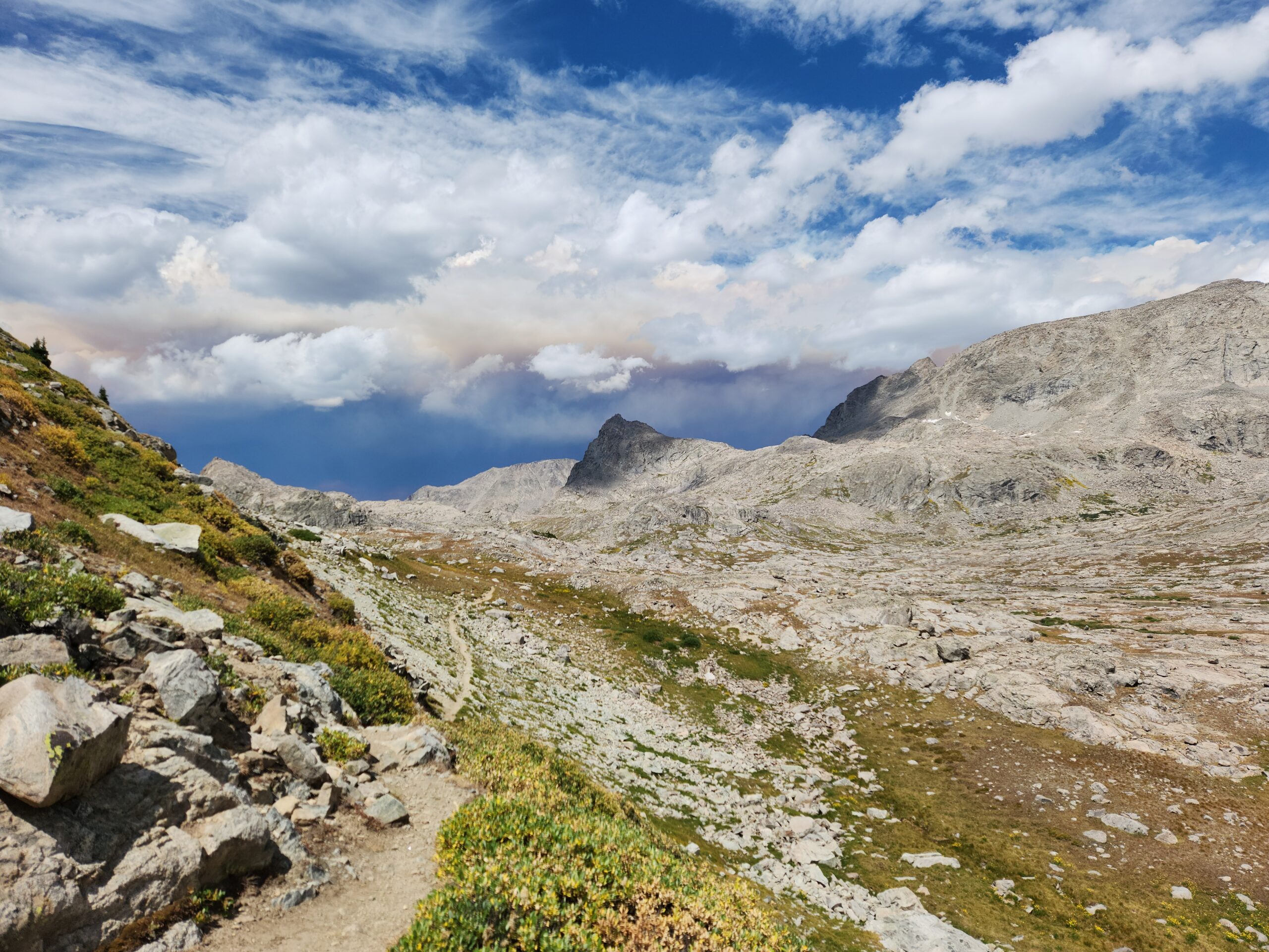
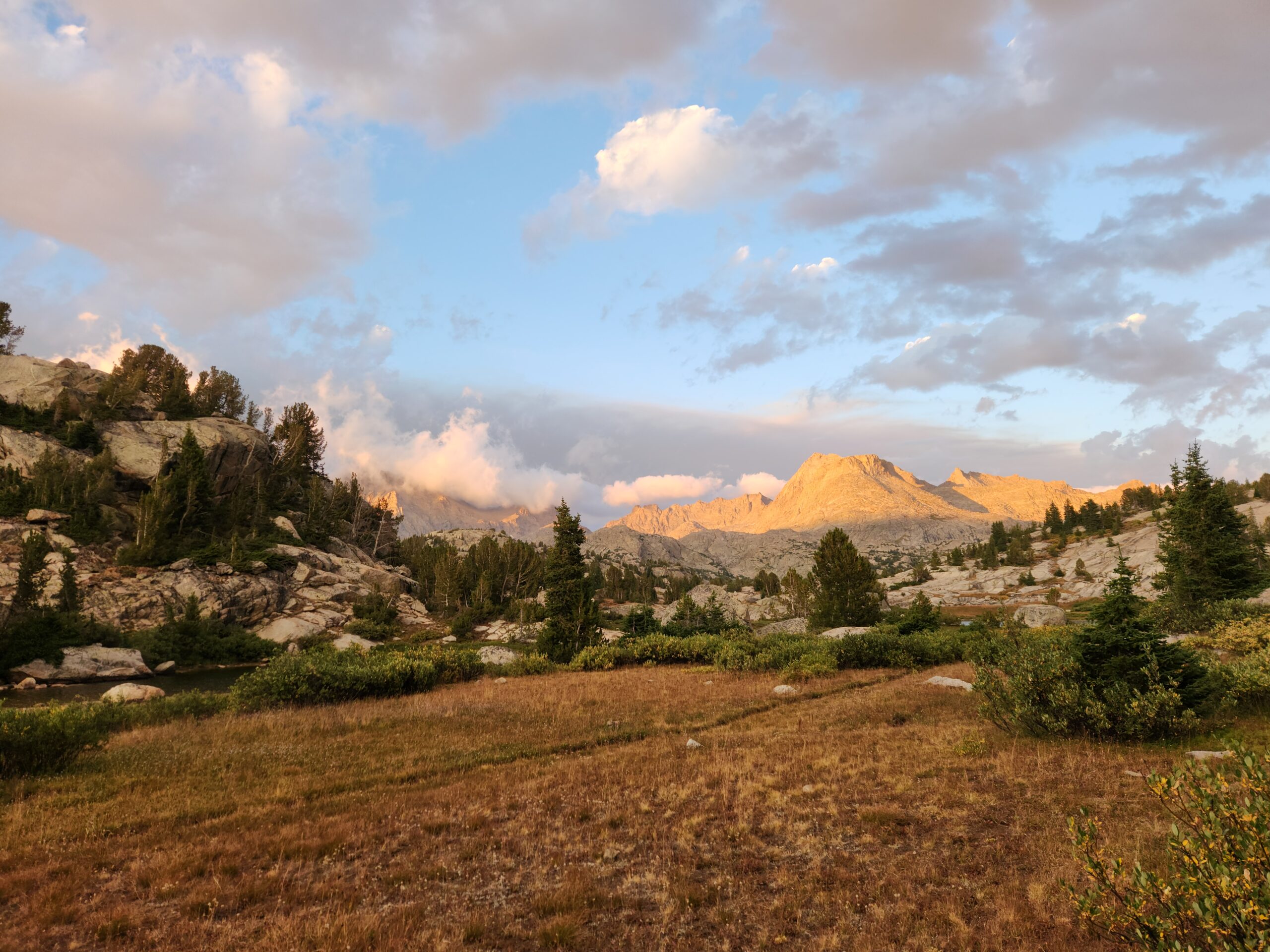
“Now we go to school”, is a phrase we used to say in the 80s when it was time to get serious. No idea where it came from. Today I left the sort of flattish/cow/swamp portion of the trail and really got up into some stuff. First order of the day was to get up, get moving, and get water. Food you can eat whenever you want really, but water is a treasure. Planning for it, pulling it, filtering it, carrying it, drinking it, its non stop. I made it up to Gunsight Pass, back up to 10k, pretty easily. 10k is NOT high when you have plenty of time to acclimate. Coming down the other (wetter) side, it was all huge pines and moss. I saw a moose on the way to Green River. At first I thought (hoped) it was a grizz, but then she turned and showed me that big horse face.
The final descent towards the Green River recreation area was from a gorgeous breezy ridge where I had lunch, and chased away the ravens who kept hopping over to beg. The valley’s a few miles wide, flattish, and you can see the USFS road coming up the whole way. At pretty regular intervals, pickup trucks towing massive trailer RVs had pulled off into little campsite areas. Not at all my jam, but apparently popular.
I got down to the bottom, passed a few NOBOs with the ‘hiker nod’ and proceeded to the parking area proper – hoping for a bathroom. Nope. Perhaps in the campground, but that was another distance away. It was weird stumbling out of the woods into a fully populated car park area.
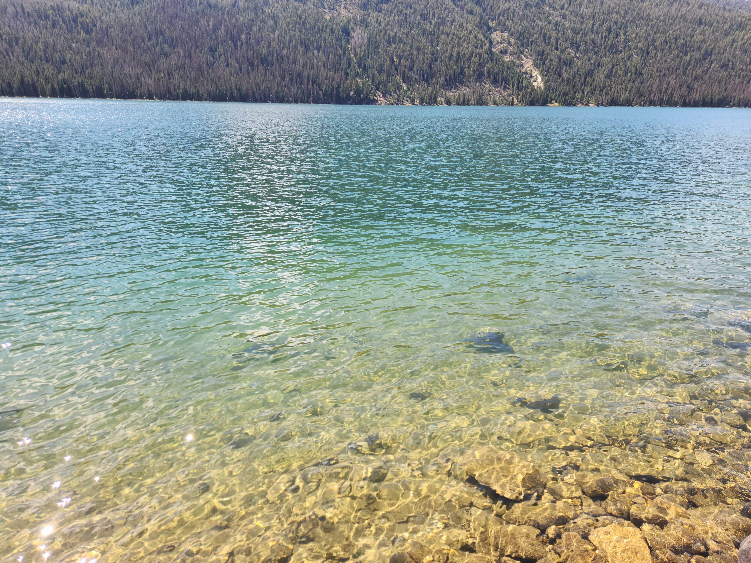
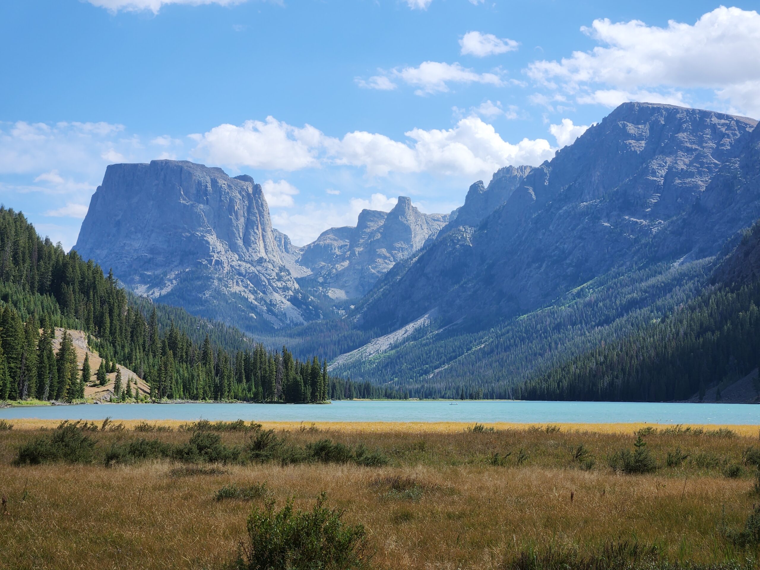
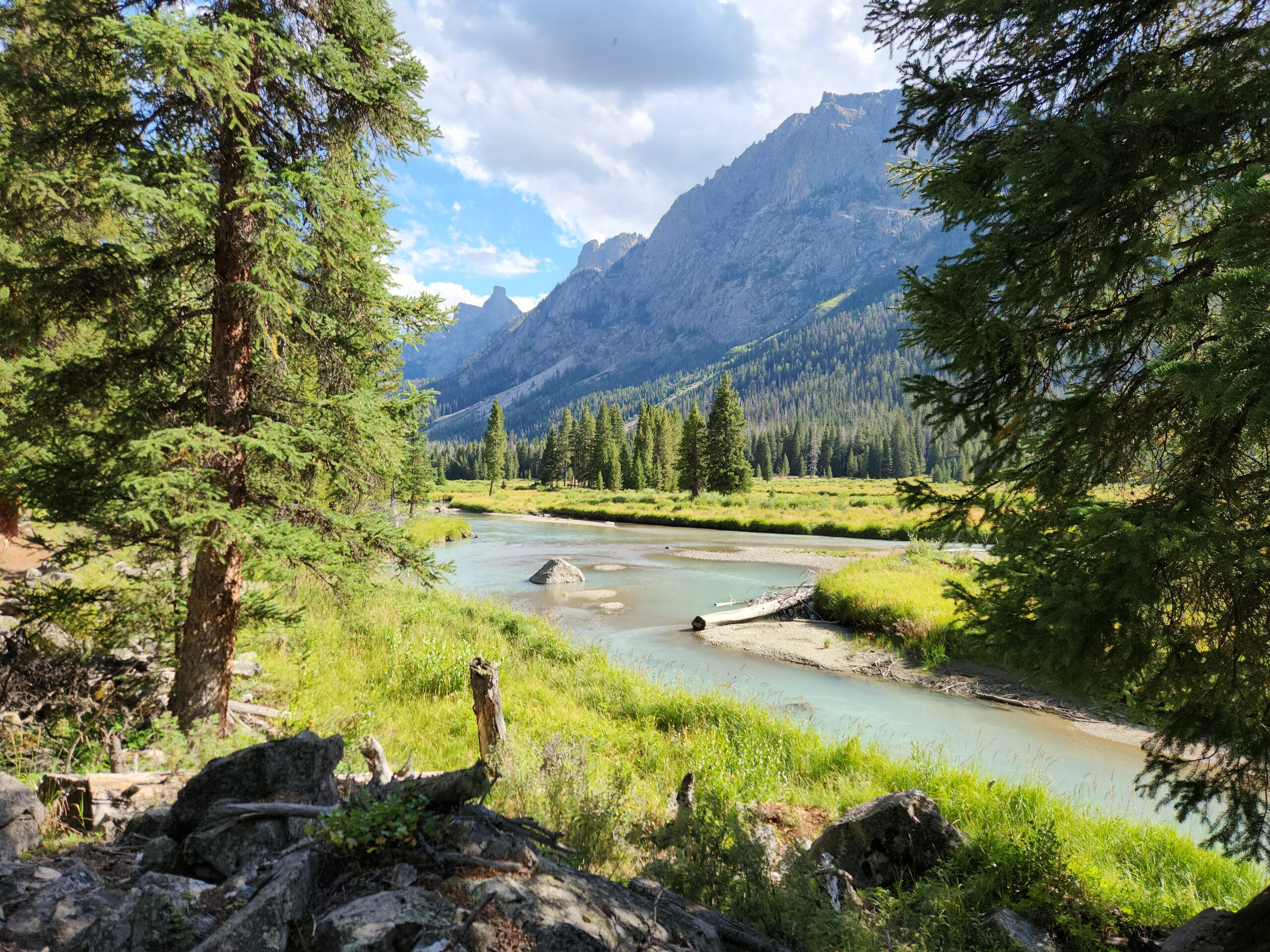
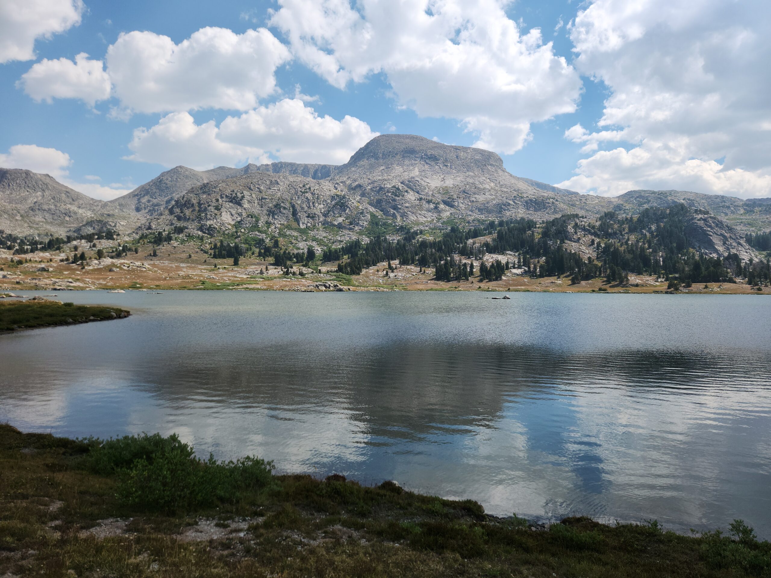
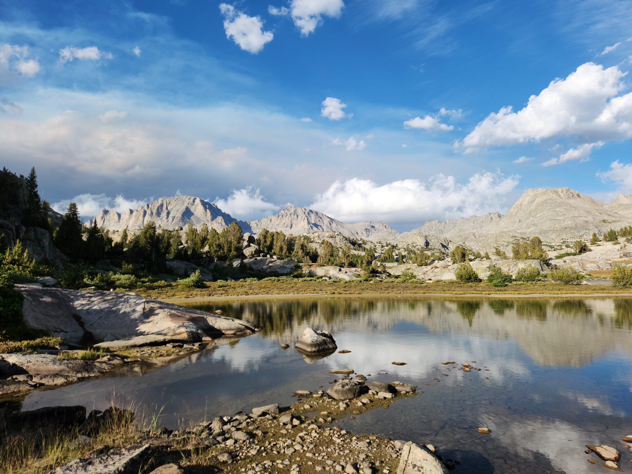
The trail at this point turns south along Green River Lake and river. The lake was that cool aqua blue green that mountain/glacier lakes get. Sort of tropical almost.
Went skinny dipping, and washed my clothes. So gross. It had been a pretty sweaty couple of days. The water was COLD. Leaving the lake and heading down the river I ran into a couple of NOBO hikers. One of whom, Noodle, said he’d heard of me. I said I wasn’t sure I was happy about everyone hearing about me. “Well it’s an unusual name, and aren’t you a flipper? Or you did this before or something?” Apparently I’m trail-famous?
Maybe half an hour later a guy on horseback told me the fire was moving fast, and that they might have to close the road to the trailhead. What fire? THAT fire, he said, pointing behind me.
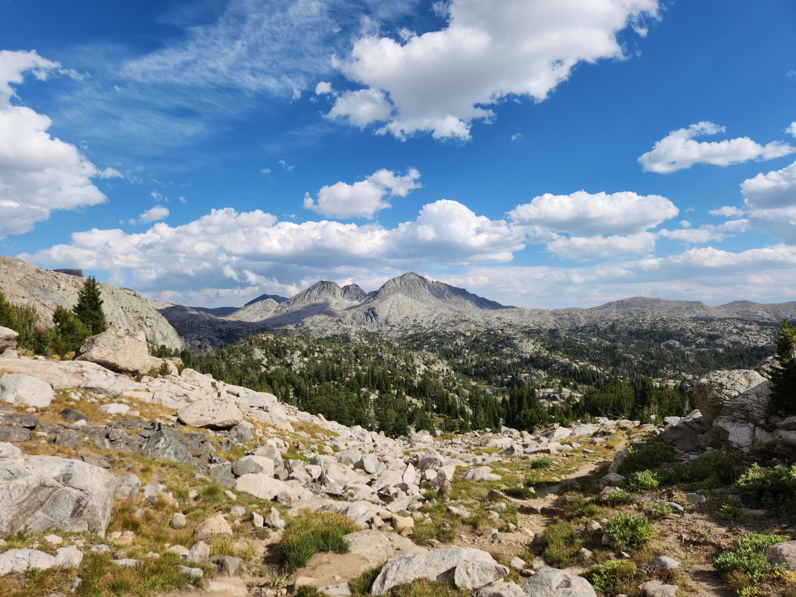
It was miles and miles of flat along the river, which was even cooler and greener than the lake. Camping is tricky, there’s some pretty strict rules about it in this area because its so popular. Plus its pretty thick forest, and you’re hiking along a steep slope next to a river. Not much flat. I ended up pushing 22, but mostly because there was camping AND clean water right there. I ran into Matsumi, a Japanese guy I hadn’t seen since Leadore! Talk about guts, his English is NOT great at all, yet he’s done all 3 of the big trails here in the US. I guess he just figures it out. He said that the Teton alt was great. Lots of people veered off the proper CDT to go through the Tetons, following a combination of local trails, GPX routes, and I think in some places, dead reckoning.
The heat is back, and so is the chafing.
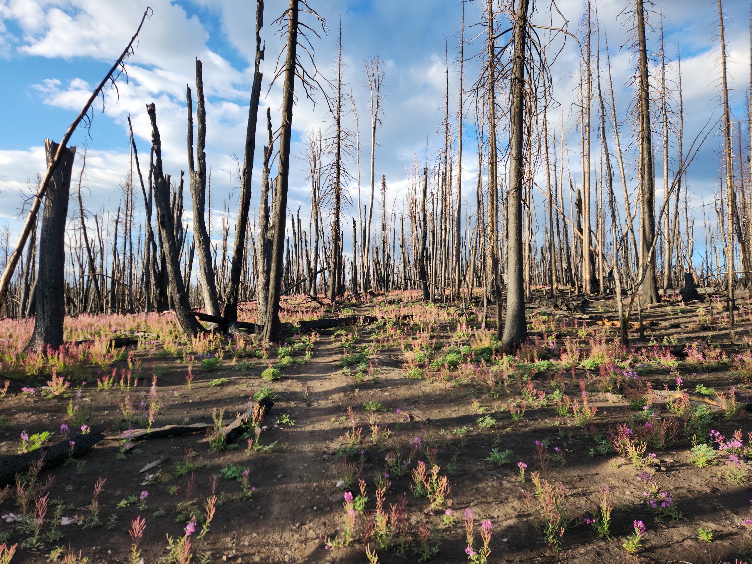
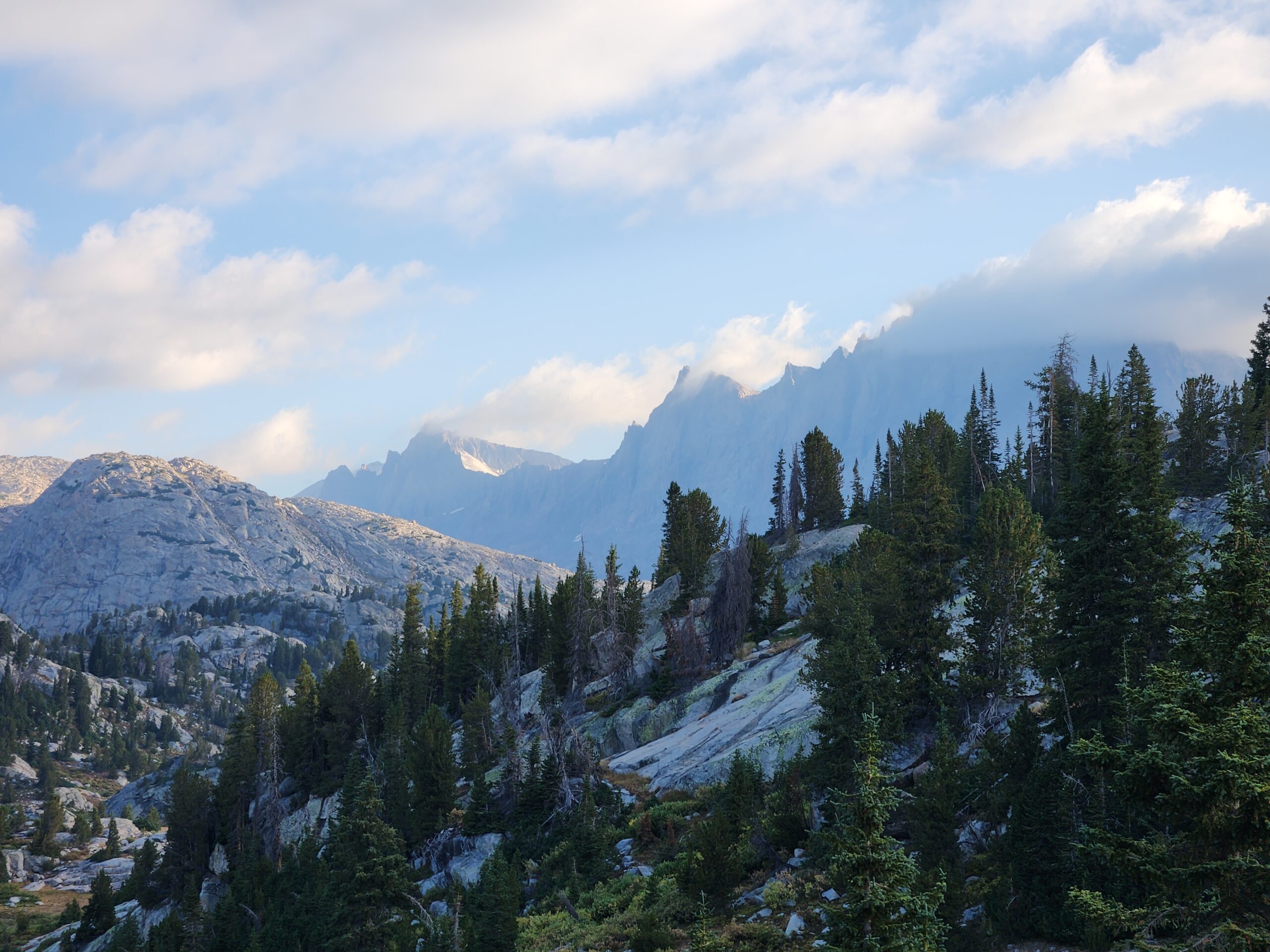
By dinner time, the entire northern sky was full of smoke, and you could smell it.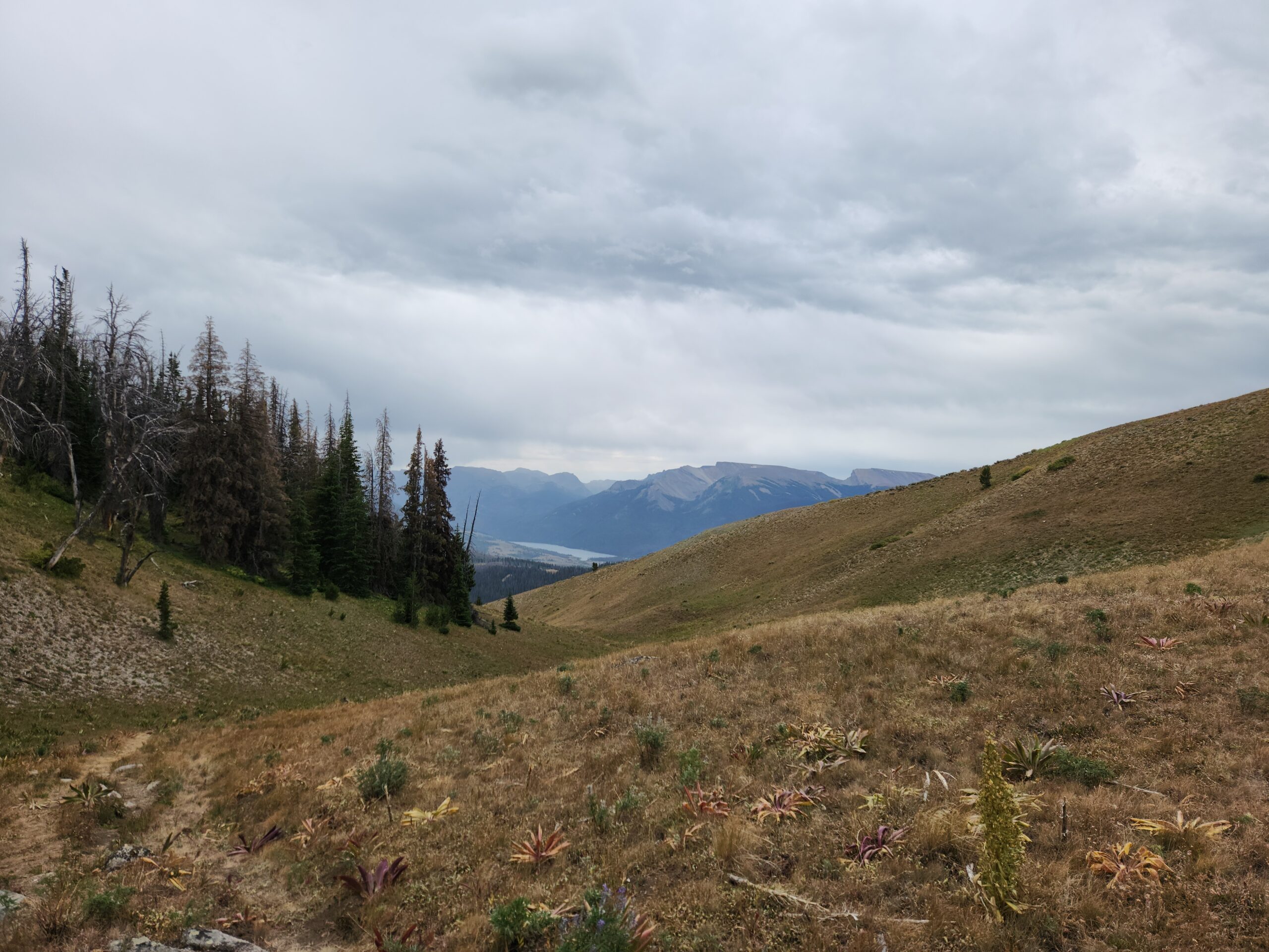


Day4 – into thin air
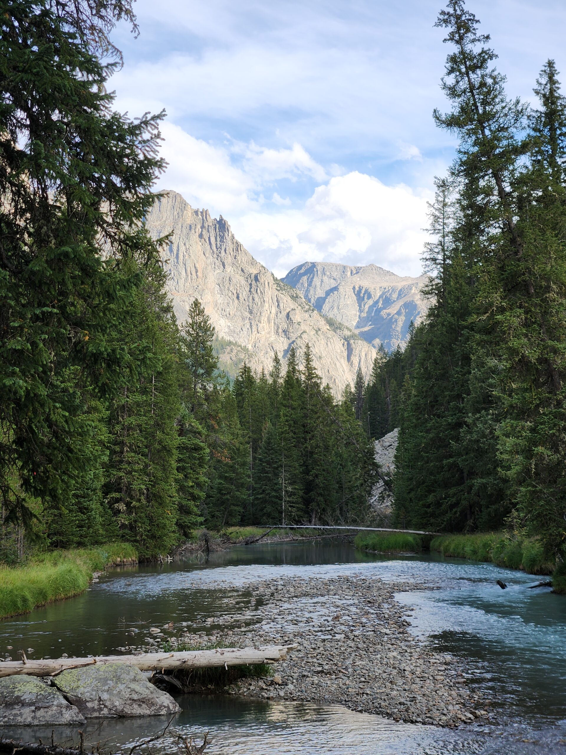
The problem with hiking in mountains, and camping by the river, is that the river is always at the bottom of the hill. So I got up, ate, packed, and started to climb. And climb. And climb. I felt like one of the Hobbits being led into Mordor by Gollum up the Winding Stair. The air tasted like smoke. I was careful to fill my bottles from the feeder stream into the Green River. You don’t want to try and filter that kind of chalky water, not if you want to stay friends with your water filter.
I met an older woman from a group who had their gear packed in for them. Yes, that’s a thing. (It actually sounds pretty awesome). I think it was the horse guy who told me about the fire. Turns out they were short a bag. It contained the tent, sleeping bag, and rainwear for 1 of them. So after a cold night where they all divvied up their gear and slept two-in-a-bag, they were going to pack out and figure something out. She was worried about the fire too.
At the junction to Knapsack Col, I ran into a group of hikers so random they had to be a church group. They were debating heading down the hill and out Green River, but worried about the fire. They had a friend coming in to pick them up. I told them by now the road was probably closed. After some dithering, I used my InReach to text their friend that they were going to turn around and go back the way they came, slightly differently, but end up back at their starting trailhead. Amazing what technology can do for the backcountry these days – try that in 1997.
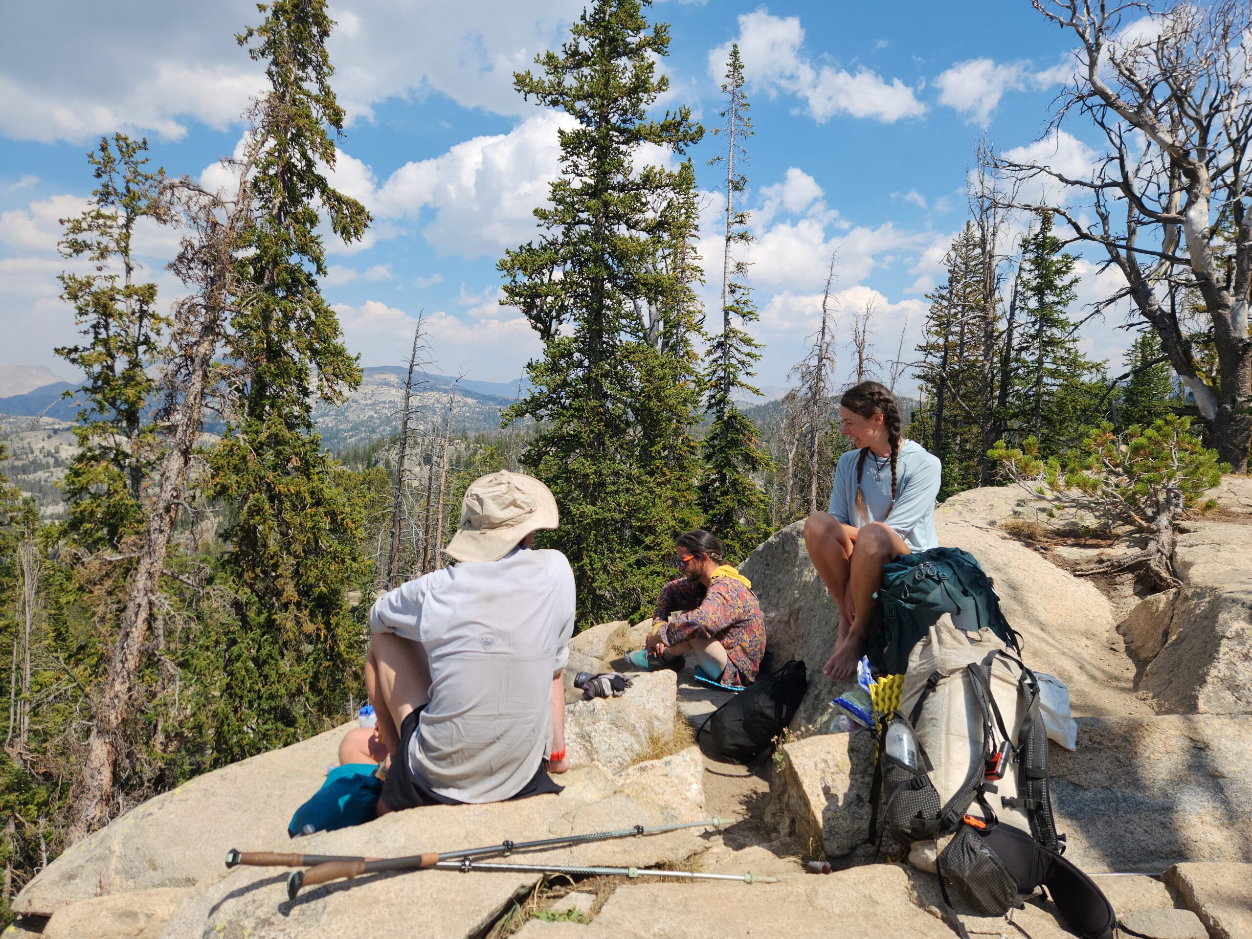
Back up to 10k and the pass. A few of that group caught me at the top, but I pushed on towards Pinedale a bit and took a break at the next lake. I broke out the last of the sunscreen at lunch. Cooking in the sun up here. Some lazy googling says that you lose about 4% protection from UV for every 1000 feet you go up.
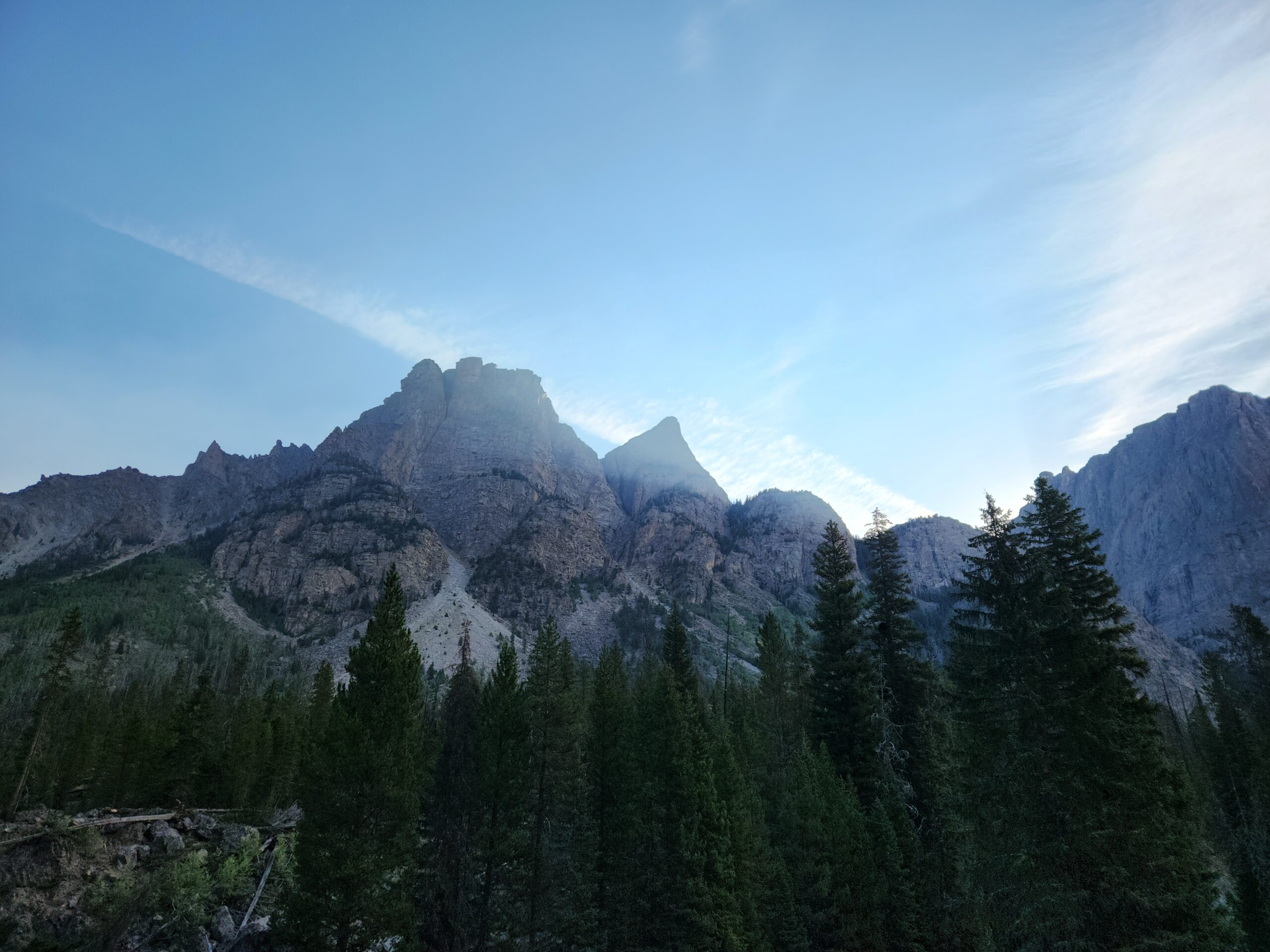
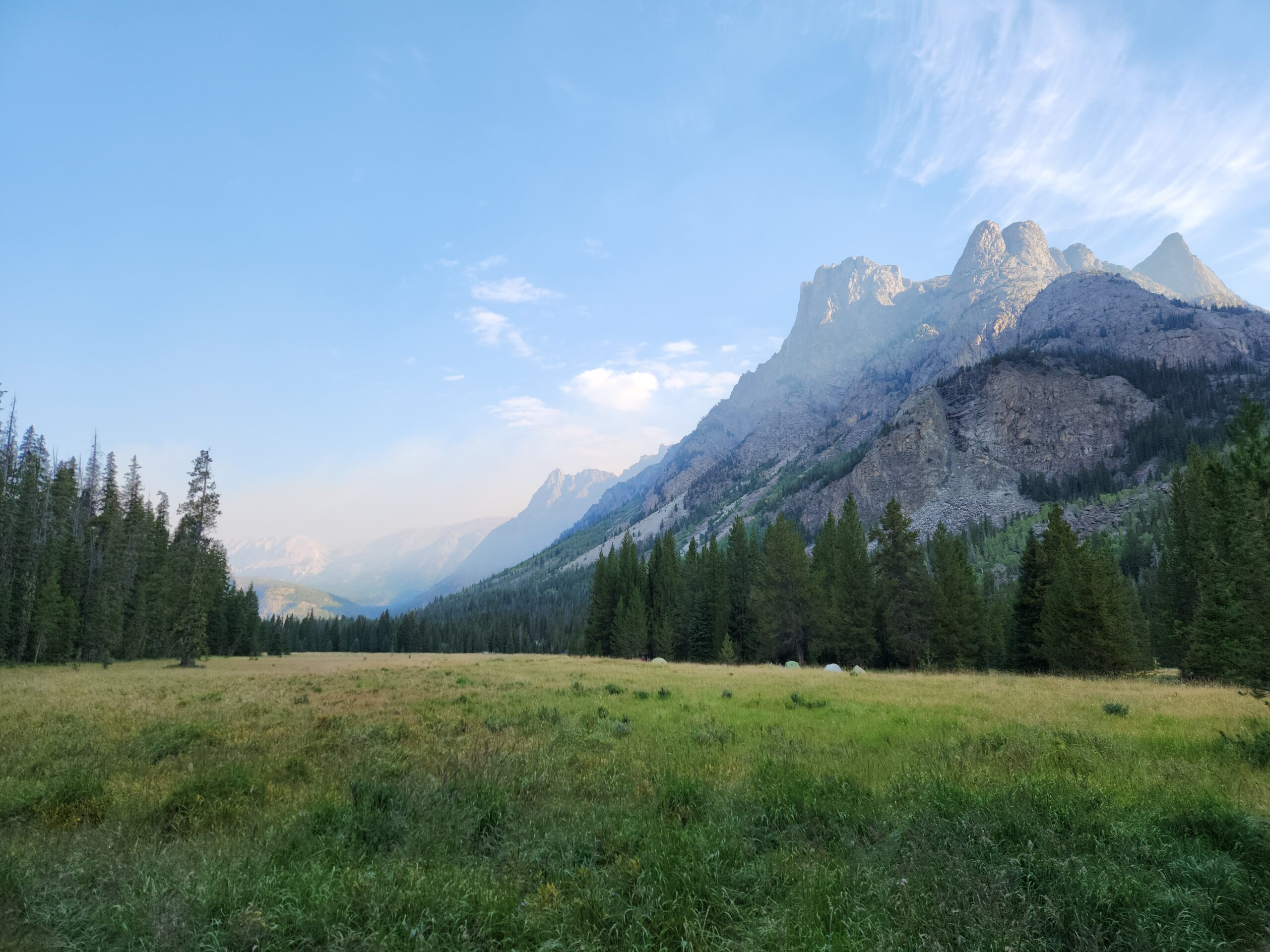
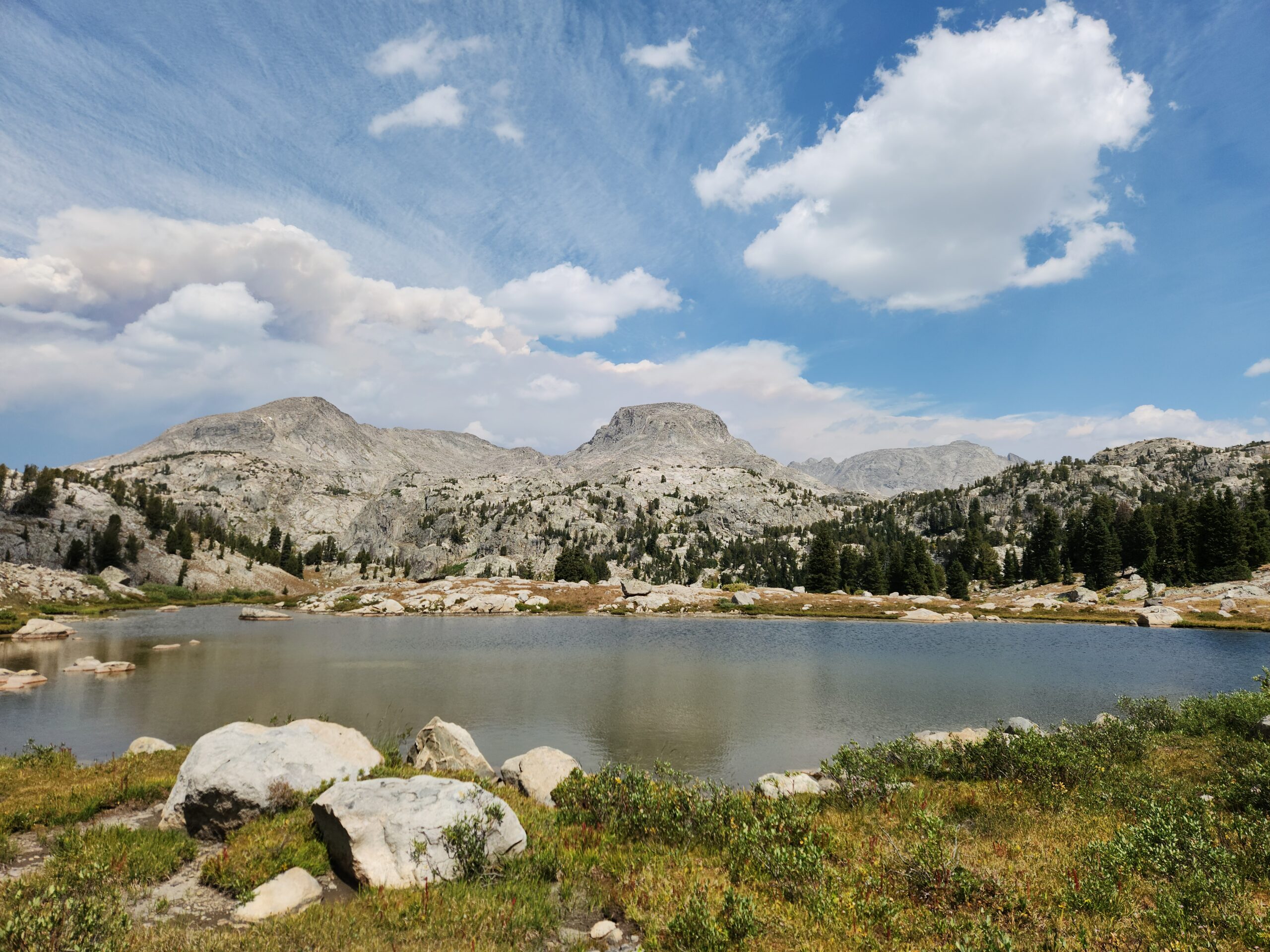
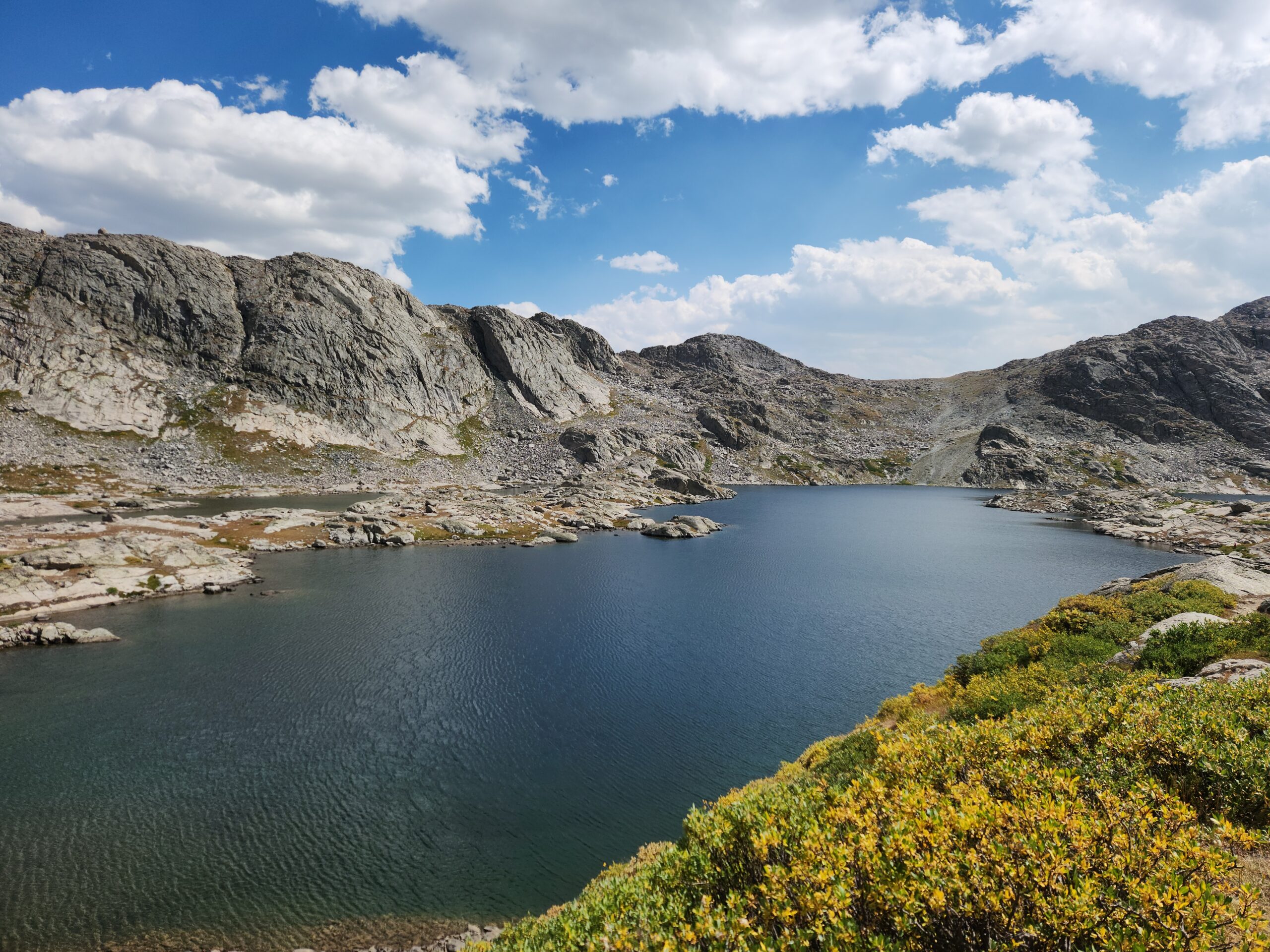
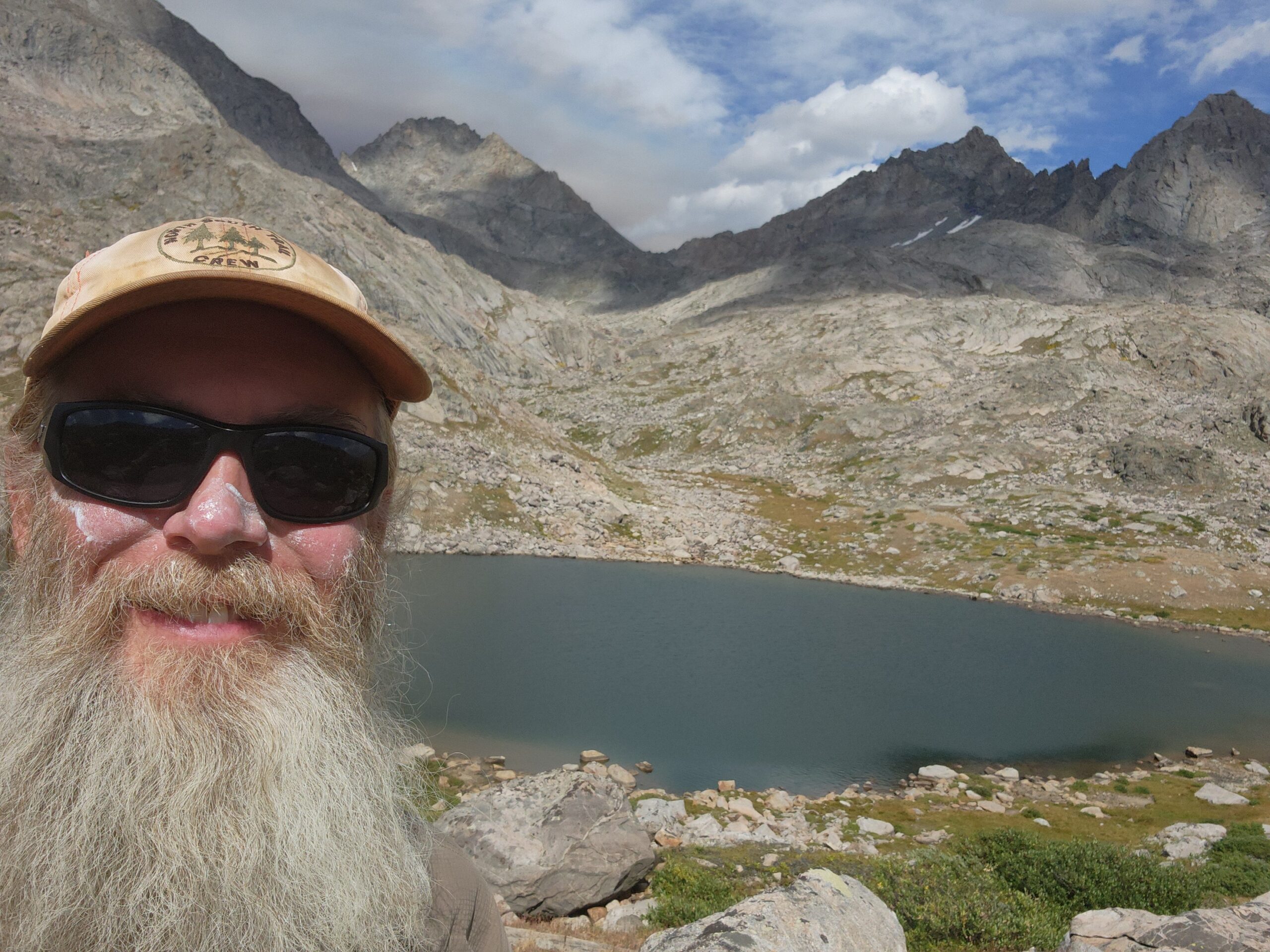
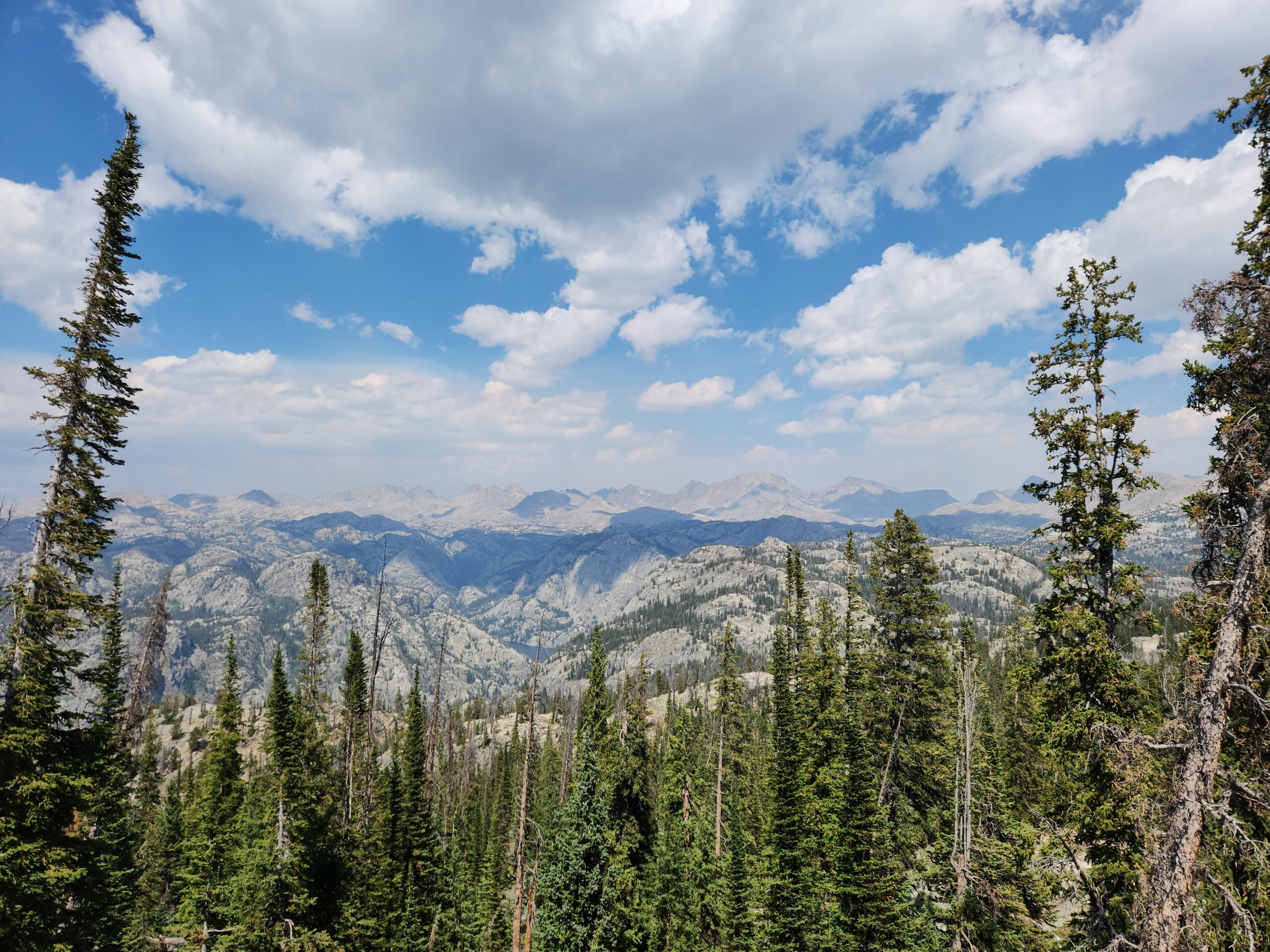
This section is gorgeous!!! Right up there with Sierra, except here there’s no snow or bone chilling cold or 4am wakeup. I never got much above 11k today, but it was a lot of little ups and downs, over small streams, some rock hopping, etc. It’s busy, with multiple large groups and a few smaller. But, tonight, at camp, I might be the only person for 5 or 10 miles. It’s silent. Not city-silent, where there’s a pause between airplanes or trucks, and not country silent, where you hear a chainsaw in the distance, but completely silent. The no-wind, no-anything kind of silence. I’m camping near but not too near a lake filled with trout. Water tastes … trouty.
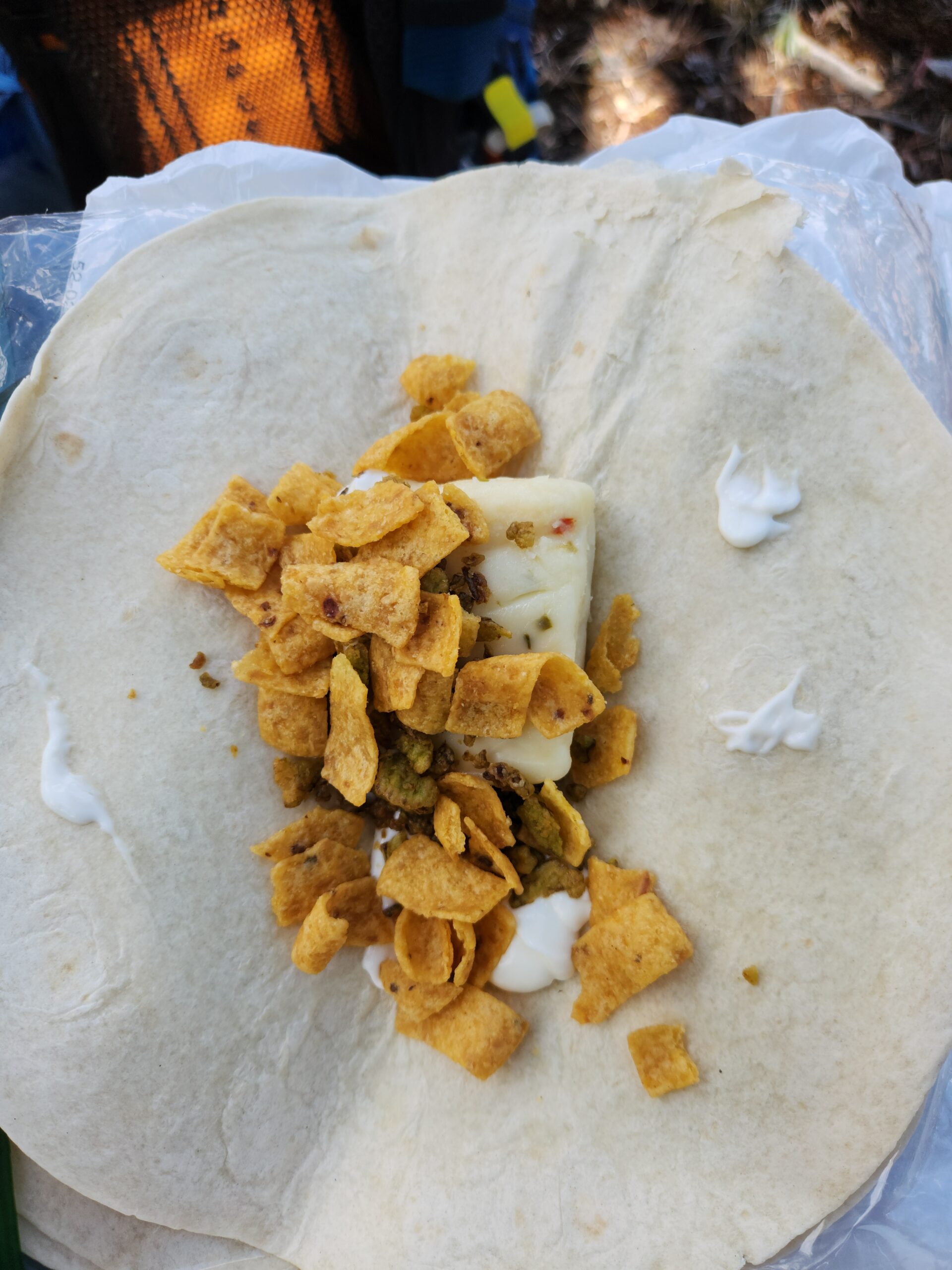
I discovered a new meal. Make couscous, then add the cheese from a Mac and Cheese, plus dried jalapeños and nutritional yeast. And water as needed so it doesn’t form cement. Holy crap, so salty and good. Follow up with Clif bar for desert. I end up with extra cheese packets from time to time, because I dump all my pasta into 1 bag, and all the cheese packets into another. And sometimes refresh the pasta bag with plain or hiker box pasta. And eyeballing the measurements, you come out with a non-integer number of meals/cheese packets ratio.
Today was 19.5 miles with 4k up. This feels like the new limit, at this elevation, time of the year, length of my legs, and motivation. Again, I’m not racing the snow to get to Mexico either.
I may not have white horses, or ladies by the score, and nobody will song of my honor and glory, but I’m a lucky man. Today ruled.
Day5 – 6+11 miles to town
Hungry and ready for town. Still up high. Now I’m starting to cross a lot of these tiny streams and pools, all with trout. Sad, what happens to them when the streams fail? Do they become protein for the mice and bugs? Circle of life, etc?
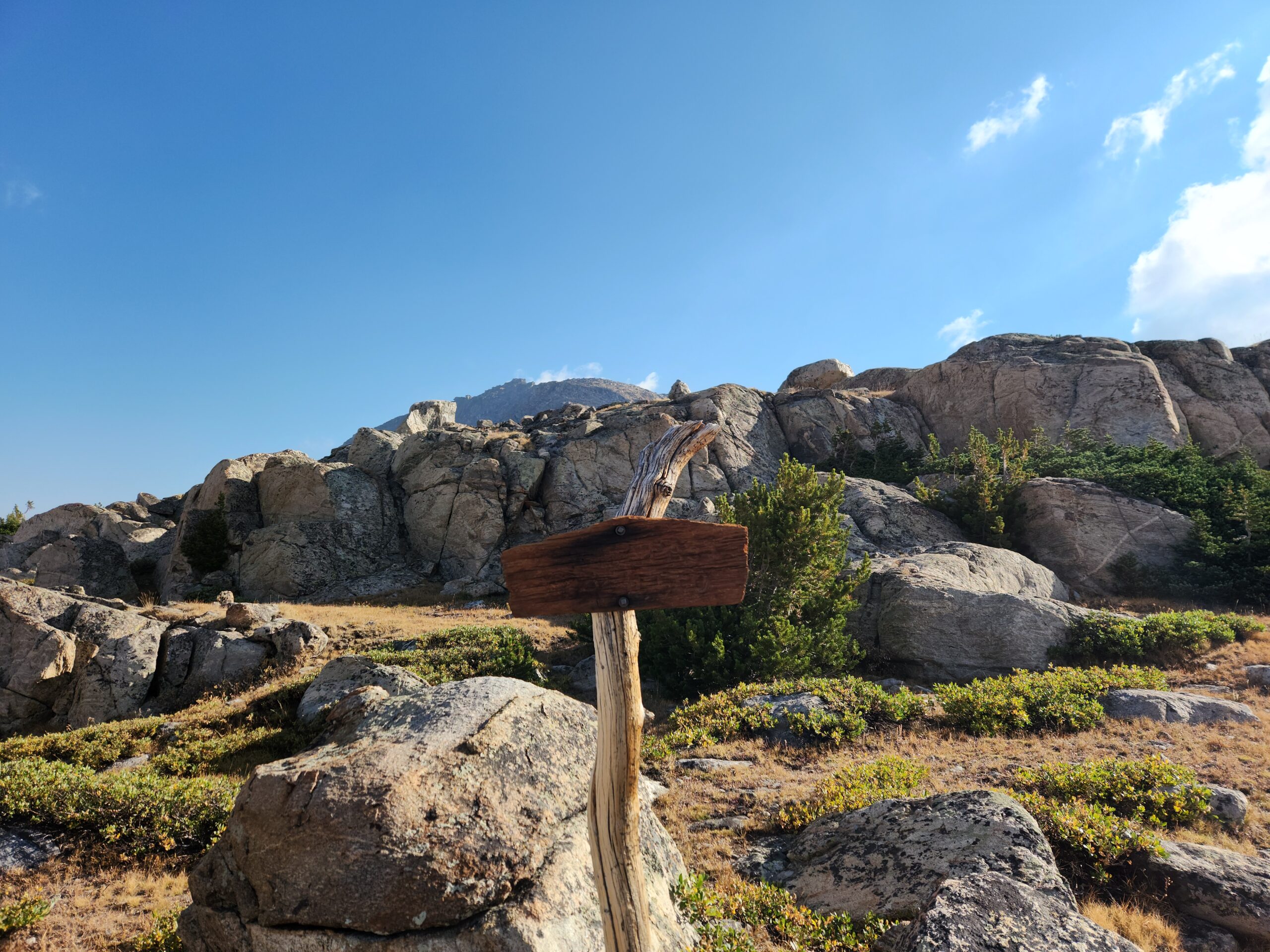
The hike down to Pinedale is a long one, its 11 miles off trail. I had got all the side quest topo maps on my phone and laid out a route using the Gaia GPS app, way back in Dubois. And the trails were well marked. This is sort of Adirondack-like, where its SO nice, yet pretty accessible, that all the trails are good and there are signs. Still, 11 miles, twice – a whole day of non CDT hiking, just to get food (and ice cream). I met many day and weekend hikers.
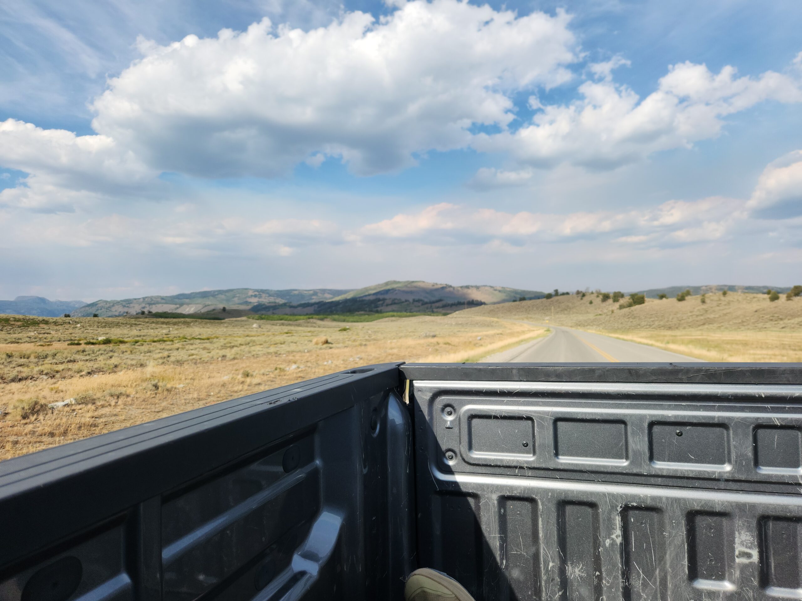
Most of the way down there’s a “Photography Point” area where you get amazing views. There I ran into Stu and Roadrunner and Mamacita, coming back up out of Pinedale. And dozens and dozens of dayhikers. Eventually, nearly out of water, I made it down to the road. A weekend, and its the end of a dead end road that ends in a USFS campground. My options were few, so I started hitching. It took 25 minutes and 9 cars. A pickup truck. “Do you care about riding in the back if the truck?” Nope. This checked off one of my must-dos for the trip, a truck bed ride. I wasn’t sure where to go in Pinedale other than the public free campground. That’s a thing in Wyoming, towns have a spot of vacant land that’s free for travellers. They dropped me off at the grocery store where I got some snacks and called home. The grocery store is also the hardware store, and sells guns, and has stuffed heads on the walls. Wyoming.
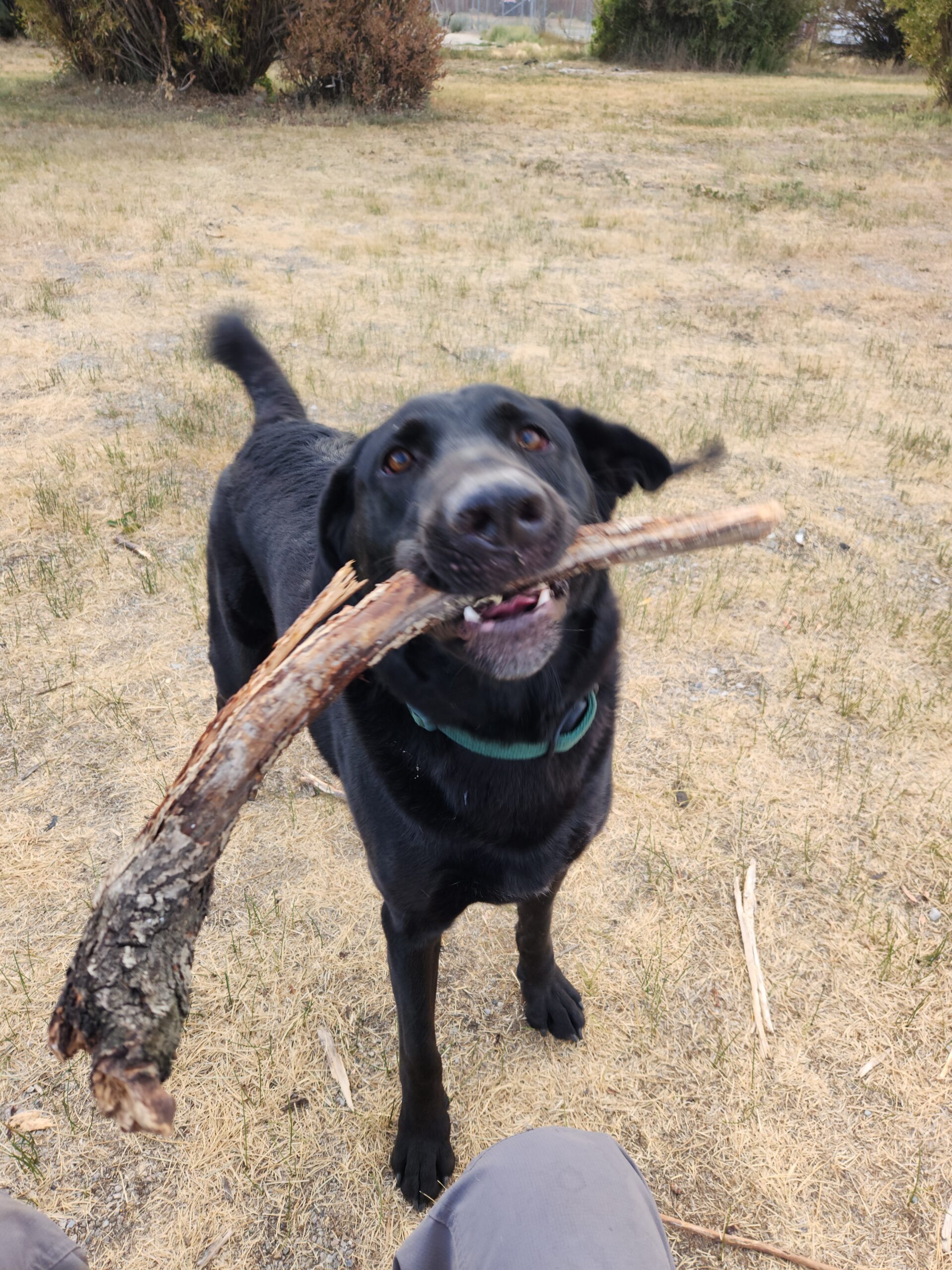
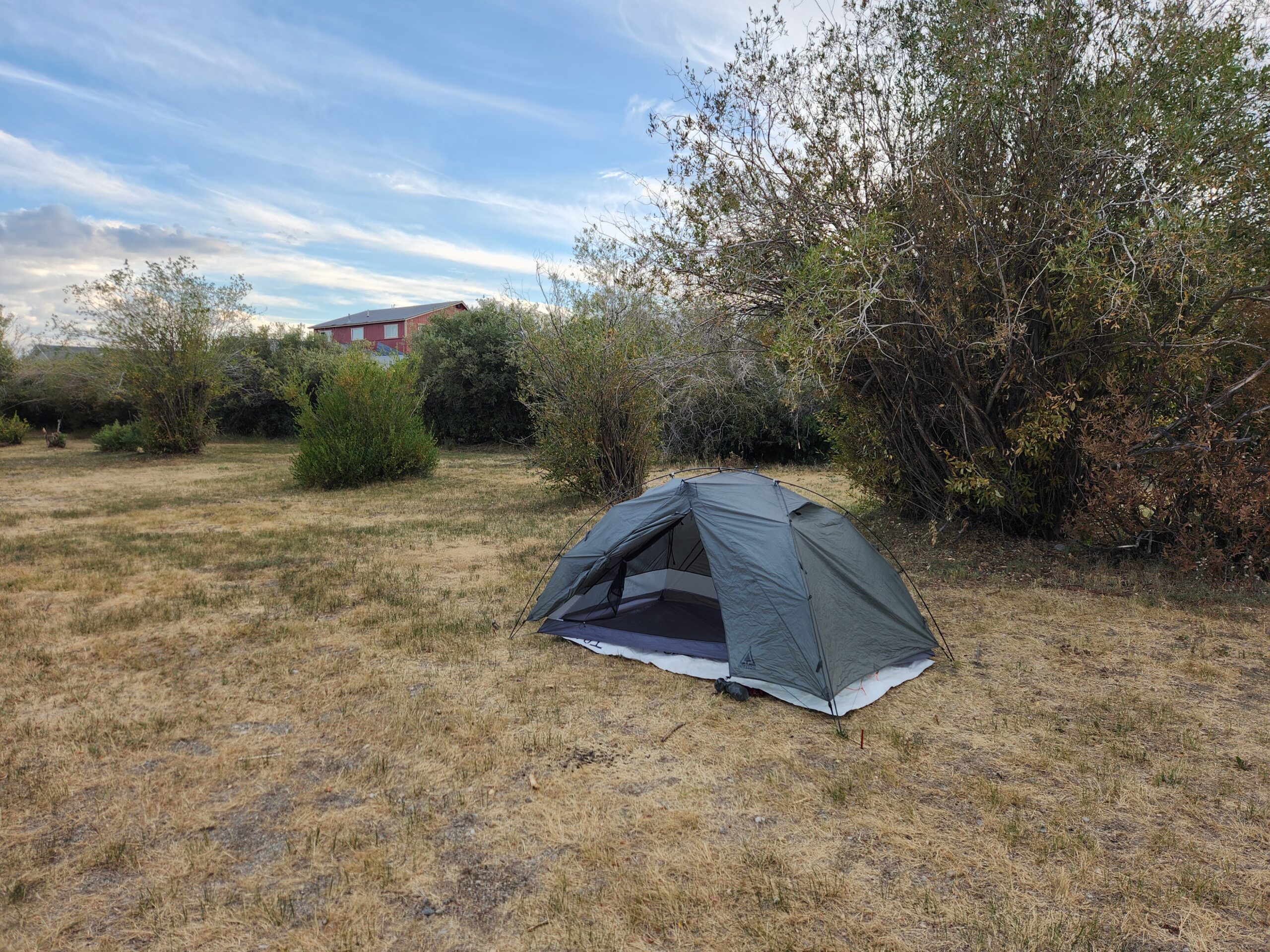
I got some groceries and walked through town, and grabbed a beer at the gas station. I figured maybe tomorrow I’d take a zero day at the hostel if I could find it. The city park is a big dry field with a few picnic tables. Each sort of commands an area that seems like its for a 1 person/group. There was 1 ritzy Transit van, 2 other guys, each solo. 1 guy without a car. I played fetch with a friendly stray dog until I got tired; he wasn’t tired. I wonder – who washes up at these free town campgrounds in Wyoming? You could make a documentary. A nice car with a nice tent. An expensive van. A hobo. All somehow brothers in arms here, with no one reaching out to the other, either out of fear or disinterest. Everyone just doing their thing, parting ways in the morning.
Smoke is really starting to roll in from that fire, and more and more people are talking about how fast its moving. Anyone north of it on the CDT is going to be cut off.
I had to get more groceries, then plan out my next move, another 5 or so days and 100 miles to the highway that would take me to Lander. The southern Winds have an alternate that everyone takes called “Cirque of the Towers”, I was excited for that.
I’m enjoying your writing and all the photos. Glad to see you made it to the Winds and didn’t get cut off by the Dollar Fire like so many other hikers.